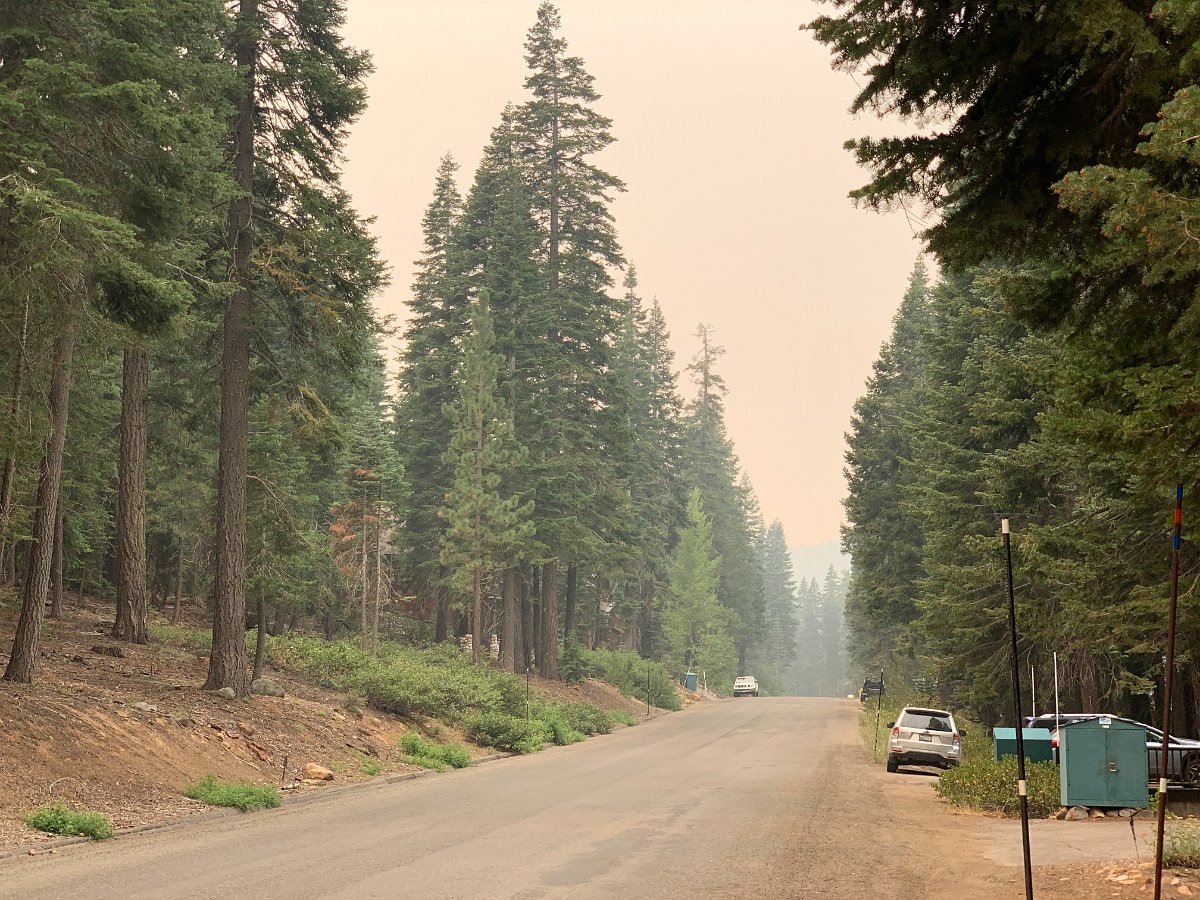
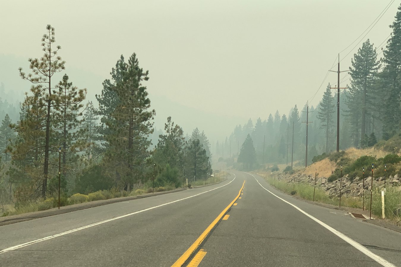
Leaving heavy smoke in Tahoe on Wednesday 8/19
We headed back home on Wednesday, leaving the heavy smoke in Tahoe from the Loyalton Fire, through the smoke filling the Central Valley to reach the heavy smoke in the Santa Cruz Mountains from the CZU Lightning Complex fires.
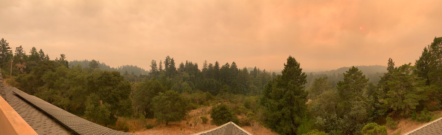
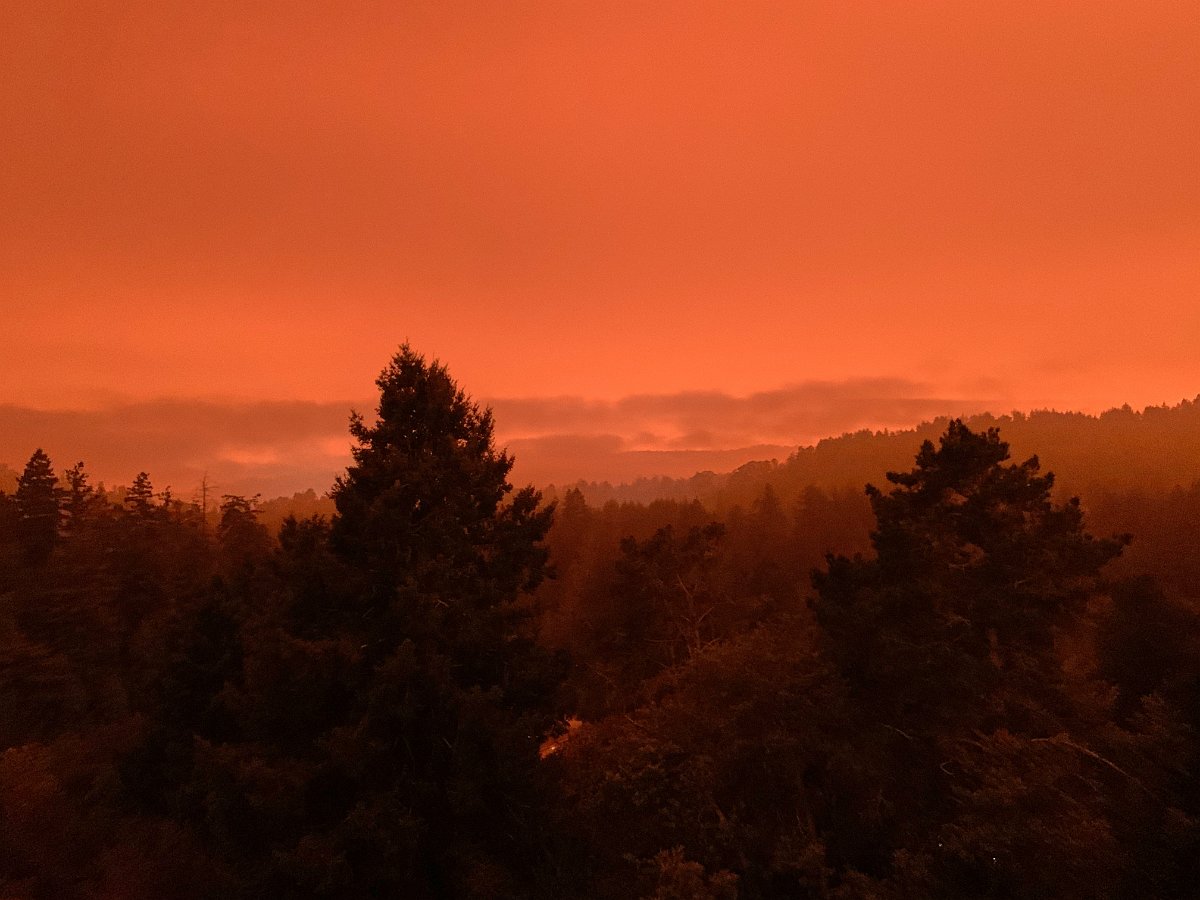
Looking south and west from the house (Wednesday evening, 8/19)
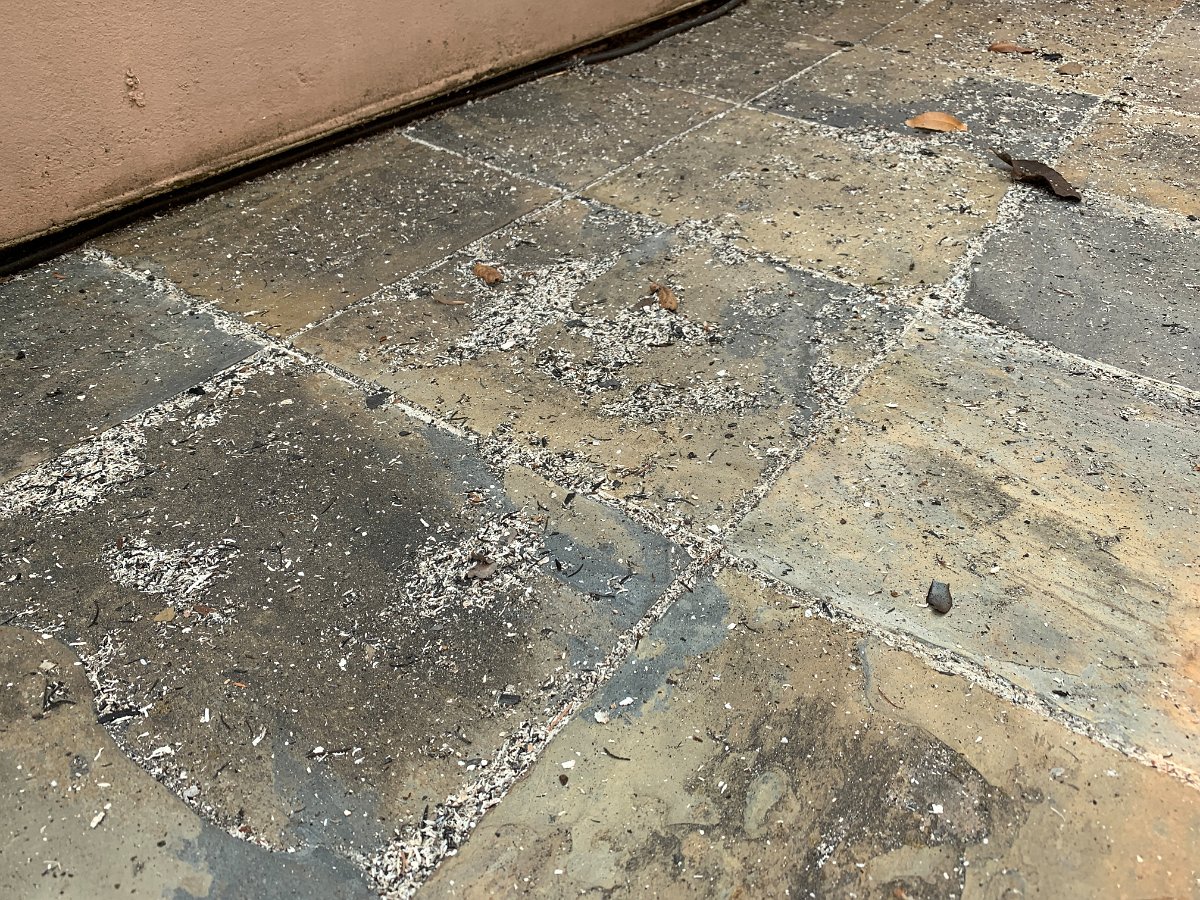
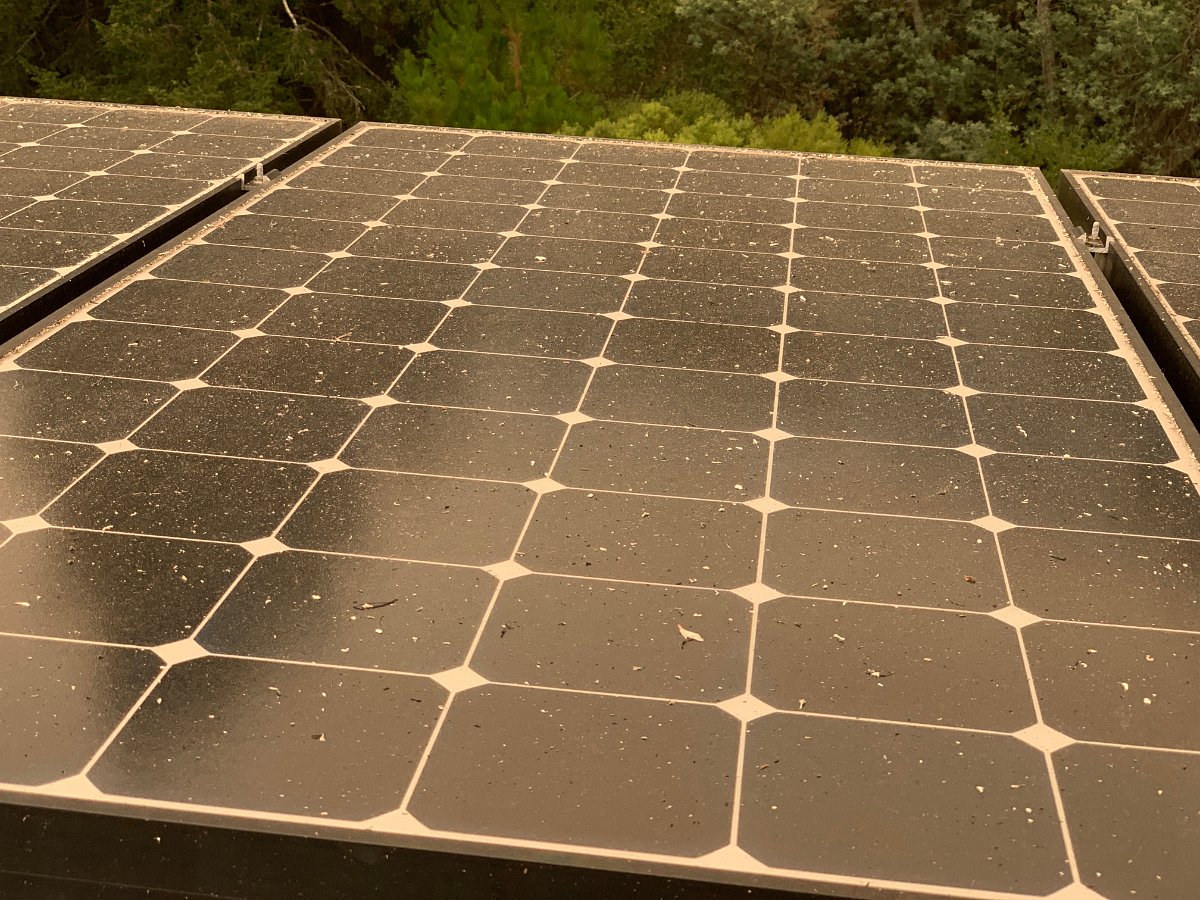
Ash and charred leaves deposited around the house (8/19)
As we came through Vacaville and Fairfield on I-80, we slipped through just before the LNU Lightning Complex fire jumped I-80 and even saw flames from the interstate:
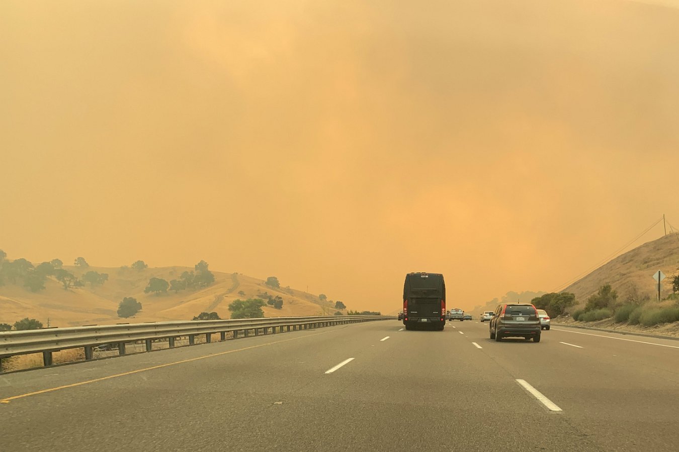
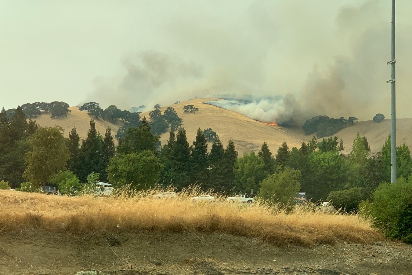
LNU Lightning Complex Fire about to cross I-80 near Fairfield on 8/19
On Wednesday and Thursday we prepped for evacuation, loading up the cars with necessities and some irreplaceables, prepping the house as per wildfire pre-evacuation recommendations (moving furniture away from windows, etc). Sure enough, the mandatory evacuation zones were expanded Thursday evening to include everything west of highway 17 (including downtown Scotts Valley). We’re a little south of Scotts Valley and just east of highway 17, but we decided to go ahead and evacuate Thursday night – heading back to Tahoe.
The evacuation areas are expected to remain in effect for a few weeks. Darlene will be renting a place near Stanford Hospital in Palo Alto as she’ll be returning to work next week.
So far, it looks like they’ve been able to mostly hold the fire west of highway 9 and north of Santa Cruz and Davenport. Unfortunately, we’ve got the potential for more fire starts due to more dry thunderstorms expected around the Bay Area from Sunday (8/22) through Tuesday morning (8/24).
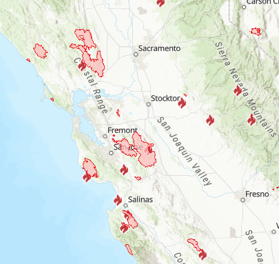
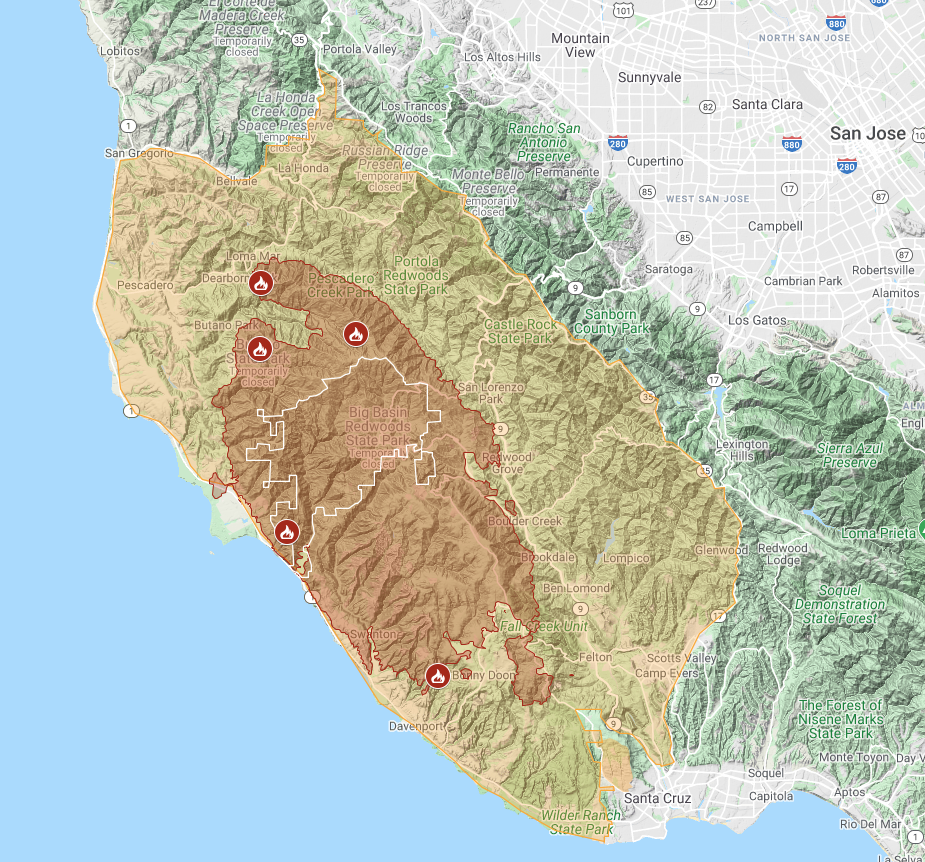
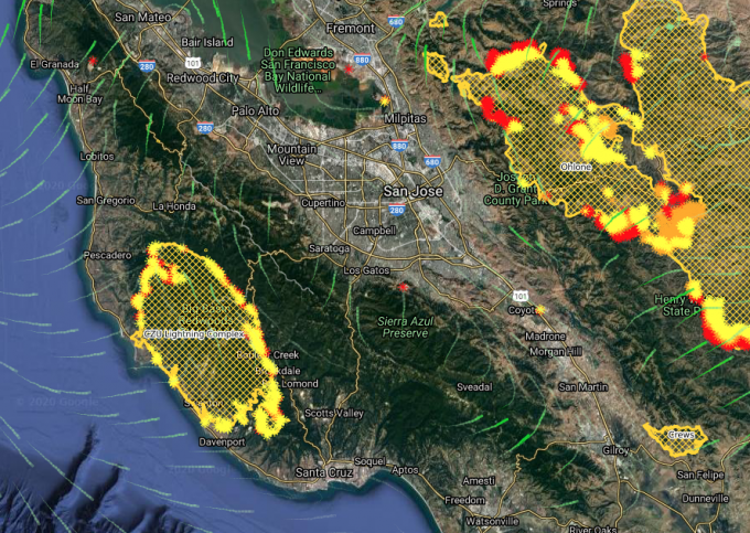
Here’s a combined, interactive map showing both the perimeter of the ZCU Lightning Complex fire and the evacuation area. 63,000 acres burned, 77,000 people evacuated – snapshot as of Saturday, 8/22:
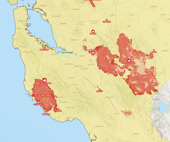
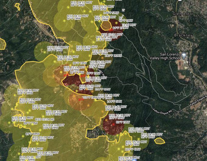
Here’s a really nice mapping tool (CalTopo) that can overlay various satellite data (like VIIRS) on a map source of your choice and plot additional weather data like wind patterns. You can even zoom in to see individual temperature sample numbers showing where the fire is hotter and cooler or no longer present:
For more info on the Santa Cruz Mountains fires, here’s some resources:
Update (Thursday, 8/27): 81,000 acres affected as of this morning but they’re continuing to get good control of the fires across the Santa Cruz Mountains. As the mandatory evac area was never extended to where we are (just east of highway 17), Darlene headed back on Monday evening since she had to go into work at the hospital on Tuesday and I headed back with the cats on Wednesday evening as things seemed to be continuing to go well. As of 3 pm Thursday, they’ve lifted the evacuation order on Scotts Valley and surrounding areas.
Update (late September): As the number and size of the wildfires continue to grow across the western states, we get a taste of our potential future norm, including days that look like night and seemingly right out of “Blade Runner 2049”:
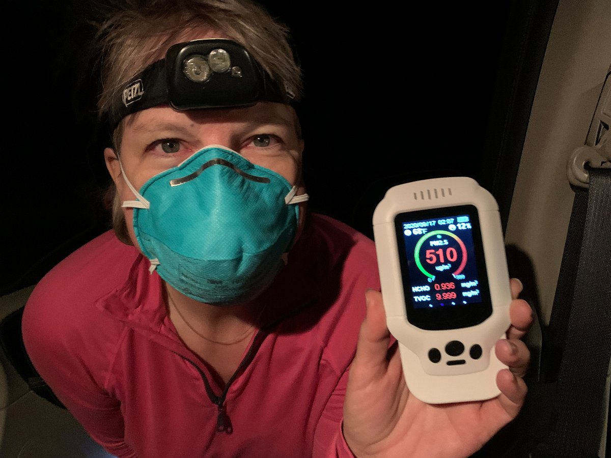
And when we ventured up through Oregon to pick up the Transit campervan in mid-September, we encountered some of the worst air yet: PM2.5 counts of well over 500 outside the rental car.
We brought along our not-so-portable home air filter to use in the car, which was quite helpful on the long drive up and overnight car camping in this nasty environment. I’ve since bought a more compact unit for the campervan given the very likely future event of being caught out in future multiple-states-wide wildfire smoke.