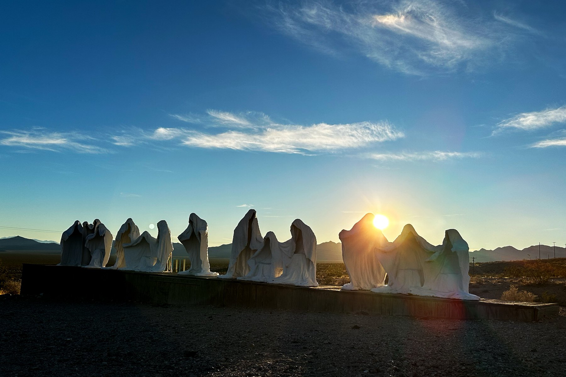
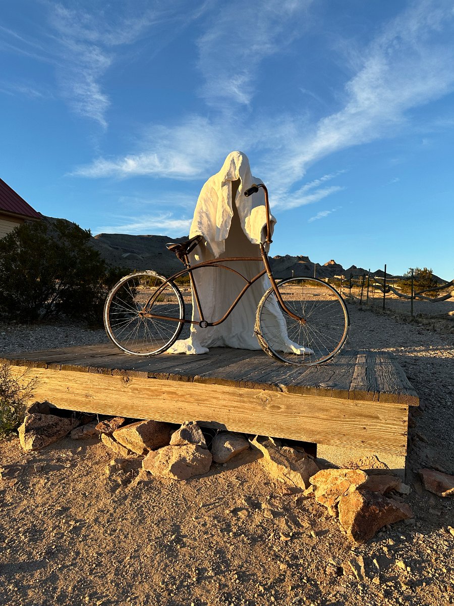
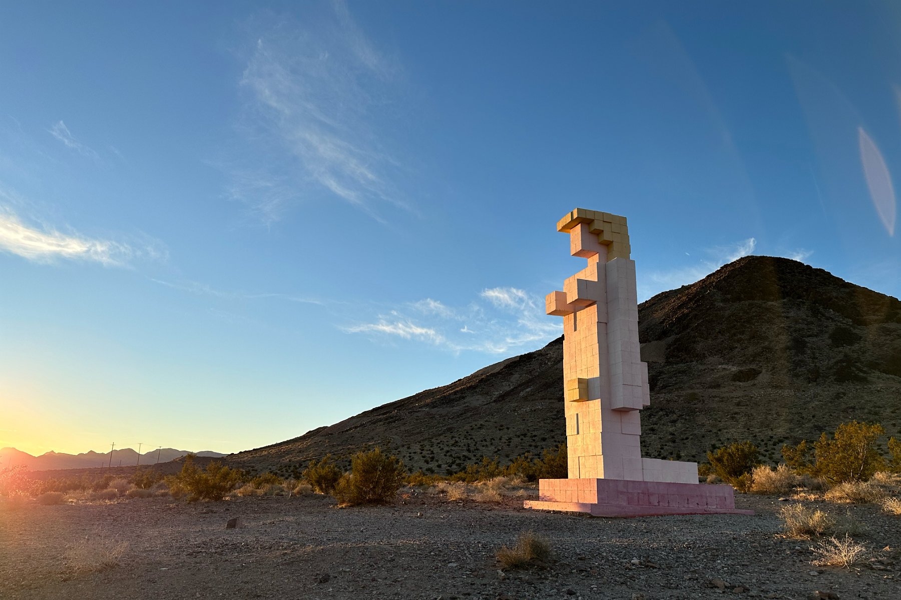
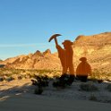
Continuing south on SR95 from Tonopah and Goldfield, we came through Beatty and reached the Goldwell Open Air Museum a little before sunset:
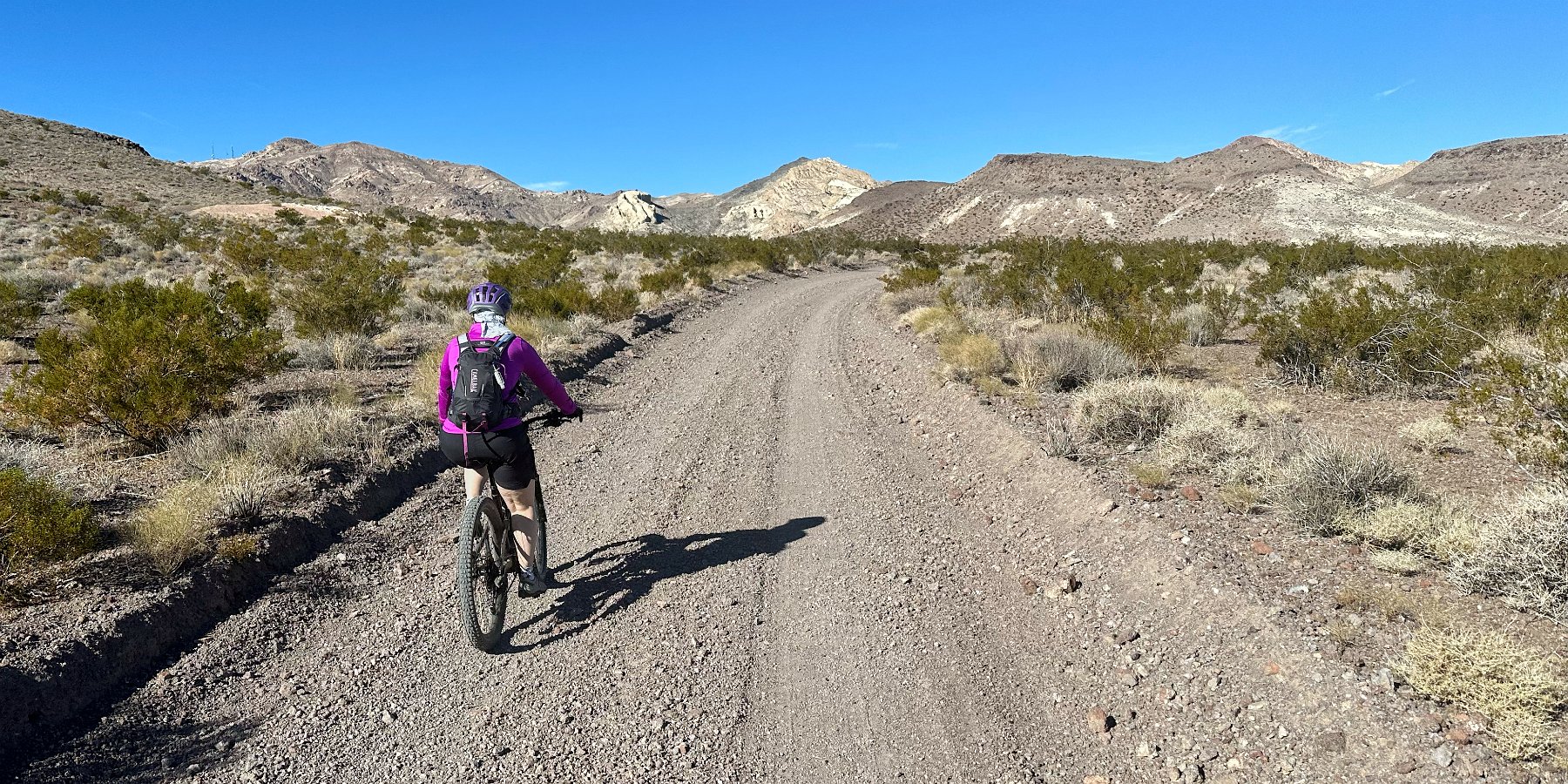
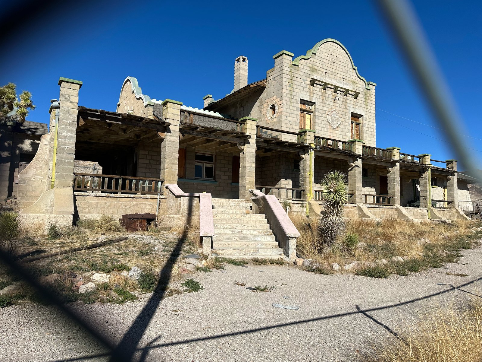
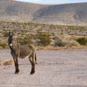
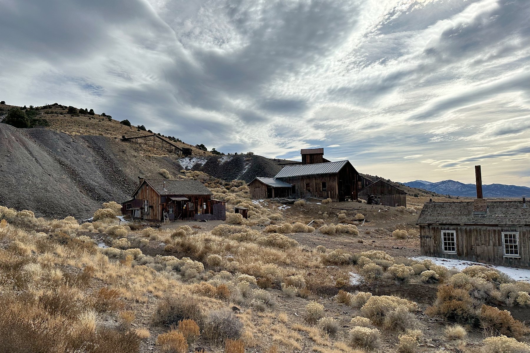
We spent the next two nights in a spot in the hills outside Beatty and ventured out on our bikes to explore and visit the remains of the mining town, Rhyolite. We also encounter some wild burros both out in the desert and in the middle of the town of Beatty.
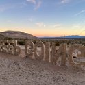
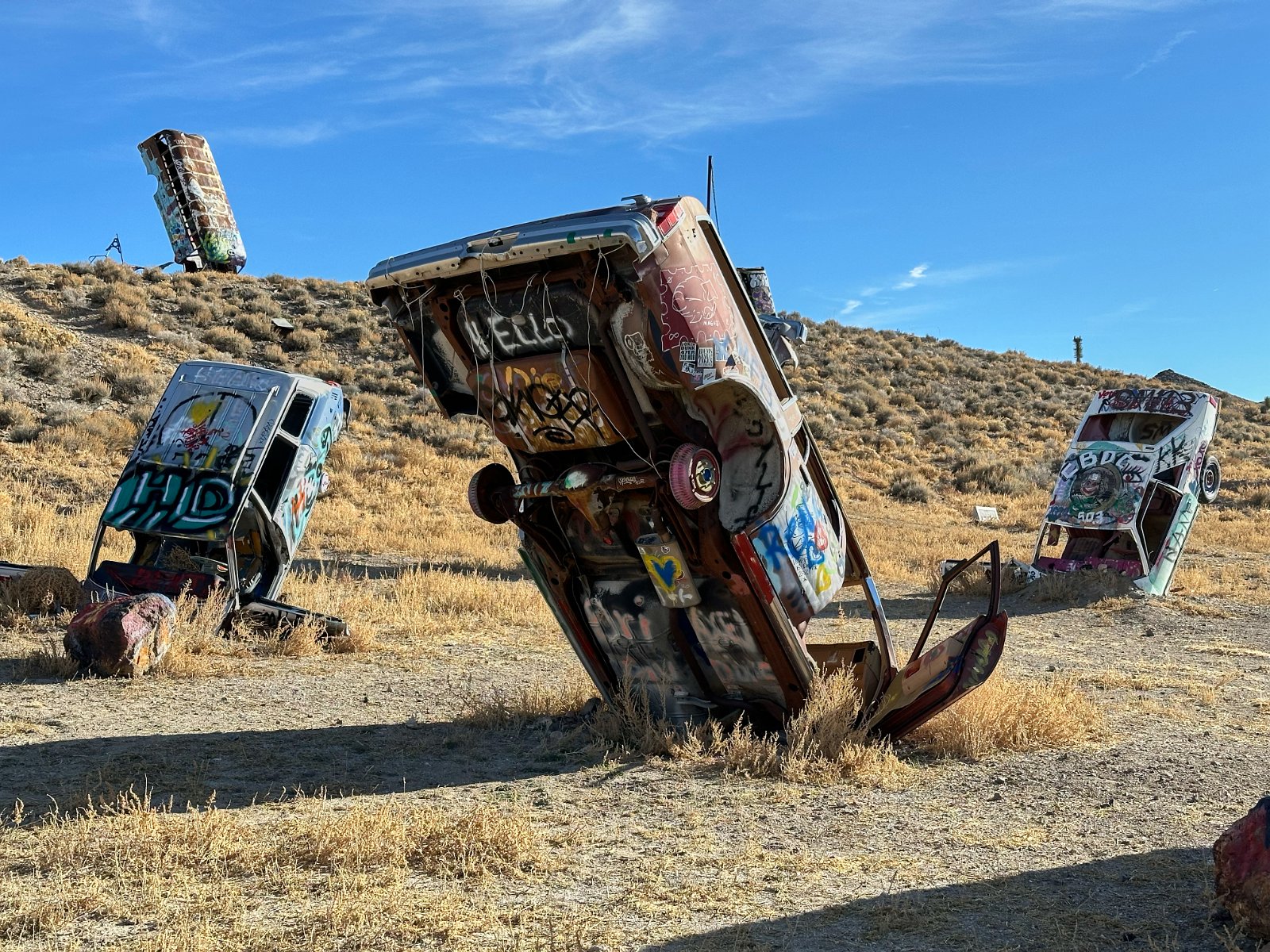
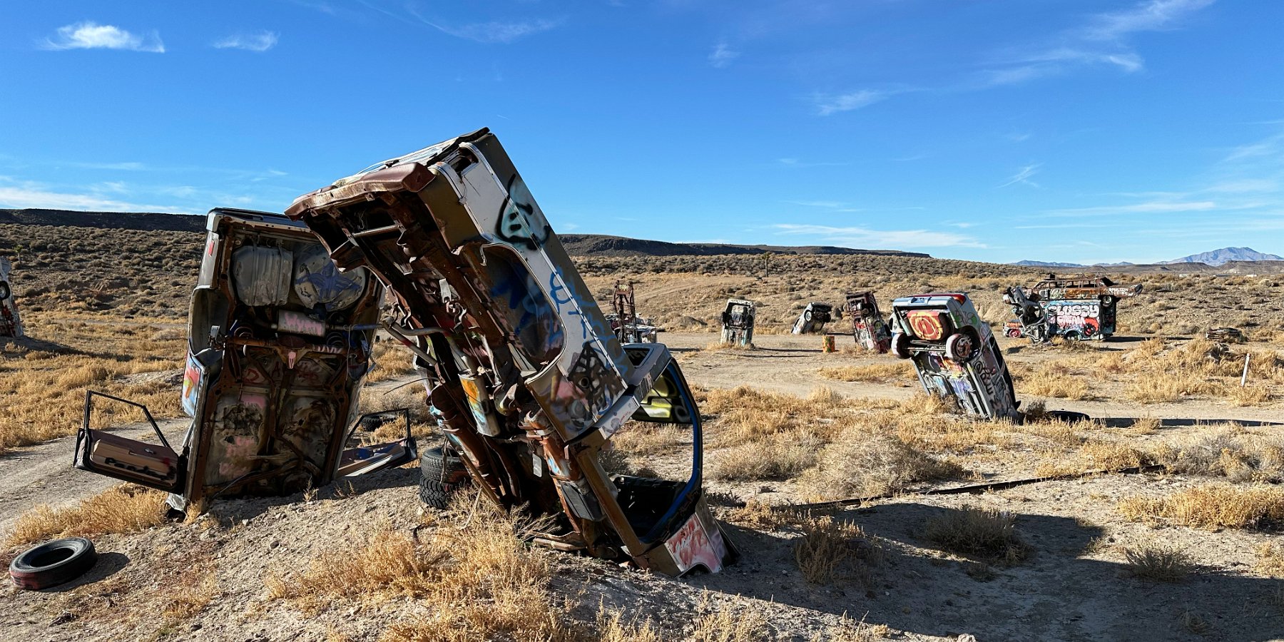
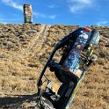
Next stop along Nevada’s SR95: another once-booming mining town, Goldfield, and the International Car Forest of the Last Church:
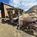
There’s a few old buildings and several collections of abandoned mining gear in town. We skipped those but did swing by the old “pioneer” graveyard in the outskirts of town to see some unusual epitaphs:
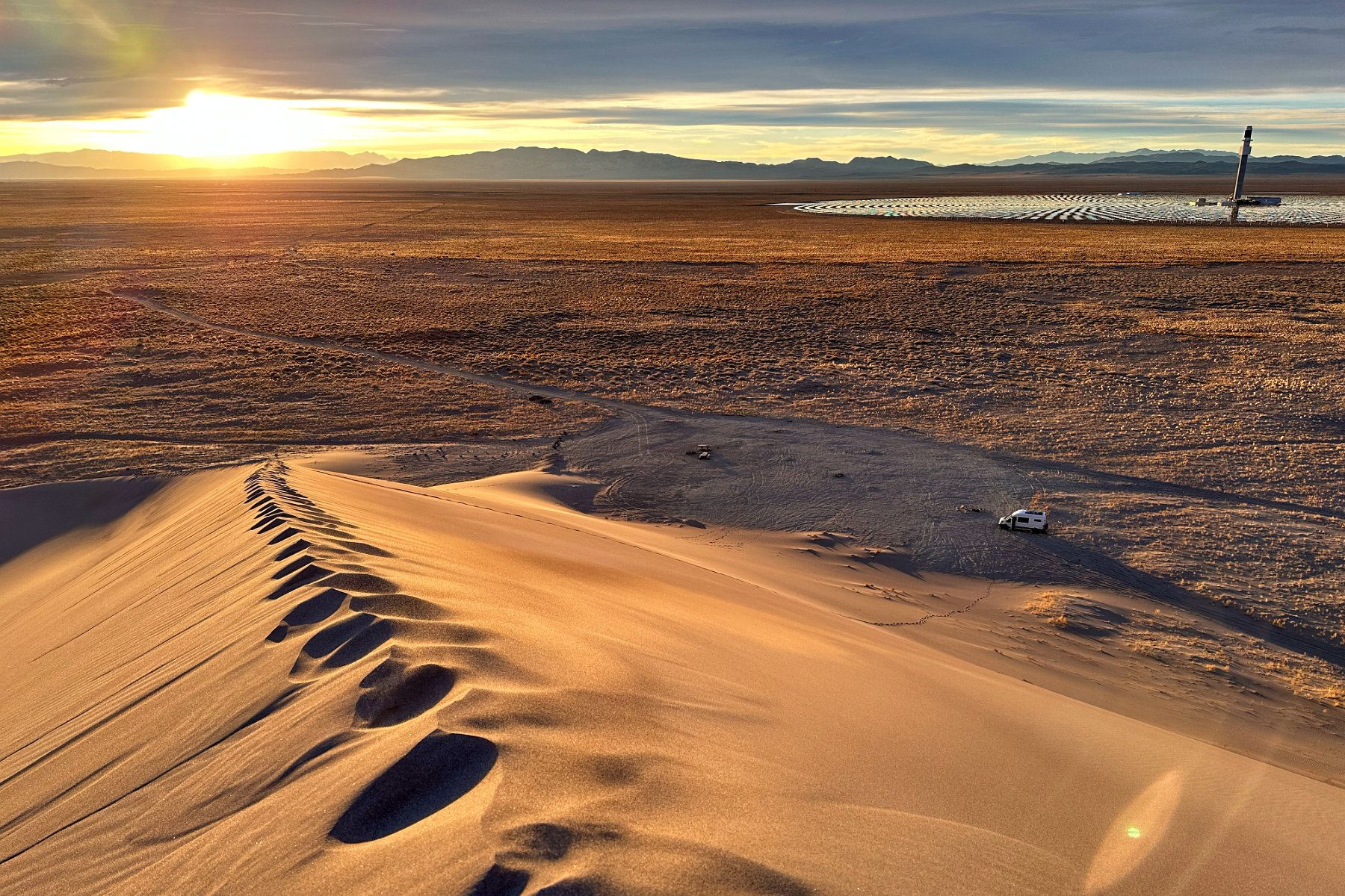
To continue our road trip down SR95 in Nevada, we returned from our Berlin ghost town detour and camped out near Tonopah at the base of the Crescent Sand Dunes, in sight of a solar concentrating power plant:
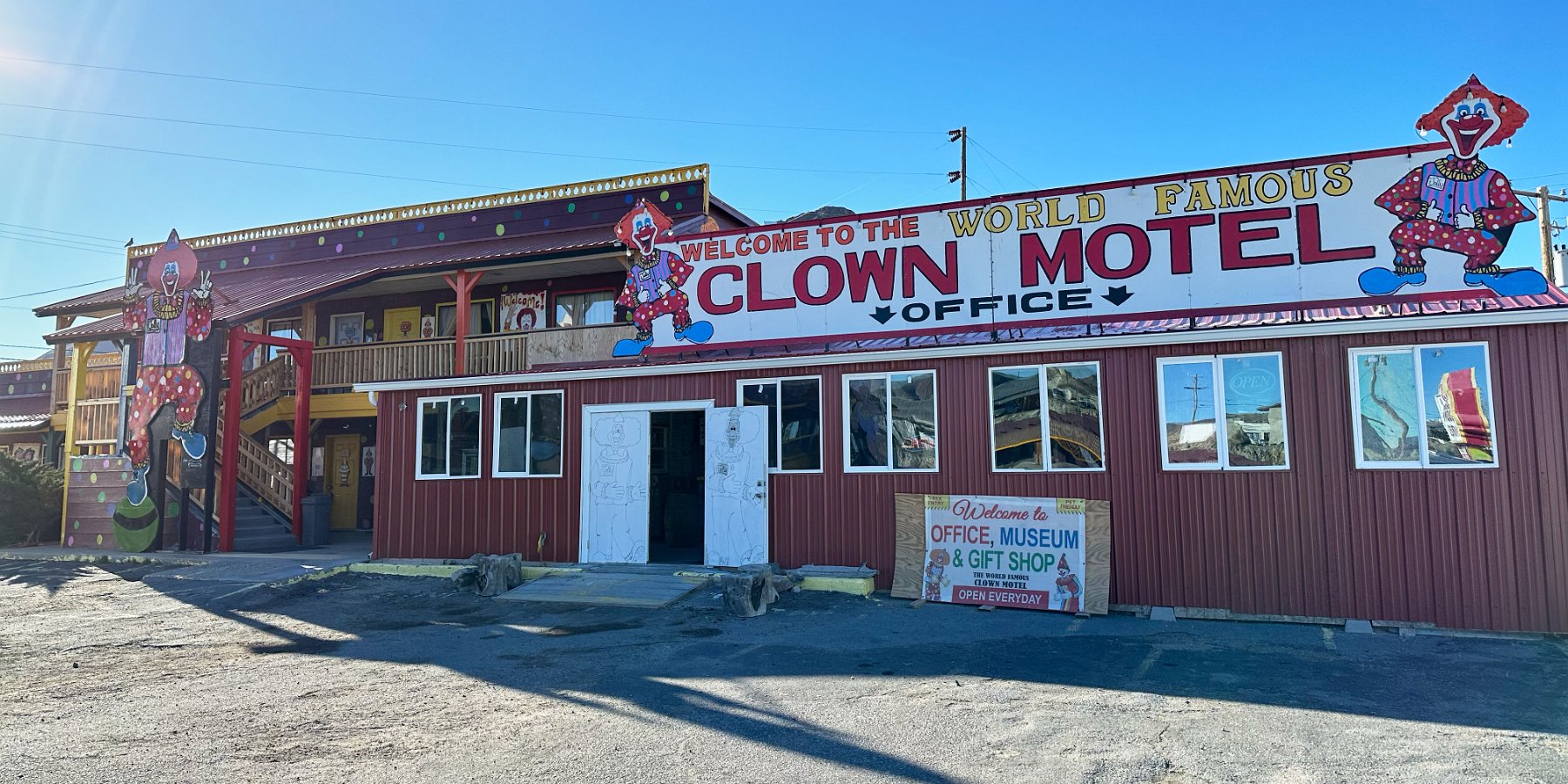
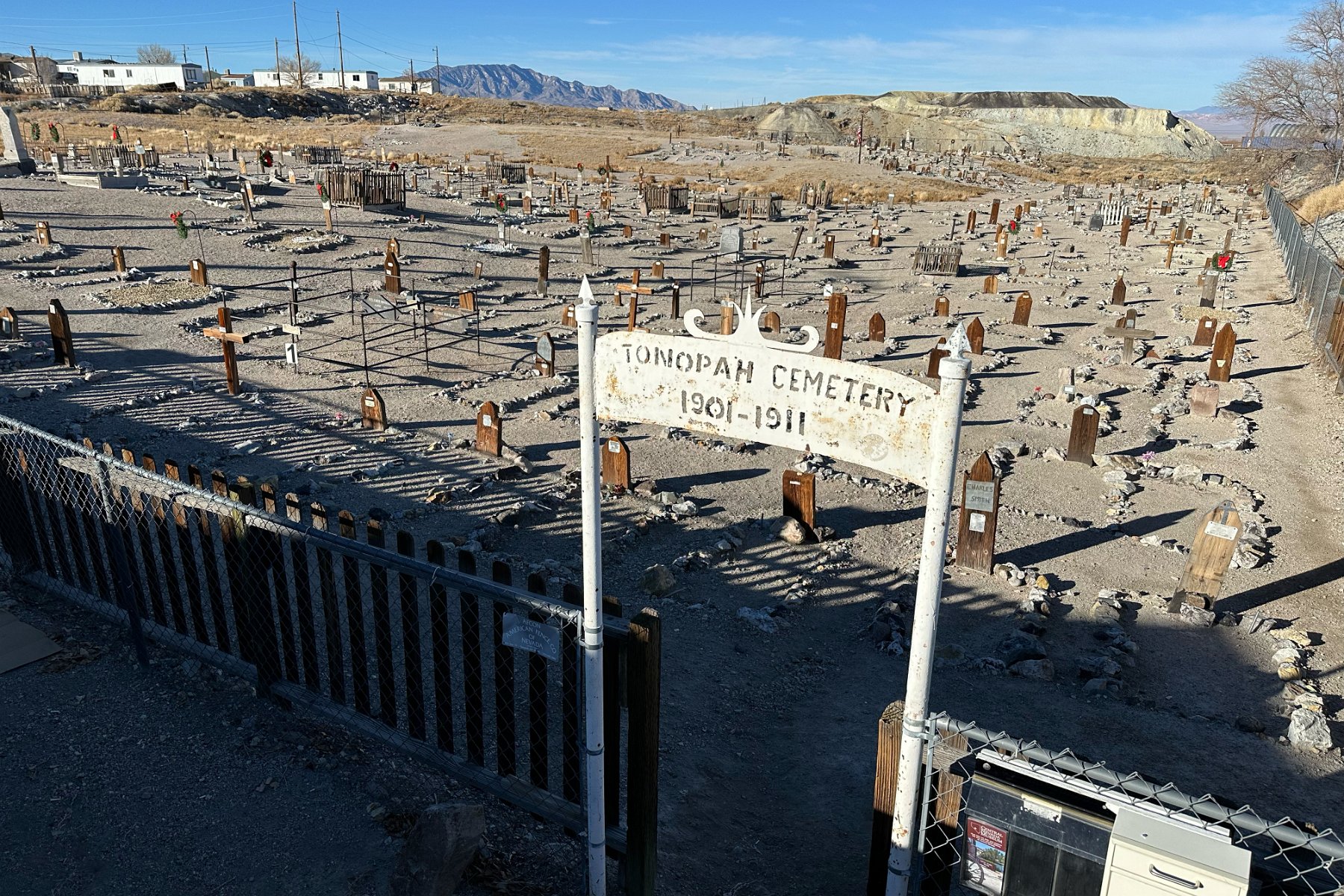
The following day, we visited the freaky fun Clown Motel and the neighboring graveyard from Tonopah’s early mining days:
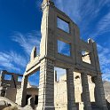
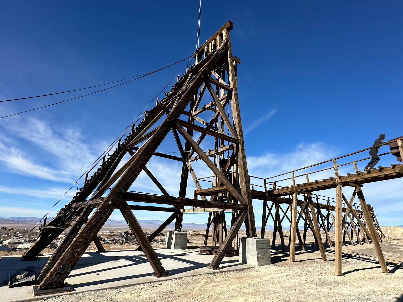
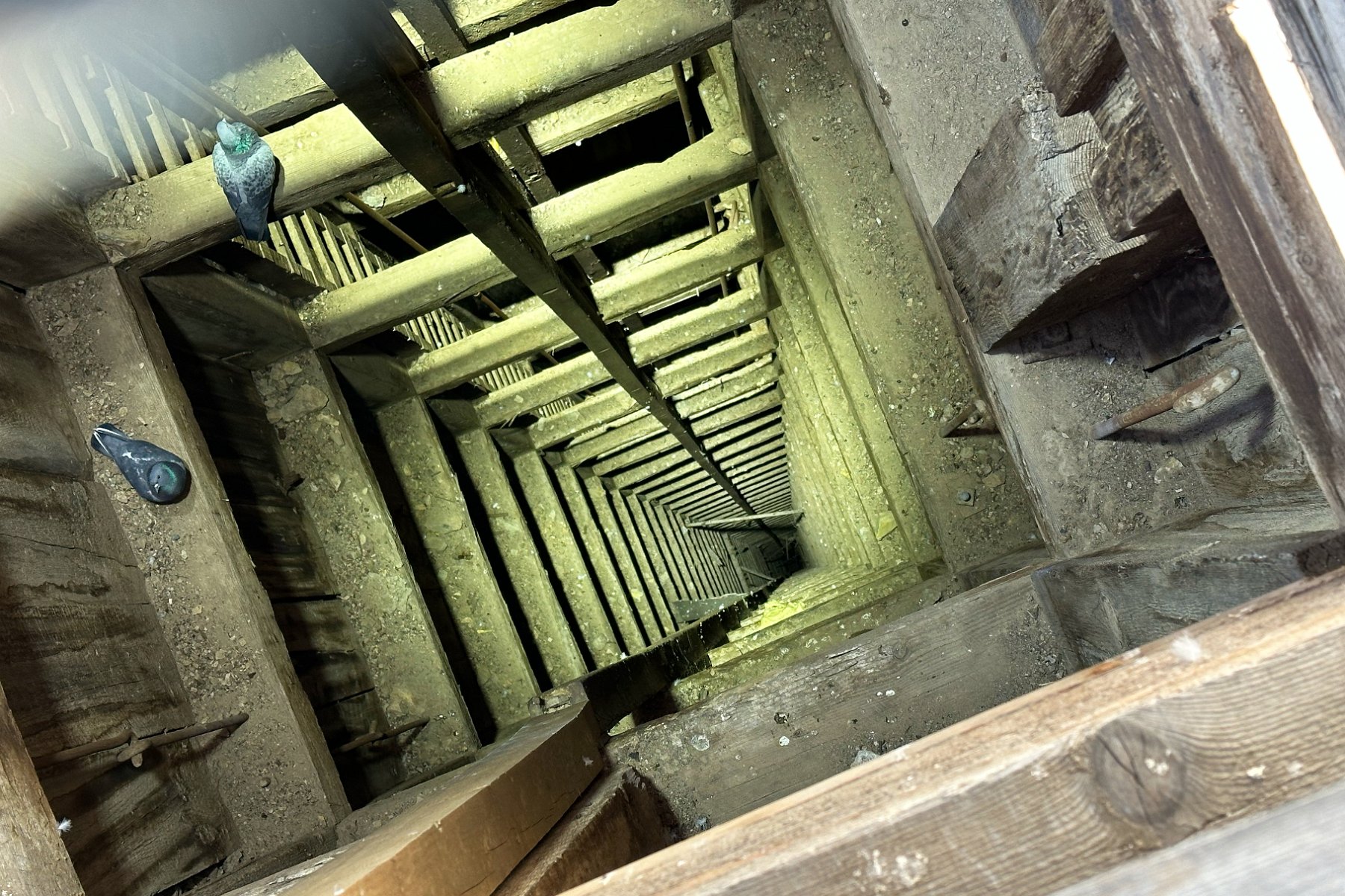
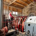
But we spent most of the day checking out the very interesting Tonopah Historic Mining Park:
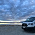
The day after Christmas, Darlene and I headed out in the camper van for a road trip down the western side of Nevada. Starting from the Tahoe house, our first stop heading south along SR95 was an overnight stay at Walker Lake:
Passing through Hawthorne the next morning, we then took a major detour off SR95 to visit Berlin /Ichthyosaur State Park –both a silver mining ghost town and a significant fossil site for ichthyosaurs. We enjoyed seeing and reading about this history of Berlin but unfortunately, the fossil site building has very limited hours in the winter so we could only peer in the window.
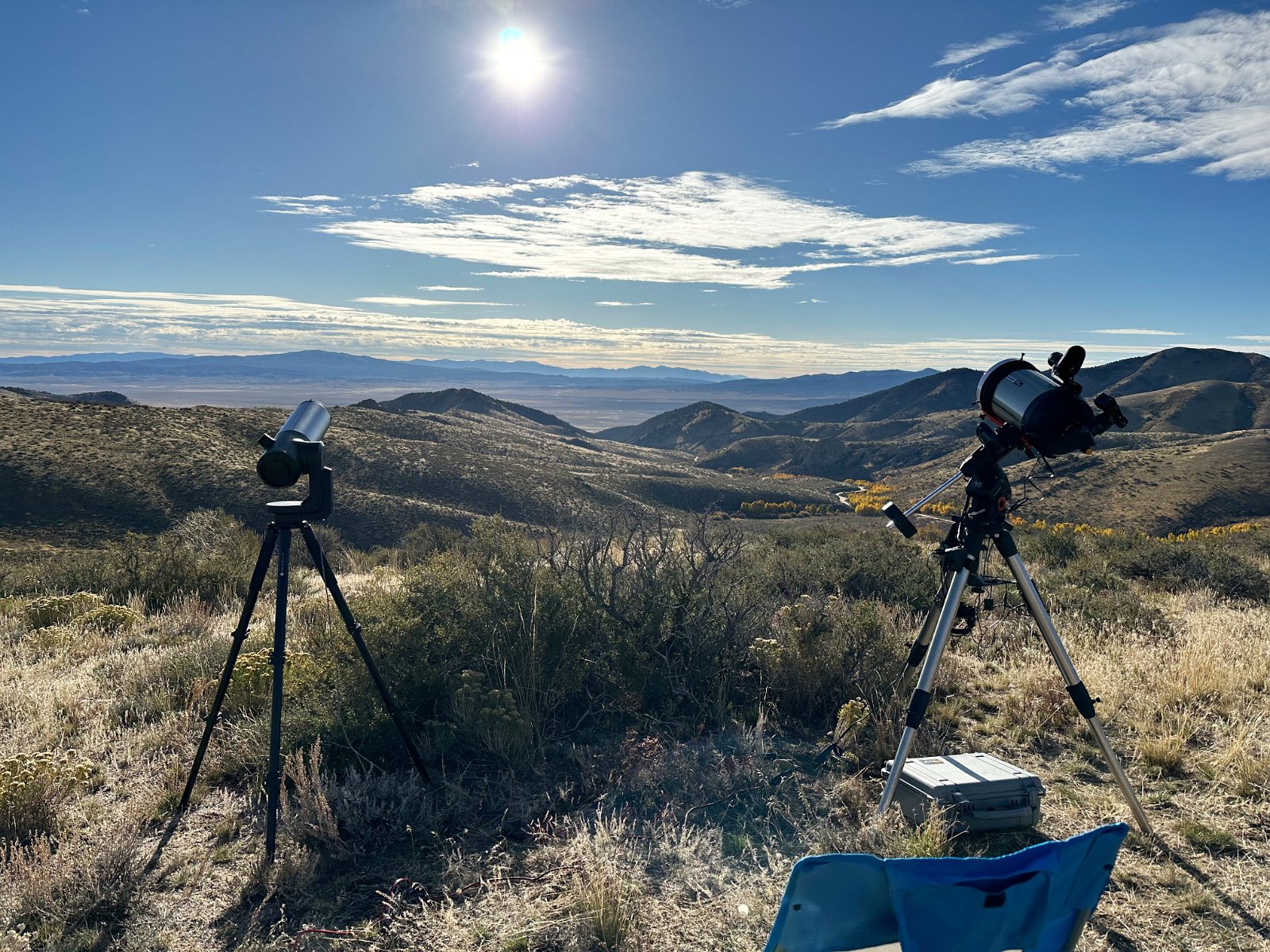
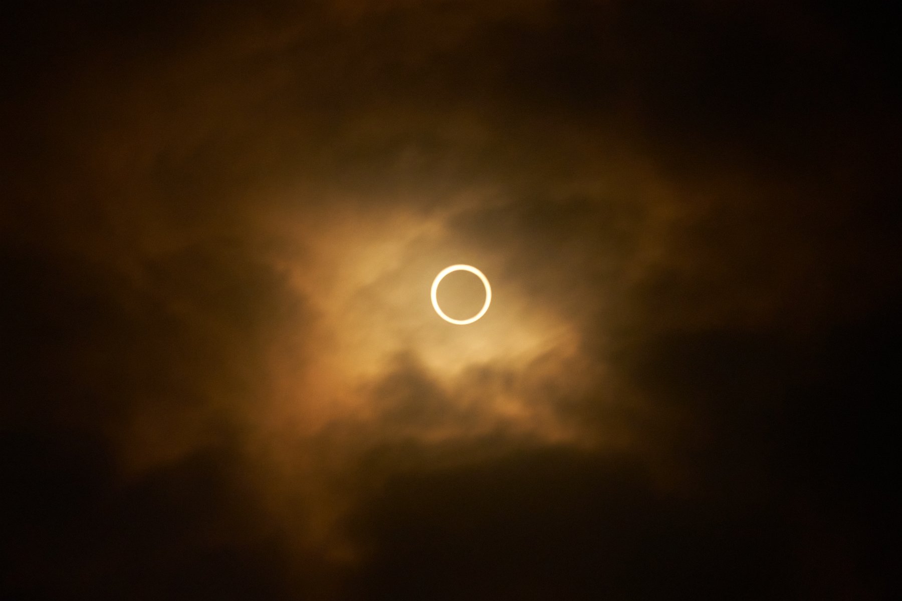
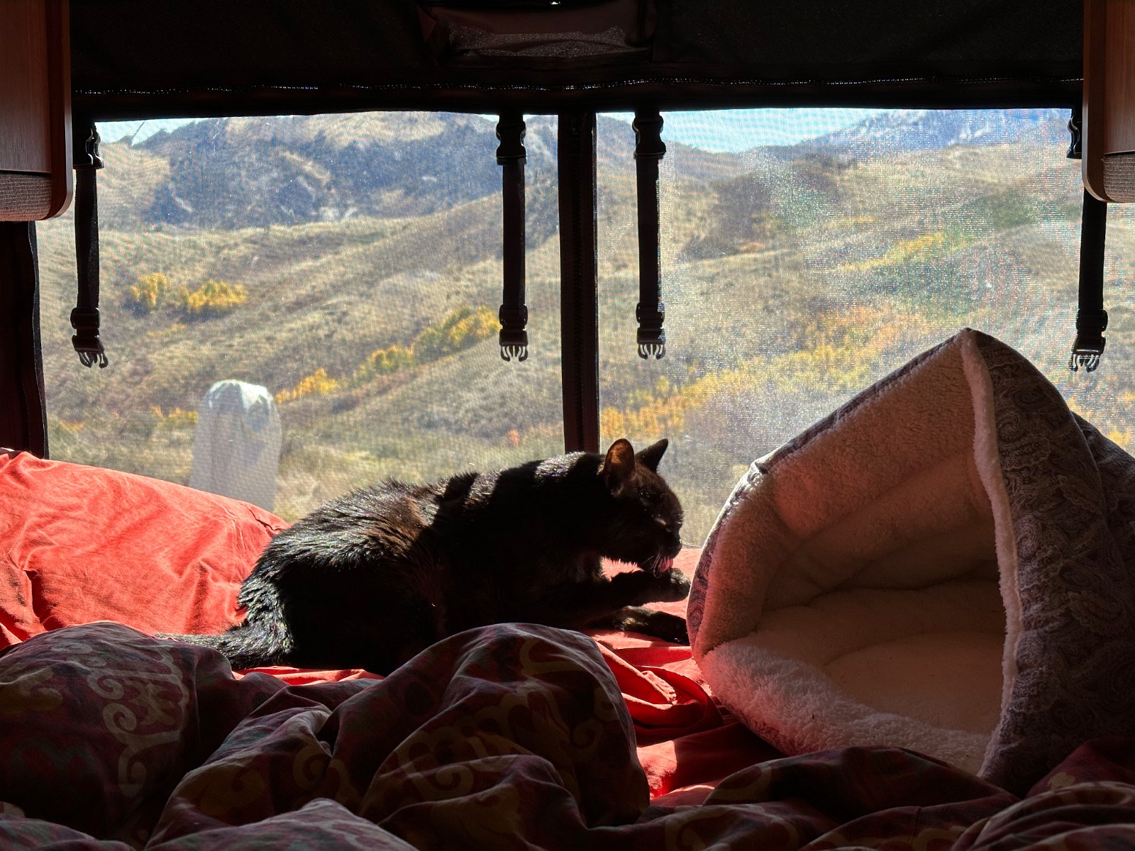
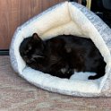
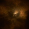
Scouting over maps of the path of October 14’s annular eclipse, I spotted a potentially nice area to view it in the lovely Ruby Mountains of central Nevada (south of Elko) – an area I had never explored before. Darlene was off to visit Maine with her sister and Hera had been having more health issues but she seemed to have stabilized again when I decided to go ahead and pack up my bike and telescopes in the van and head out a couple days in advance to secure a nice spot.
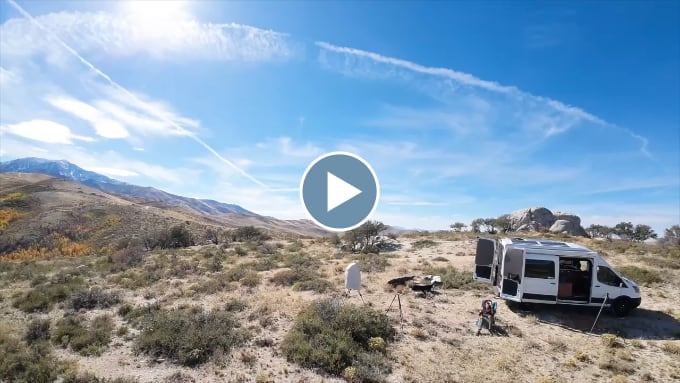
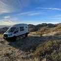
I found a spot with a gorgeous panoramic view on Harrison Pass that was somewhat isolated from the access road – and the soon-to-be-gathering small crowd of vehicles and campers. I set up and tested my cameras and telescopes the day before the eclipse and also did a bit of exploring by mountain bike on what turned out to be some nasty steep ATV roads.
Two-minute video of the annular eclipse
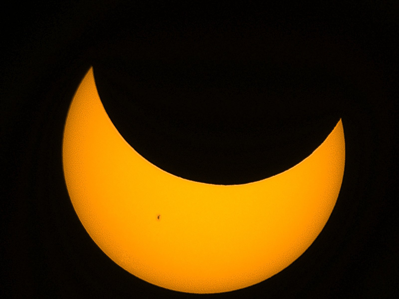
The sky started out fairly clear as the eclipse began but unfortunately the cooling air seemed to form more and more clouds as the time of max eclipse approached. It looked like we were going to be completely overcast and I could see and hear lots of folks jumping in their cars and driving down the highway to try to find some open sky. As it turned out though, the clouds thinned enough to give a filtered view of the full annular “ring of fire”. And sure enough, the clouds dissipated as the moon began to uncover the sun again. Maybe a mountain ridge viewing point wasn’t such a great idea given that mountains tend to attract cloud cover even without the cooling effect of an eclipse. At any rate, the eclipse viewing was a success.
I decided to cut the trip short due to Hera’s deteriorating health but then the van broke down as I got to Elko: check engine light on and lots of codes saying half the cylinders were misfiring – and on a Sunday when all the repair shops are closed. I eventually got a 24/7 mobile mechanic service to check it out but they recommended taking it to the one Ford dealer in town as it was going to be an extensive diagnosis and repair, and should be under warranty anyway. (Only 21,000 miles on the van.) Apparently driving it too far in this state could cause serious engine damage so I spent two nights in the Ford service parking lot. First waiting for them to open on Monday morning and then waiting most of Monday for a technician to become available. Something’s failed with the VCT (variable camshaft timing) system and it’s going to be a multi-day repair job (engine take-apart) but they can’t even locate parts right now due to the UAW strike including closures of many parts warehouses across the country. So I decided to rent a minivan, transfer everything out and head home with Hera. Once again, the van is kaput and in a shop far away.
Update (11/10/2023): It took three weeks but eventually the UAW strike ended and they repaired the engine over three days. Darlene and I drove out in my car (with Hera) to pick it up.
Before heading out of Elko, I noticed the fresh water tank was empty – which seemed very weird. Why would they go to the trouble to find and open the dump valve? We found a place to refill and it was nearly full before I stepped out and noticed all the water draining through the side door of the van. Turns out the water pump filter/strainer had burst. I should’ve emptied the tanks and pipes before leaving it because it apparently got cold enough to freeze and bust things. I didn’t think about it before I left the van there amidst all the worry about the engine failure, my sick cat and being stranded in Elko for who knows how long.
The scary thing was that the water was flooding the electrical compartment. It was right on the edge of submerging the fuse box. It was dumb luck I caught it when I did. I don’t know what would’ve happened – shorted out, started a fire? Anyway, I stopped the fill and we sat there for a while letting things drain before moving the van for fear of shifting the water and making contact and then who knows what.
When we got home I investigated further and found that I was able to replace the little $10 pump filter part and there were no other leaks. Click through for the full gallery:
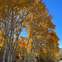
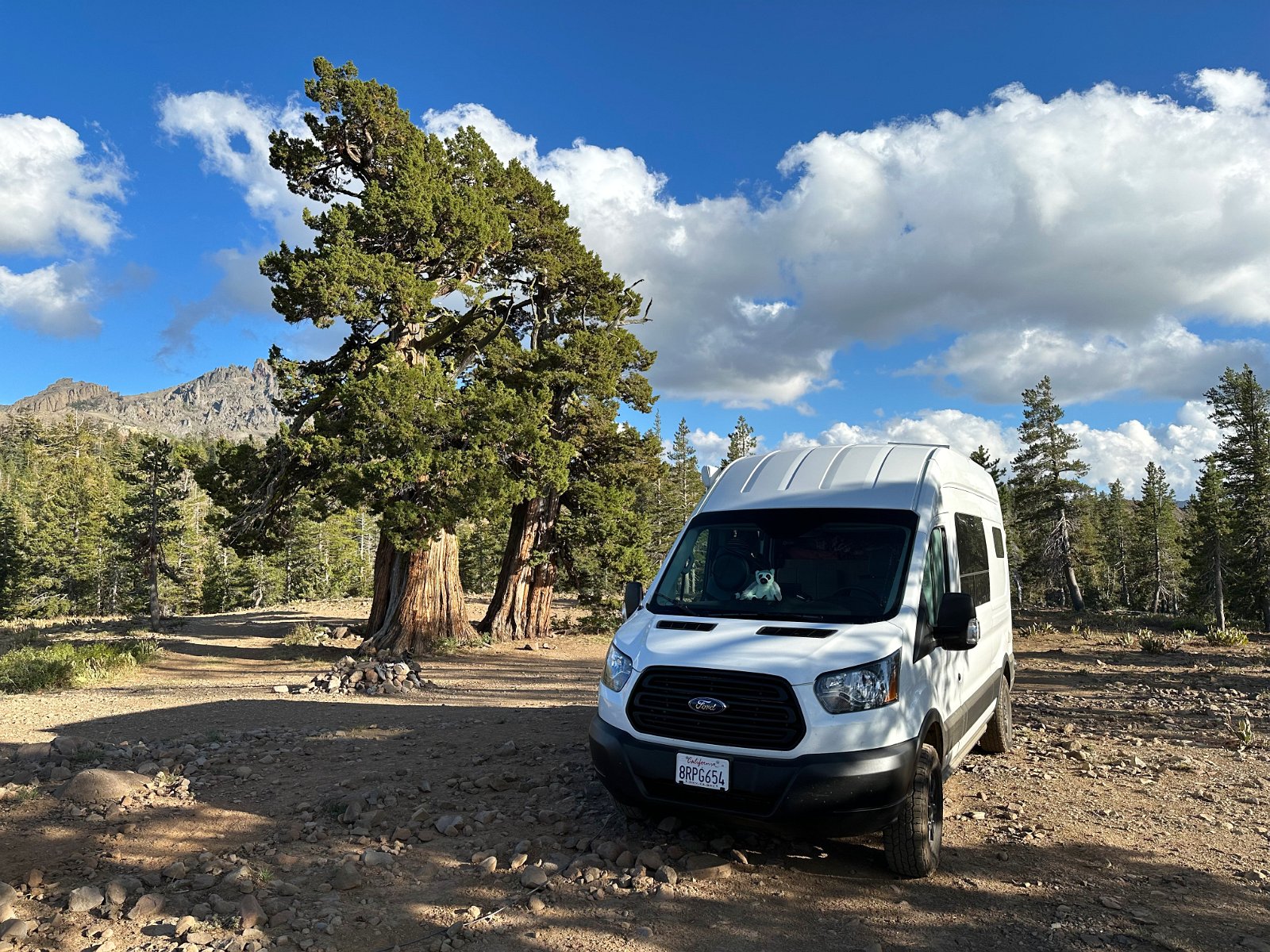
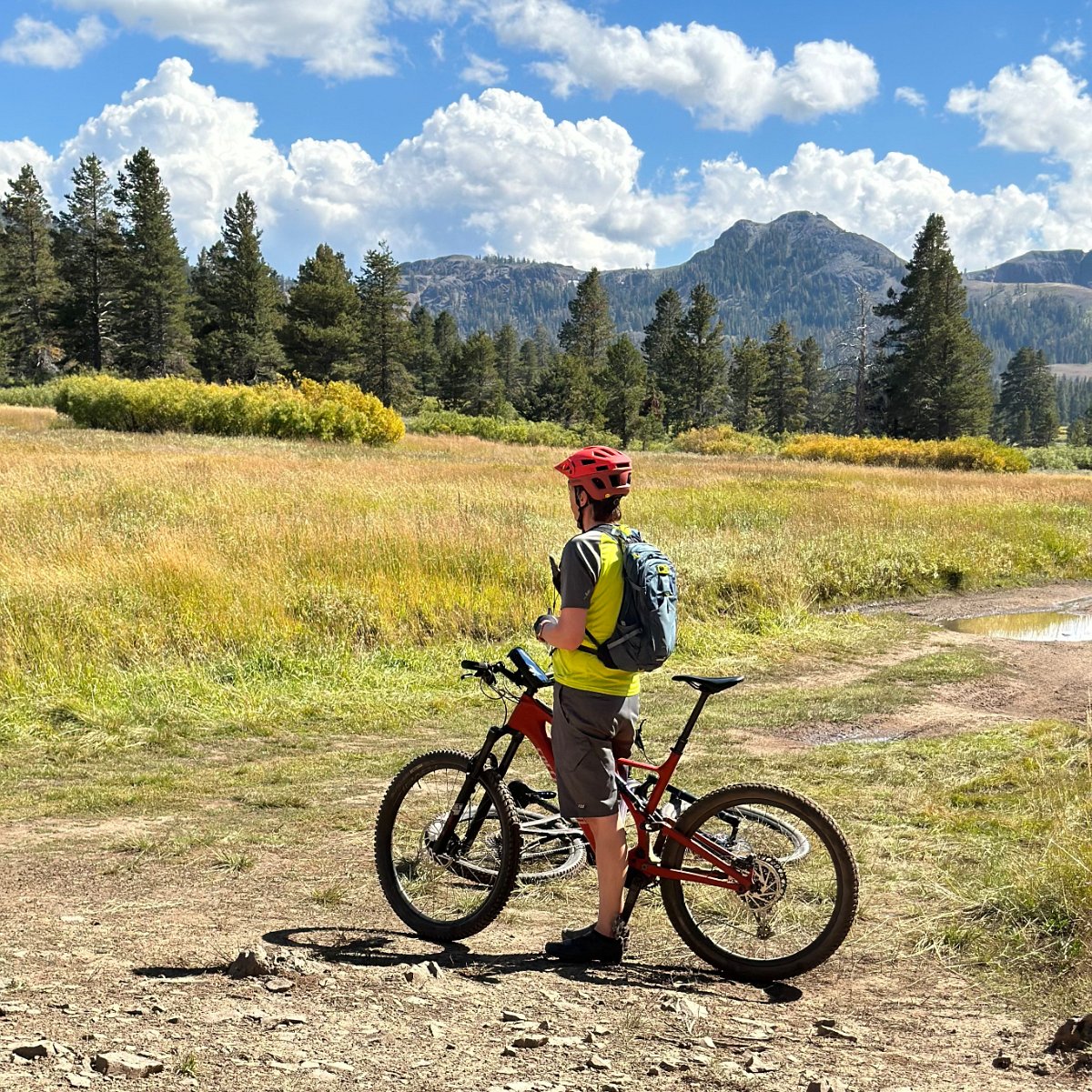
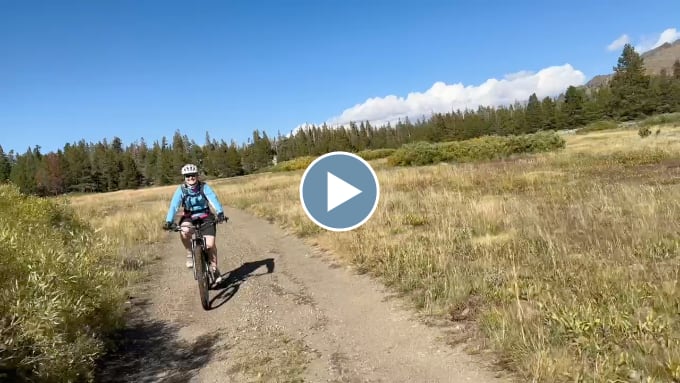
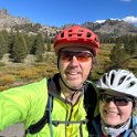
One year after the camper van was rear-ended and a very long time at a body ship plus several more months getting rebuilt and outfitted, Darlene and I (and Hera) were finally able to head out in the van again for some exploration. We ended up camping out in four different dispersed spots we found over not quite two weeks in an area of the Sierra Nevada between Carson and Ebbetts Passes (often near the Pacific Crest Trail), going exploring by mountain biking, hiking and geocaching.
We had nice weather the whole time except for some wildfire smoke that started to blow in on the last couple of days. We cut the trip a couple days short to avoid getting caught out in a bit of snow forecast for the higher elevations.
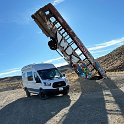
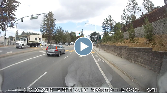
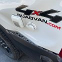
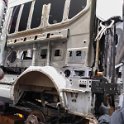
We had the van loaded up and we had just headed out on our next extended road trip, this time up to Alberta and British Columbia for a few weeks – but we didn’t even make it out of town before this happened:
Dash cam video (warning: lots of profanity)
We were off to a very late start and had numerous unhelpful things come up that morning – and Darlene was just realizing she had forgotten her phone (you can hear her calling it to locate it) – and then… the impact. It was immediately clear that we weren’t going anywhere now and there would be who knows how much hassle ahead to deal with whatever had just happened.
We were fine and the cats were fine. The kids who slammed into us didn’t have their seat belts on though. One ended up slamming his teeth into steering wheel, the other had his head smashed into the windshield, bits of glass in his forehead and he was bleeding at the scene. We encouraged them to go to the hospital.
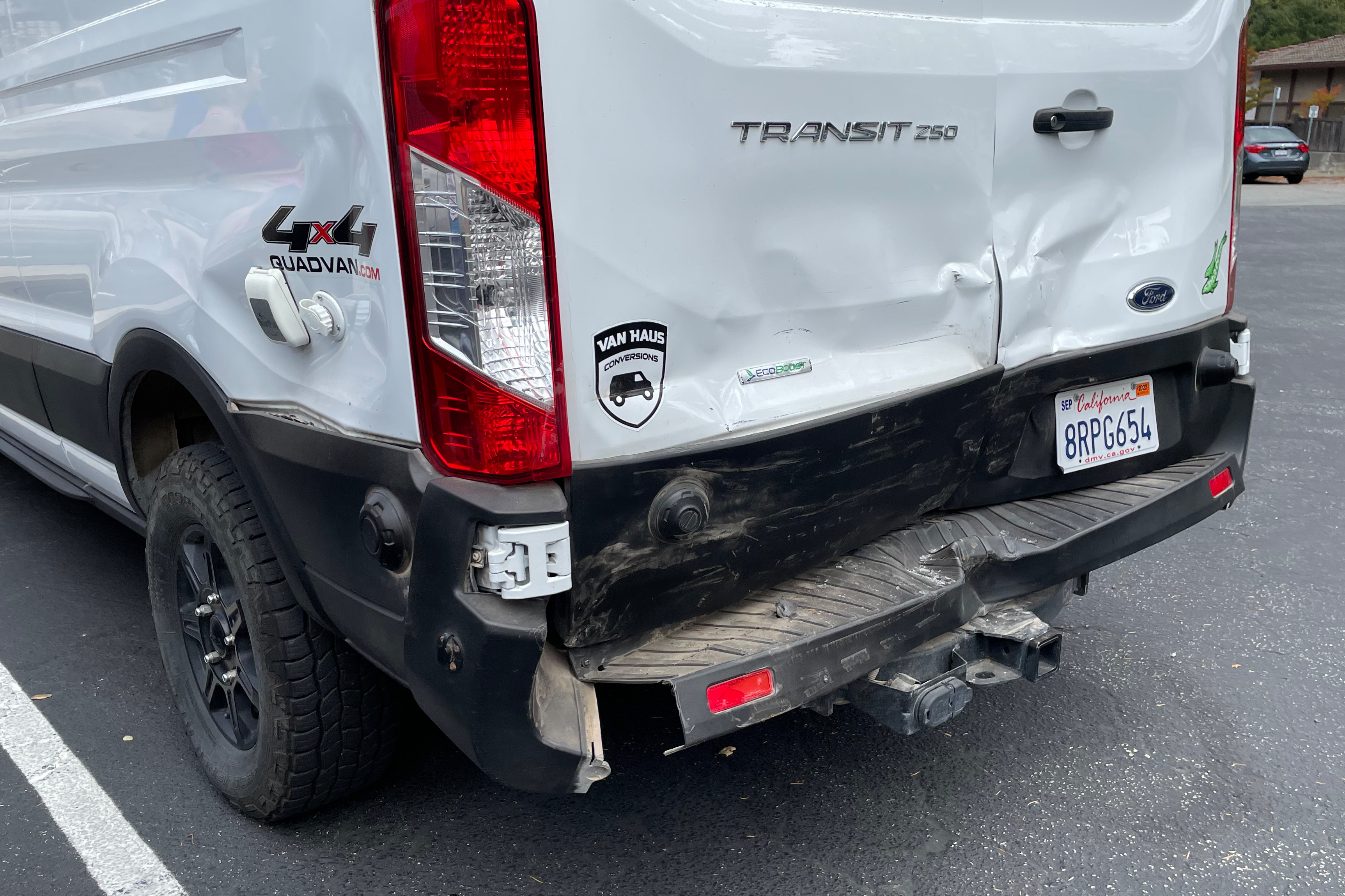
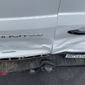
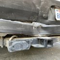
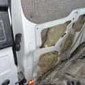
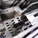
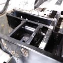
So yeah, a very abrupt end to our road trip. Can’t open the cargo doors any more but we managed to squeeze the bikes and all of our gear out through the front opening under the bed to unload everything. The van is now back up in Vancouver, WA at Van Haus Conversions where the original custom build was done. All of the interior installation (cabinets, walls, insulation, wiring, plumbing, etc) needs to be removed before a body shop can tackle the exterior damage. Then it will all need to be rebuilt again after the body work is completed. Plus the flooring will need to be replaced as it was buckled from intrusion by the cargo doors being crushed.
Very bummed. I can’t help but think that if we’d left a minute earlier or later we would have missed this whole mess. But then perhaps that young driver who somehow didn’t see this big white van slow down in front of them would’ve run over that woman and her dog. We’ll never know. But what’s with that Volvo sitting at the green light the whole time, eh?
Update (end of March 2023): Six months later and the van is still at the body shop. It’s been a long series of setbacks, delays and excuses (mostly from the body shop) and it’s still doesn’t even look close to ready to go back to my van builder, Van Haus, so that they can rebuild the interior. Maybe I’ll document all of that mess at some point, but in the meantime I’ve added a bunch of the blurry photos the body shop has sent me over the past few months to the gallery:
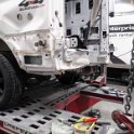
Update (early May 2023): The body shop finally finished and now the van goes off to Van Haus to have the interior rebuilt.
Update (mid-August 2023): The van rebuild is finally complete! Almost an entire year lost – and we’ve only had it three years since it was originally completed in August of 2020.
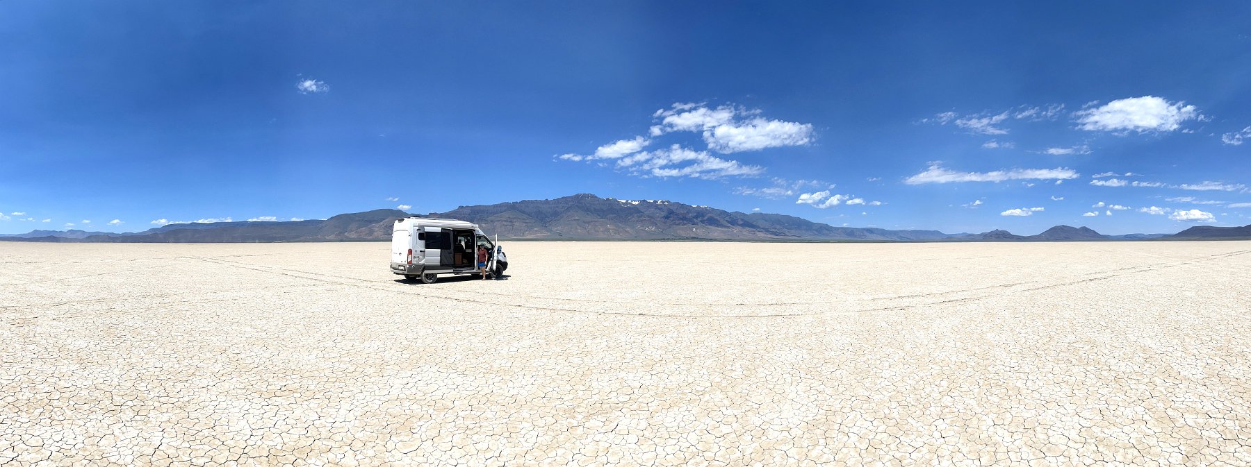
Exploring southeastern Oregon, Darlene and I made our way up to Alvord Desert, below the eastern front of Steens Mountain. We zipped around the playa mid-day for a little while and then continued north along the steep eastern front of the mountain. As it turns out, all the roads up into the mountain from this side feature private property signs and require special permission to access, so we ended up continuing on to other southeastern Oregon destinations before eventually circling back several days later.
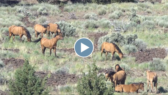
Kiger Mustangs
On our way back we passed through the Malheur National Wildlife Refuge and headed to the highlands in hopes of seeing the Kiger Mustangs. These are wild horses which were only fairly recently discovered to be direct descendents of Iberian horses brought over by Spanish conquistadors some 400 years ago. We did come across a large herd near the road that we could watch for a long while before sunset, even while we cooked and ate dinner.
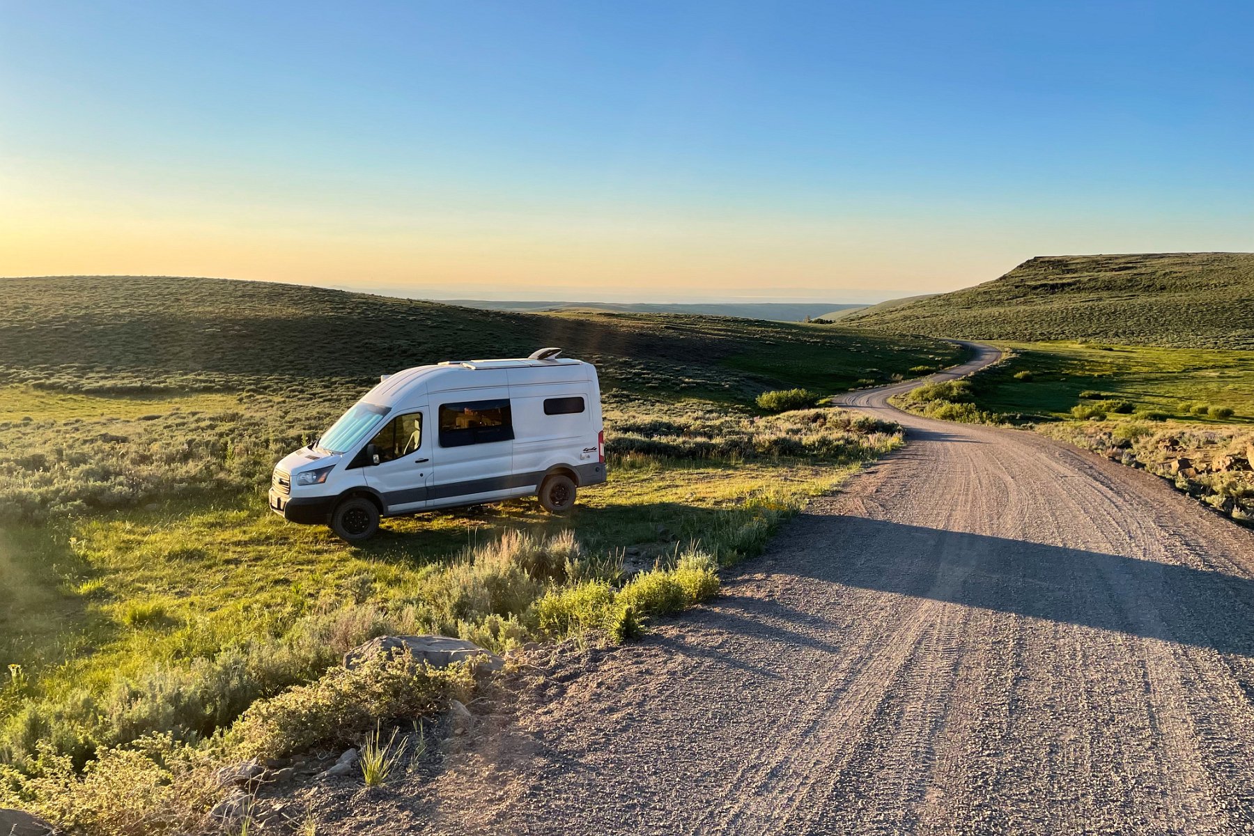
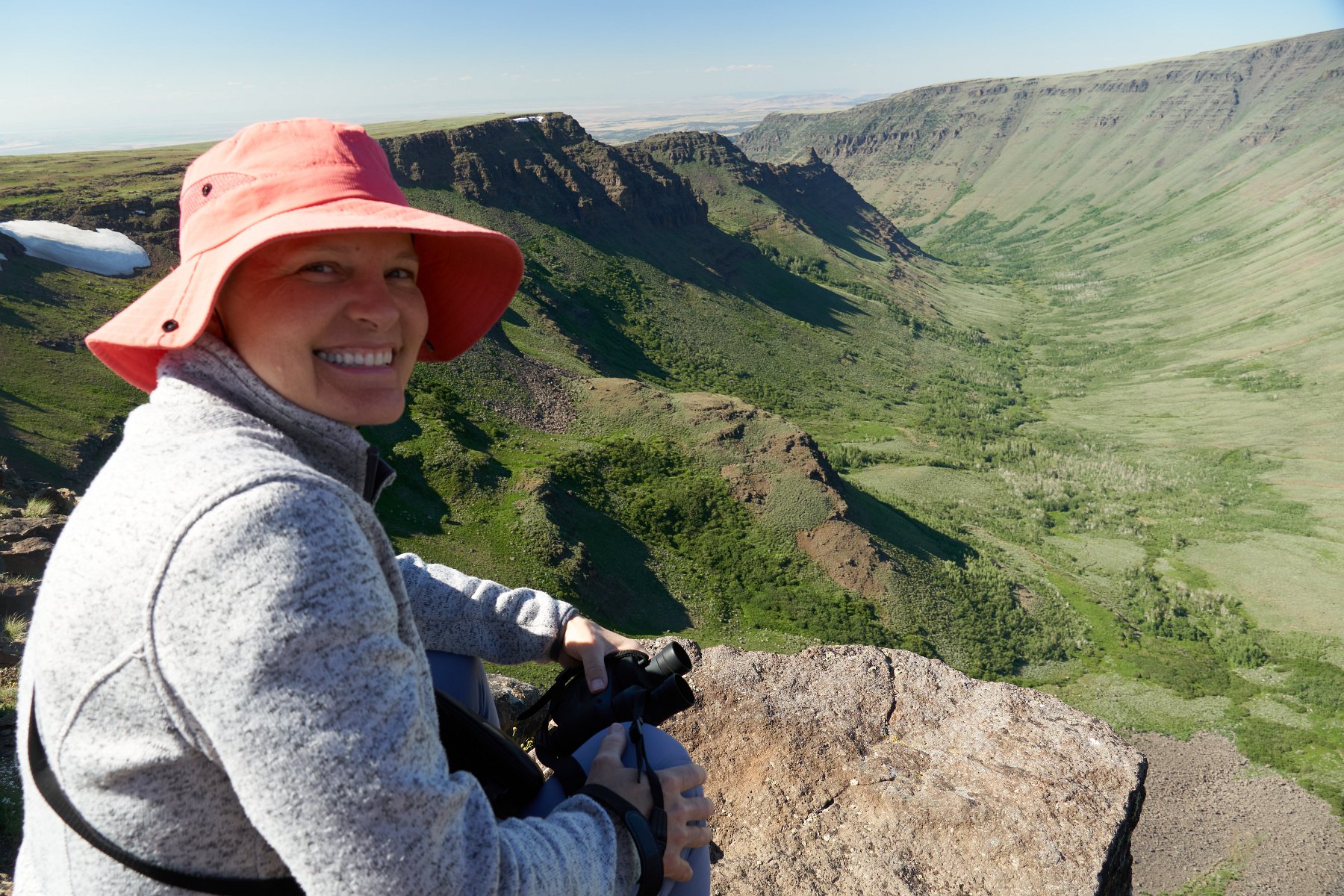
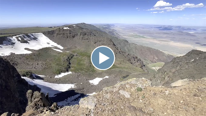
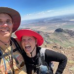
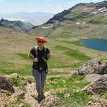
The next day we took up the Steens Mountain loop from the north, going clockwise and checking out Kiger Gorge before finding a pullout along the road to spend the night. (Too many mosquitos in the actual campground back down amongst the creek and aspens.) Over the next couple of days, we checked out many stupendous viewpoints and got in a few hikes (including off-trail from the peak). We camped at another pullout near the top one night so we could more easily catch sunrise and we ran into another herd of wild horses at lower elevations.
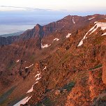
Steens Mountain montage
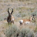
After Steens Mountain, we headed home west (choosing to skip a follow-up visit to Alvord Desert) and stayed overnight in Hart Mountain National Antelope Refuge where we enjoyed a soak in a hot spring pool and did spot a herd of antelope.