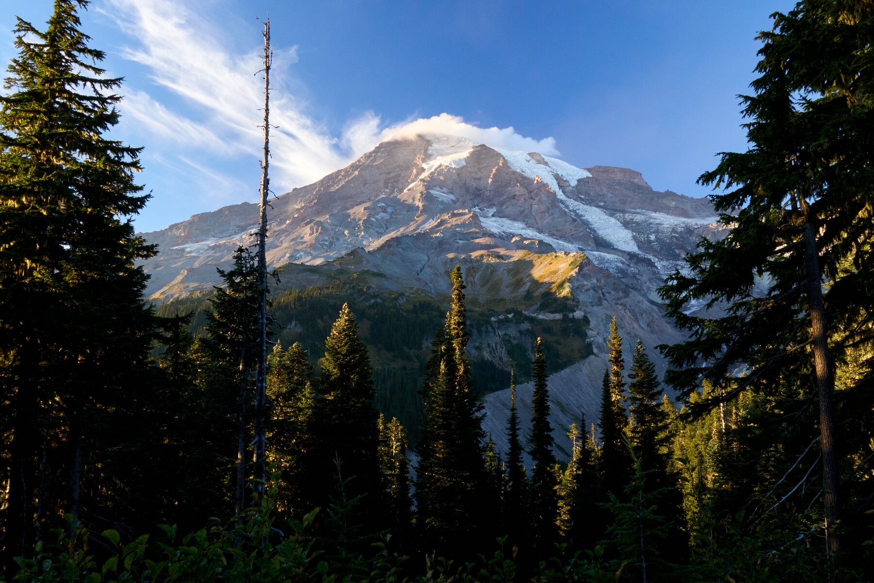
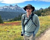
On our way home from Canada, we decided to swing over to Mt. Rainier National Park and squeeze in a couple of days exploring the south side of the park. We were arriving late so we found a wild campsite outside of the park boundary and then claimed an available campground site in the park the next day.
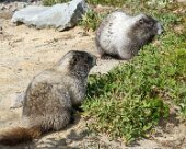
We got up to the trailhead at Paradise fairly early and hiked the full Skyline Trail loop. There happened to be a black bear and her two cubs near the lodge and we saw yet another black bear while on the trail as well as a mountain goat and a bunch of very tame marmots. We could also see Mt. Adams and Mt. St. Helens in the distance.
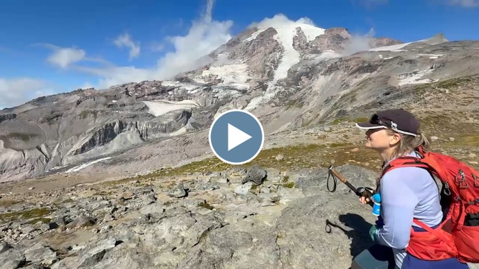
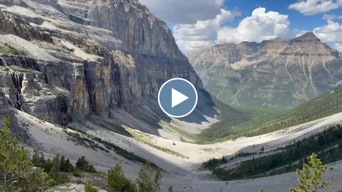
A three-minute video of our visit to Mt. Rainier
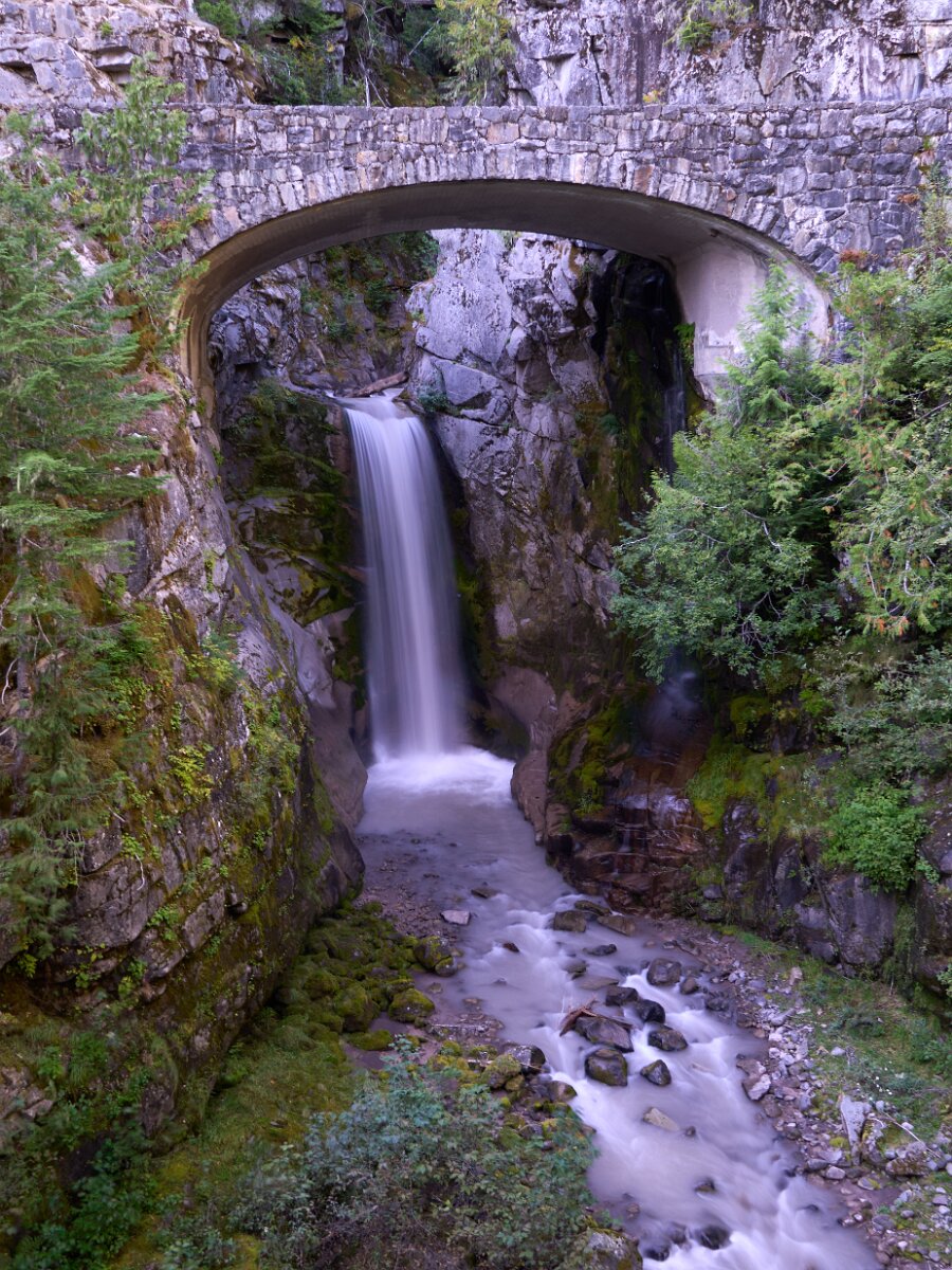
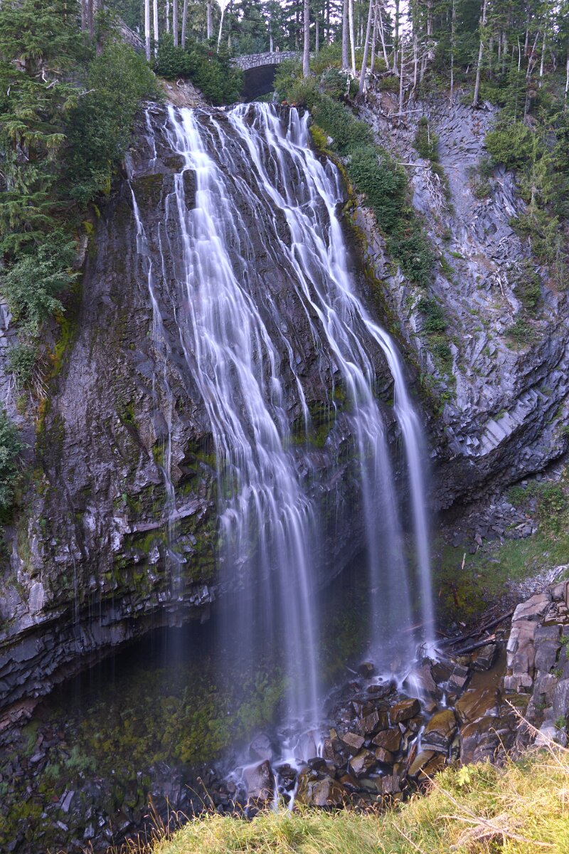
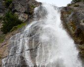
The following day I did an out-and-back hike alone to Comet Falls on the Van Trump Trail because Darlene wasn’t feeling up for more hiking. We also visited a bunch of roadside points like the Longmire Museum, Christine Falls, Narada Falls, Box Canyon and Silver Falls. We couldn’t easily check out the east or north side of the park due to road closures so after two days, we headed out and home south.
On July 26th, Darlene and I set out in the camper van for a two-month journey across western Canada with the possibility of going all the way to Alaska. The goal was to visit a bunch of their national parks like Banff and Jasper without any particular time constraints. We didn’t have any camping reservations because we didn’t want to have to decide in advance how long we would want to spend in any given area. Of course we expected that would be a bit of a challenge in the more popular parks where the campgrounds tend to fill up and you can’t just camp anywhere in the wild, but somehow we’d manage!
We ended up getting as far as the southwest corner of the Yukon territory before we had to make our way back by the end of September. Two months and 7,658 miles! It was a great trip and we saw a lot of gorgeous scenery and we didn’t get mauled by a grizzly even once!
I’ve broken up the trip into separate posts and galleries for each of the national parks and other major travel sections but I created one video montage of the whole trip:
By mid-September it was clear we needed to start our return journey. Since we had come up via the Stewart-Cassiar highway, we chose to return via the part of the Alaska (Alcan) Highway we had yet to see, from Watson Lake on south.
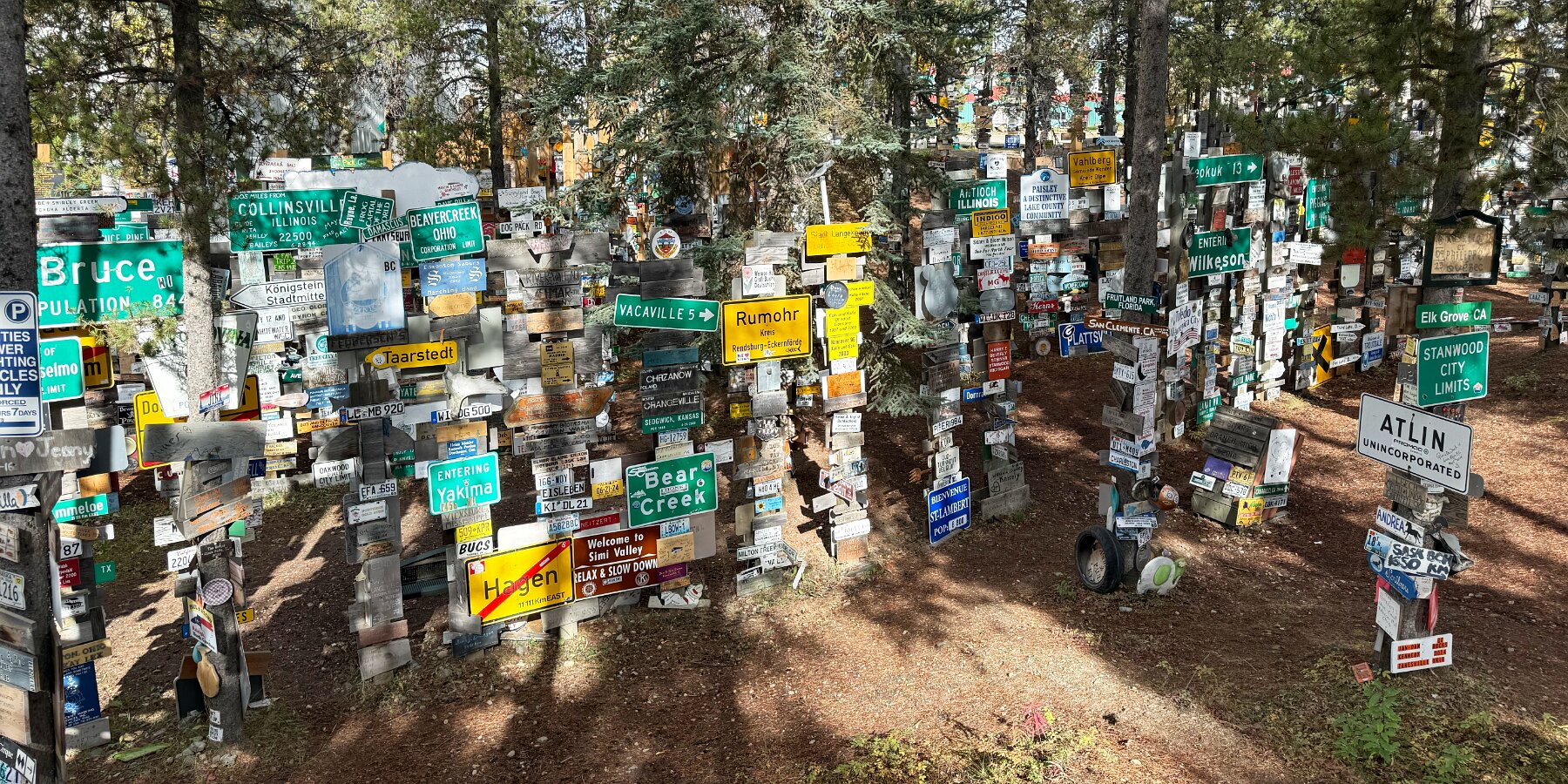
In Watson Lake, we spent a little time browsing the tens of thousands of signs making up the Signpost Forest and Darlene bought something to add to the collection. We also enjoyed the very interesting presentation on auroras at the Northern Lights Centre in Watson Lake. This is where we learned that what we had experienced a few nights ago in Kluane National Park was a full on aurora outbreak.
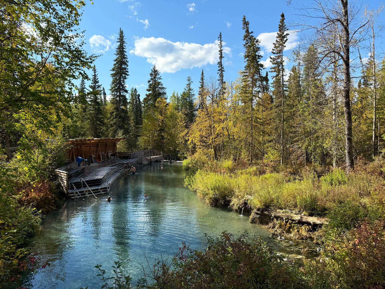
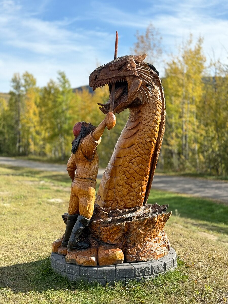
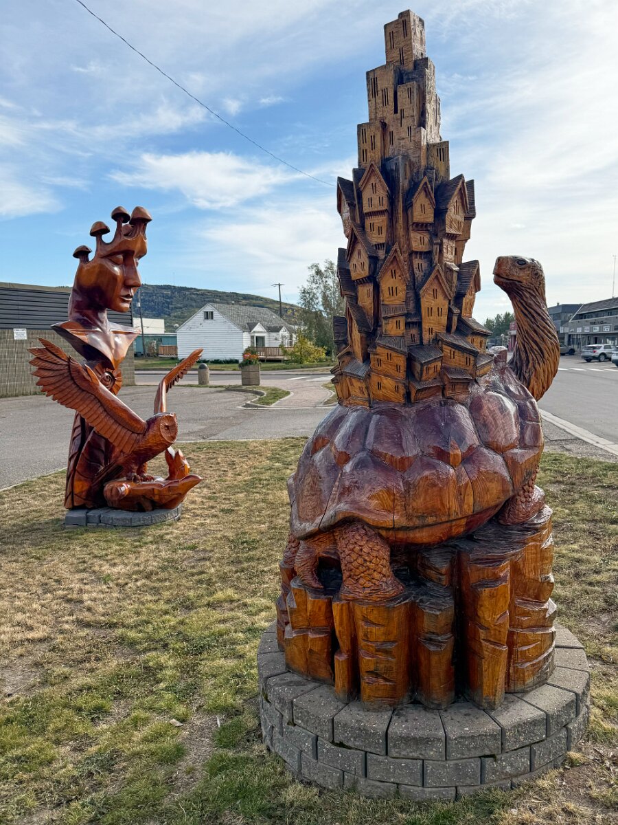
Other stops along our Alaska Highway return trip were to visit Smith River Falls and have a soak in the Liard River Hot Springs. One favorite stop was the town of Chetwynd which hosts an international chainsaw carving championship and there are many dozens of these fantastic carvings spread all around town.
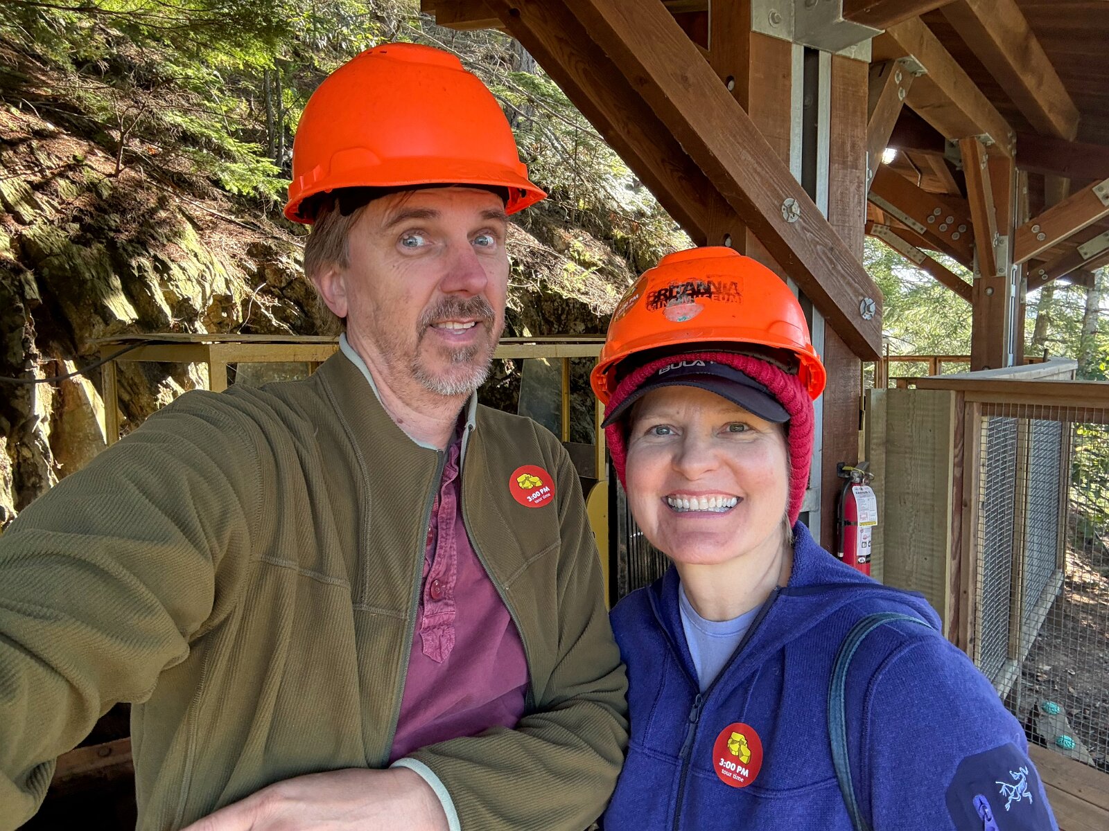
We stayed overnight again in Prince George and took the opportunity to do an oil change and tire rotation – it takes a lot of miles to travel up and down across Canada. Continuing south we eventually joined highway 99 (“The Sea to Sky Highway”), stopping off in Marble Canyon, Lillooet, Nairn Falls, Whistler and Brandywine Falls. We found and stayed at a couple of different overnight sites near Squamish as we checked out the town and the local sights like Shannon Falls and the Britannia Mine tour.
As we reached the end of the Sea to Sky Highway we hit really heavy traffic before we could even get across the harbor so we gave up and found a restaurant and hotel in West Vancouver for the night. And so after two wonderful months traveling around western Canada, we crossed back into the US from Vancouver.
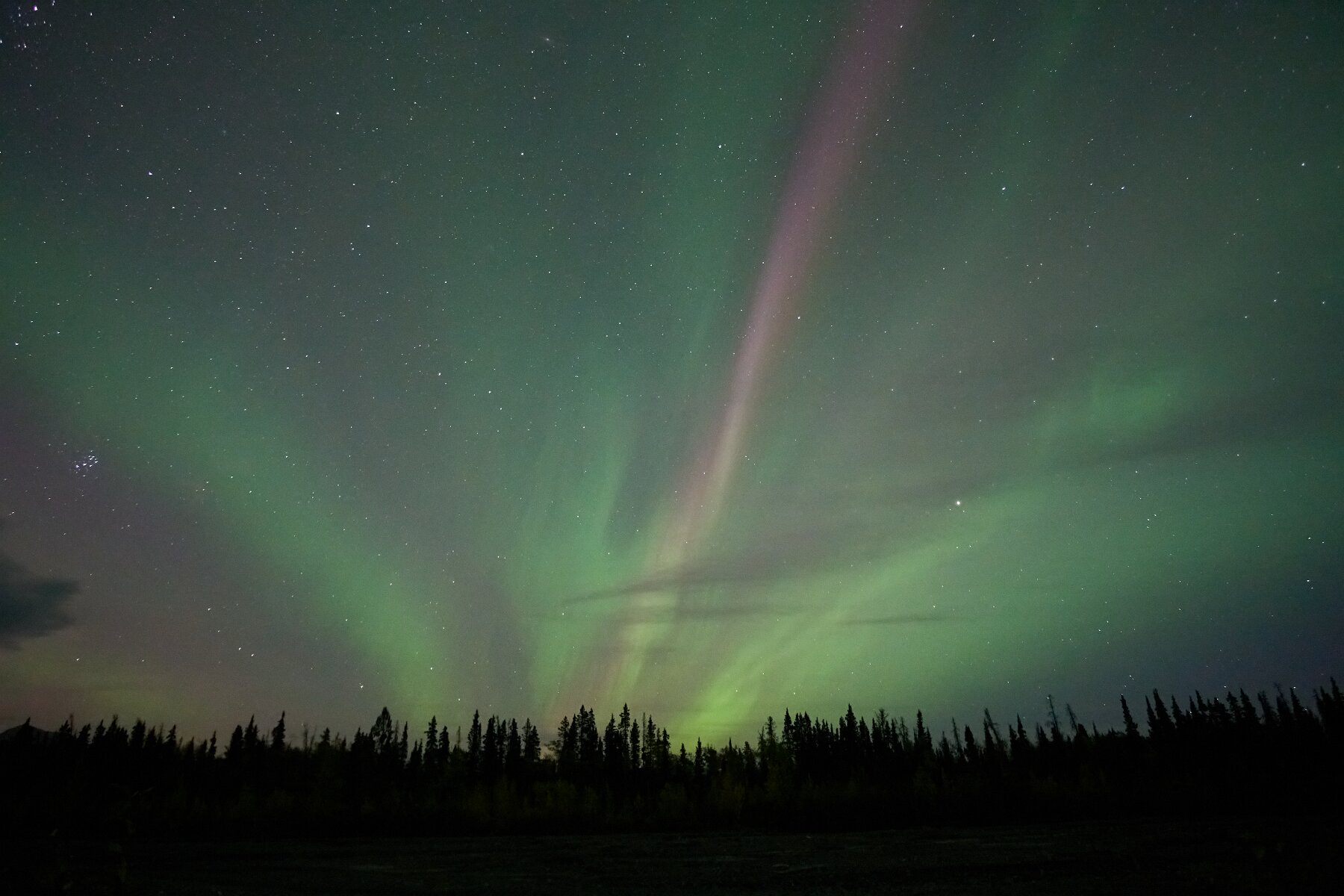
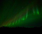
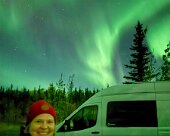
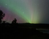
We lucked out one night while in the southwest corner of Canada’s Yukon Territory, just outside of Kluane National Park and Reserve. We had found a nice open sky spot to camp along Quill Creek and since the aurora watch web sites were showing that good activity was expected that night, I set up cameras ready for the usual long exposure time lapse recordings and kept watch. I was using my DSLR, my iPhone and my new Insta360 X5 camera that records in all directions at once (albeit with a pair of smallish sensors). It wasn’t long before we were treated to what began as a really great aurora display. It was really nice, lots of dancing colors in many directions.
It started out as a really nice aurora display…
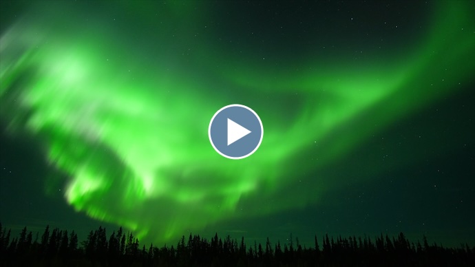
And then things went nuts! We got what we would later learn is called a full auroral outburst. The whole sky erupted and lit up the ground much brighter than a full moon could. The curtains and swirls of color ran the full gamut of reds and purples and greens and they were moving fast – swirling and cascading around in real time. Normally you would capture an aurora on camera using extended exposures to bring out the colors that aren’t so obvious to the naked eye and you record many frames in time lapse over dozens of minutes to speed up the motion that is typically very slow, much like slow-moving clouds. Well now the whole sky, in every direction, was animating and swirling in full color to our naked eyes. This went on for many minutes… tt was amazing! Unfortunately, my cameras were still running time-lapse and longer exposures while we were so distracted by the light show. But regardless, it was awesome to experience!
I’ve done what I can with the recordings, adjusting exposure and slowing down the footage so that it doesn’t fly by in mere seconds:
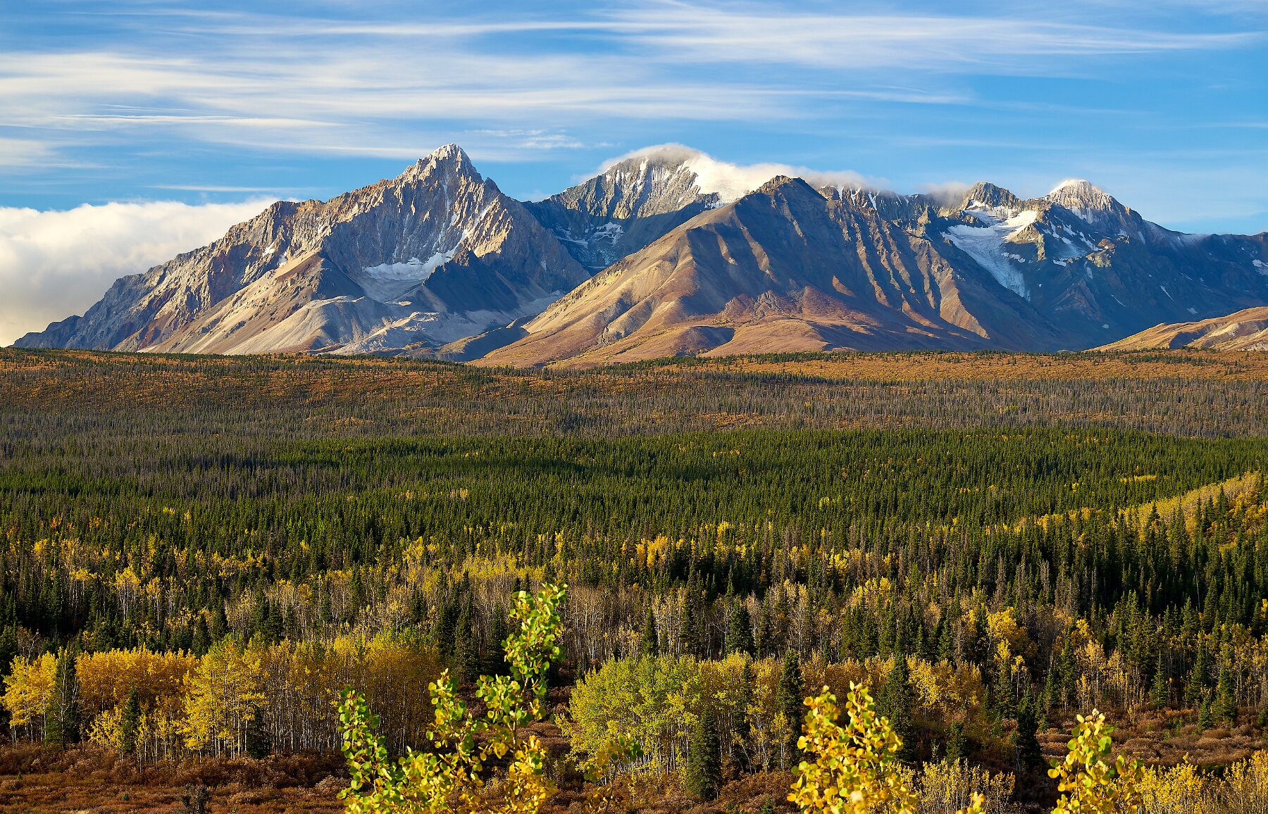
Kluane National Park and Reserve takes up the entire southwest corner of the Yukon territory and includes the Canadian portion of the Satint Elias Mountains – the highest coastal mountains in the world and the highest points in Canada.
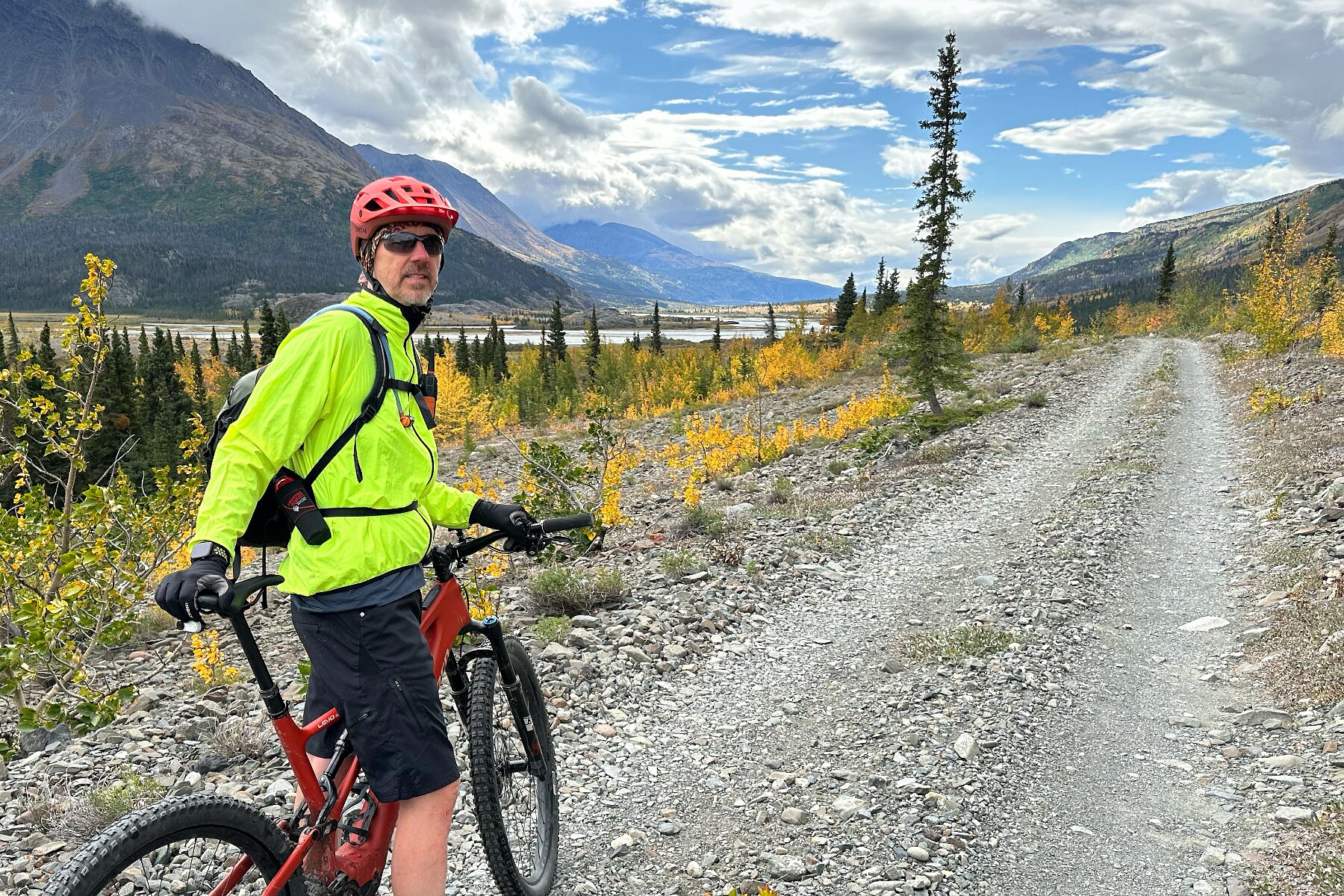
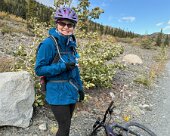
After hitting up the visitors center and talking to a park ranger (“park wardens” in Canada), we opted to start our exploration of the park on the Alsek River Valley Road by mountain bike. We found a nice secluded wild camping spot from an offshoot of that road just outside the park boundary. The next day gave us cold and heavy winds but we set out anyway by bike. We didn’t go as far as I would’ve liked but the scenery was fantastic all the way. That afternoon we had a surprise visit from a local who was out for a walk who chatted me up for a long while.
Following the Alsek River Valley Road
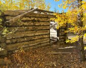
We took off again the following day and explored a little further along the Alaska highway to Kluane Lake, the Ä’äy Chù (Slim’s River) trailhead and the Silver City ghost town. We walked around the ghost town for a bit trying to figure out what we’re looking at – lots of kennels for animals of different sizes apparently. (A fox farm according to this web site.)
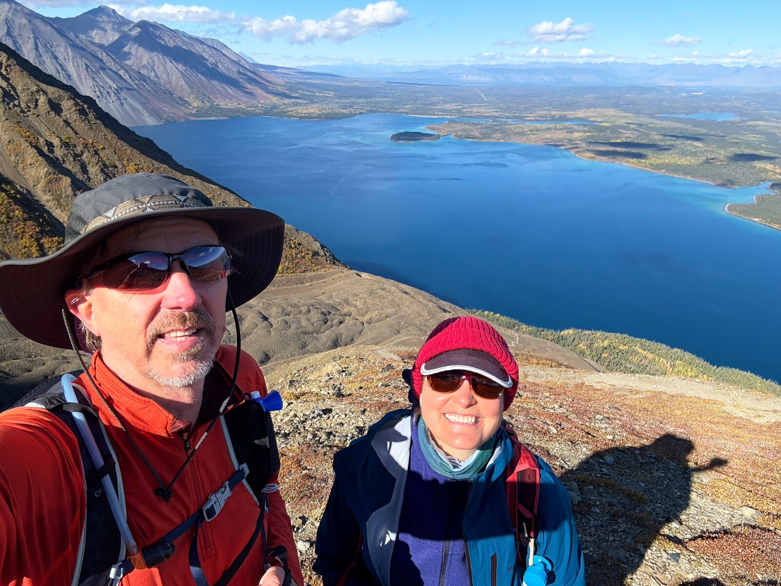
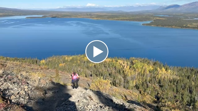
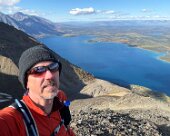
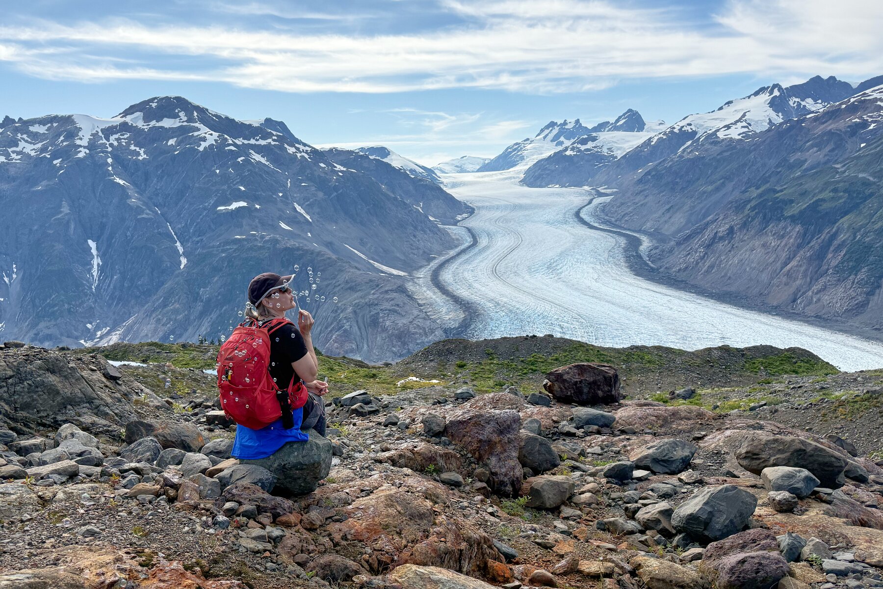
Our next destination was Kathleen Lake. We looked for a suitable wild camping spot but eventually settled on the established campground there. The next day we took up the King’s Throne trail and it was quite the climb the entire way but ever more fantastic panoramic views. Darlene tapped out around 4100 feet but I continued for a while longer (4900 ft) before deciding it was getting late and the trail feeling more precarious on my own.
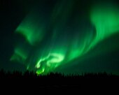
Half-way up the Kings Throne Trail above Kathleen LakeA little video of our ascent of the King’s Throne trail
After the hike, we looked for a wild camping spot off the highway by following a rough fishermans road along Quill Creek until we picked out a nice open sky spot. That evening we were treated to a spectacular aurora display. (I’ve broken out a description of what we saw in a separate post here.) We had already decided that we needed to start making our way back home but that aurora display was a wonderful topper for our whole Canadian road trip.
Out of Jasper, we could have chosen to go north to join the Alaska Highway (ALCON) out of Dawson Creek but we decided to go west first to get to Stewart on the coast in time to possibly see grizzlies feasting on the salmon run before then turning north on the Stewart-Cassiar Highway for the Yukon.
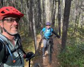
Along the way, we overnighted in Prince George and, after our detour to Fort St. James for the chicken races, we camped overnight near the town of Smithers and put in an afternoon ride on some of their mountain bike trails. The next day we made another detour to go south on the Cassiar Highway to visit Terrace which also had some nice biking trails. After our ride we tried to find a campsite at this little lakeside park on the shore of Kitsumkalum Lake but it was overrun with weekend revelers. Giving up the lake shore we found a crazy sweet and secluded fishing spot along the river downstream.
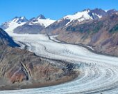
Eventually though we made it to Stewart, BC and then just across the border and through Hyder, Alaska to a camping area near the Fish Creek Wildlife Observation Site after dark. The recommended viewing times are at dusk and dawn but we showed up late the following morning and missed out on a sighting, not realizing that Hyder was an hour ahead of British Columbia time. However, we spent the day following the dirt road north to admire the massive Salmon Glacier and do some hiking.
In view of the Salmon Glacier
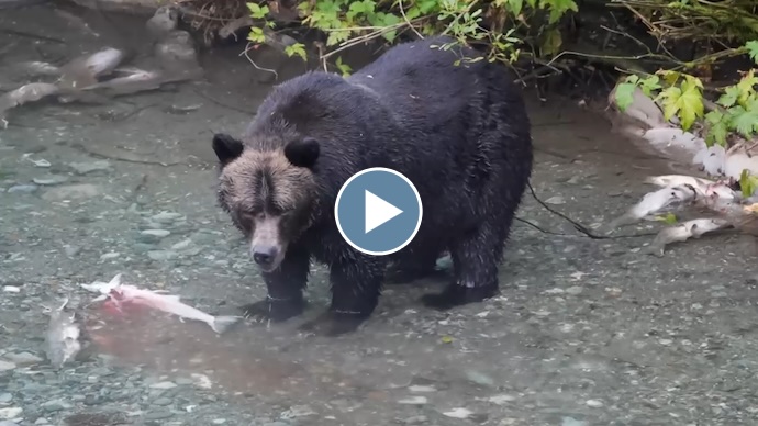
That night we did luck out and get to see a grizzly bear make her away along the creek apparently looking for just the right salmon to feast on. The next morning, well before sunrise, we were among the first to arrive and once again got to watch the same bear. After these two successful sessions, we decided to move on and follow the Stewart-Cassiar Highway on north to the Yukon.
Grizzly (brown bear) at Fish Creek near Hyder, Alaska
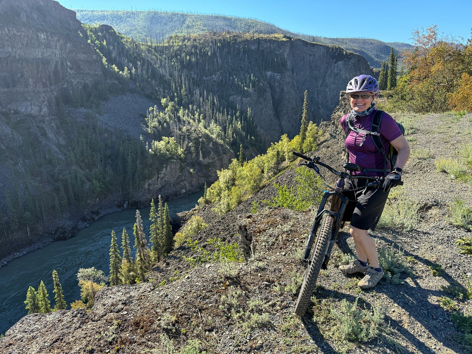
The northern part of British Columbia is seriously remote and there are few opportunities for sightseeing, at least not by any roads. We did make another multi-day detour down a very long stretch of unpaved road to see and bike along the accessible part of the “Grand Canyon of the Stikine”.
Stikine River Canyon
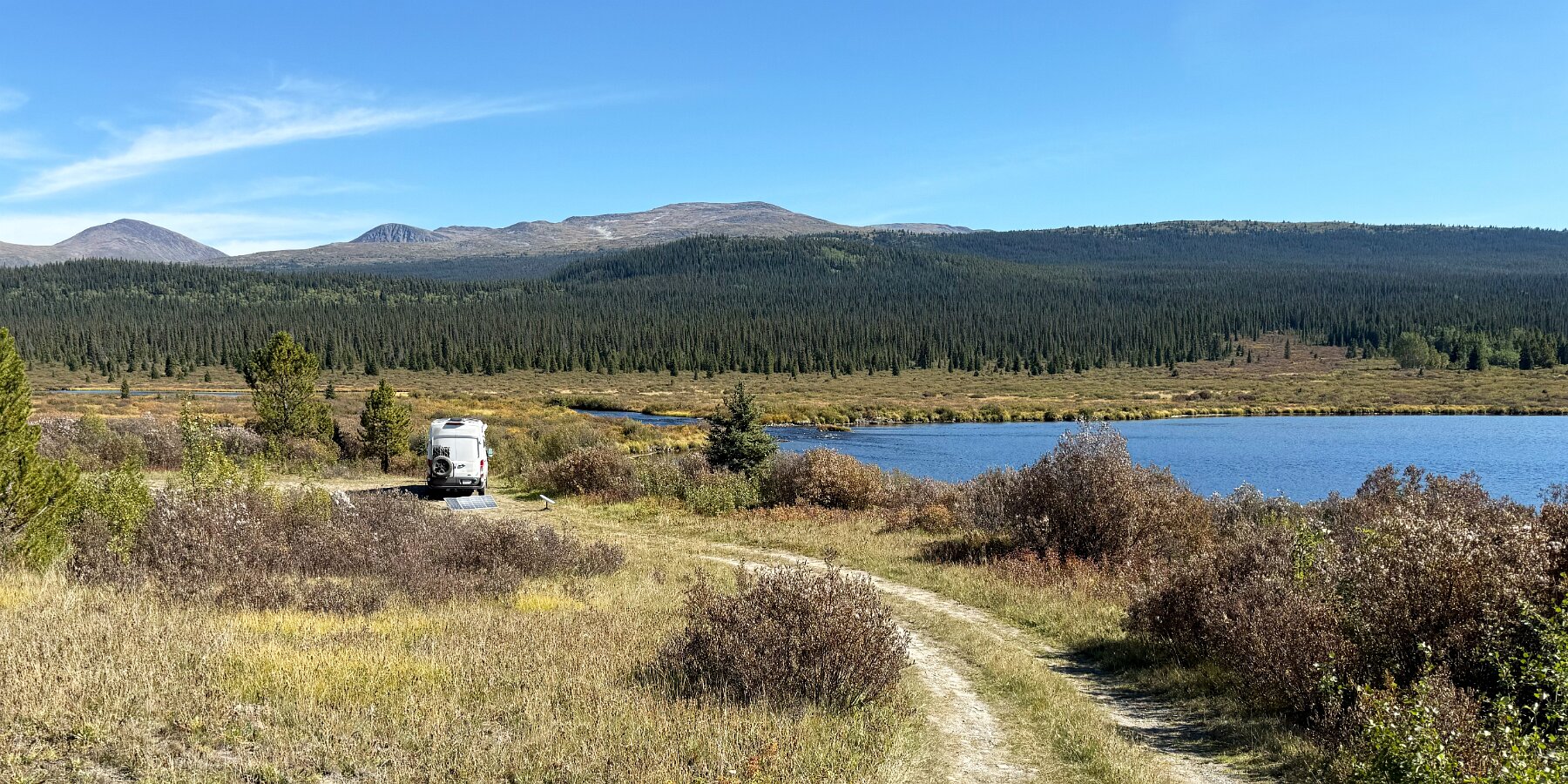
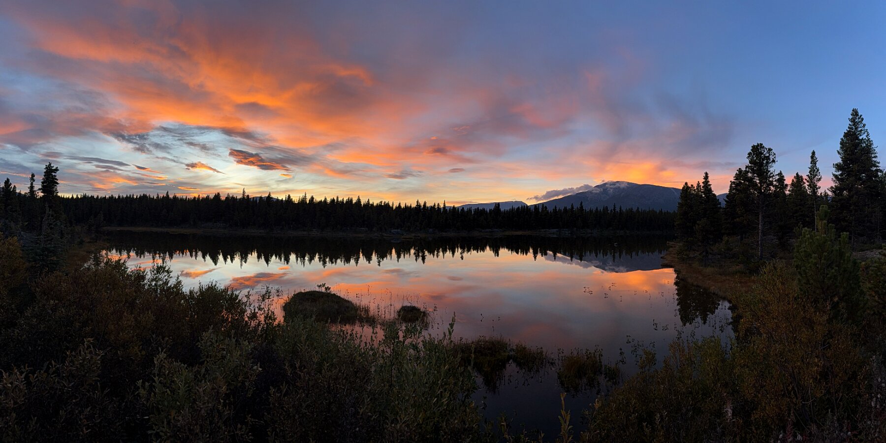
Continuing north along the Cassiar Highway, we eventually joined the Alaska Highway (or ALCAN) to head further west towards the Yukon and Alaska. Then we took a detour south again into British Columbia to visit Atlin Lake and found a really nice wild camping spot alongside an unnamed lake on Fourth of July Creek near the McDonald Lake Recreation Site. We stayed two nights, did a little hike towards the nearby mountains but didn’t go very far and had a nice little auroral display one night.
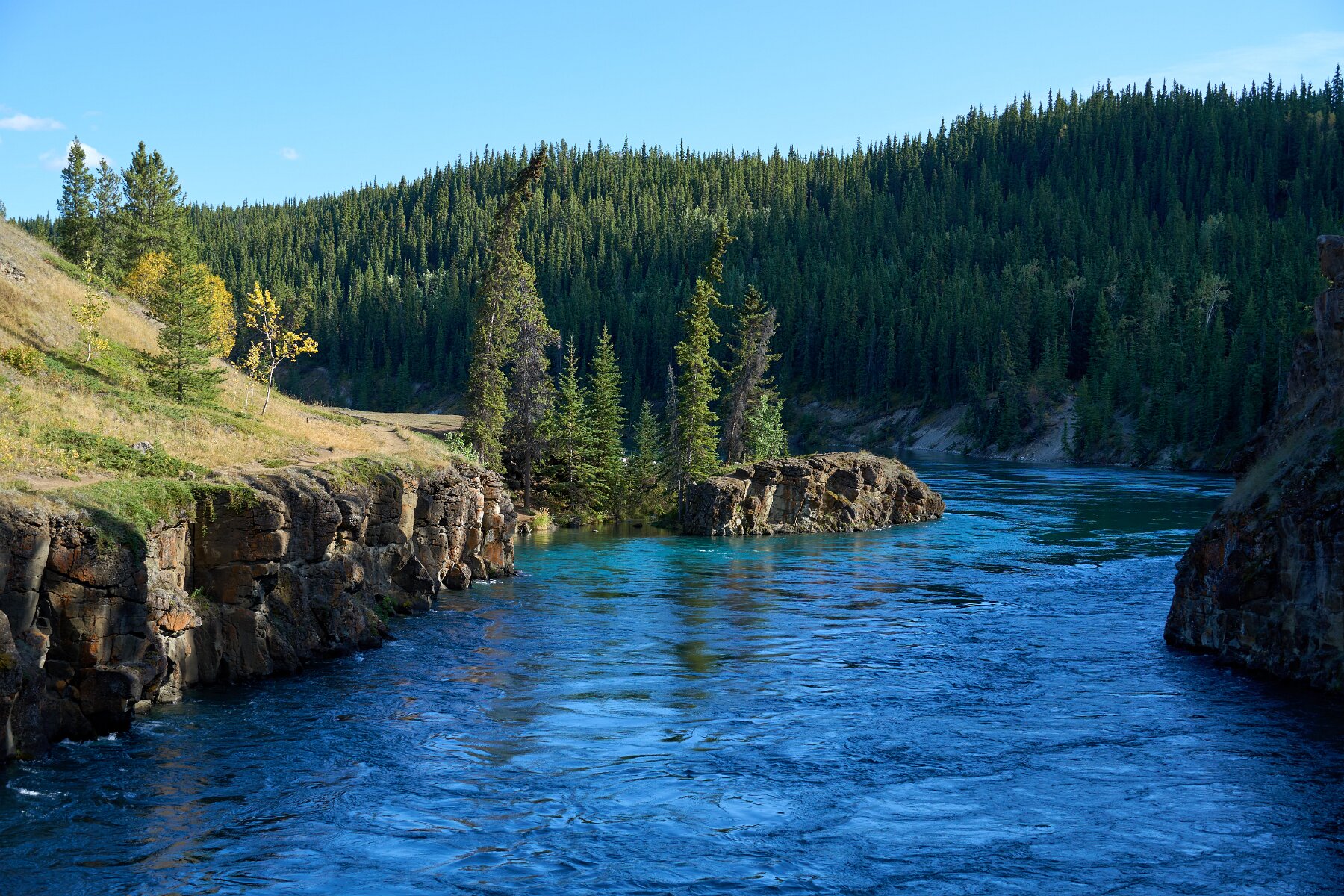
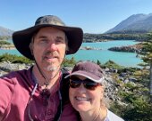
Returning to the Alaska Highway, we decided to make an extended side trip down to Skagway. After that we eventually reached Whitehorse where we stayed in a hotel for a couple of nights, checked out some local museums and exhibits (particularly on the Klondike Gold Rush), ventured out on some local mountain biking trails (there’s tons around Whitehorse) and went to see Miles Canyon.
Miles Canyon outside Whitehorse
After Whitehorse, we continued west on the Alaska Highway towards Kluane National Park.
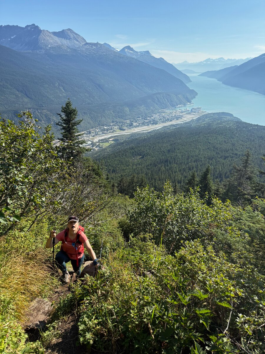
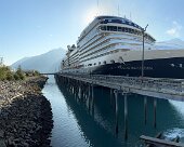
This was a detour far south from the Alaska (ALCAN) Highway to visit the historic town of Skagway, Alaska, famous for the Klondike Gold Rush of the late 1890’s. The historic downtown area is now contained within the Klondike Gold Rush National Historical Park. Despite the cruise ships unloading on the town in the summer months, it’s a fun and fascinating place to visit.
We camped along the beautiful Yukon highway both coming and going and stayed a couple of nights at the Dyea Flats Campground a few miles away. Besides enjoying the town itself, we had a couple of great hikes: one challenging climb up a portion of the AB Mountain trail for fantastic views and another along the International Falls Trail from the top of the Klondike Highway pass.
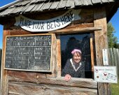
We saw the signs along the highway: “Fort St. James – World Class Chicken Racing”. Okay, after looking it up online… so it would be an hour out of our way round trip, but hey, it’s chicken racing… world class!
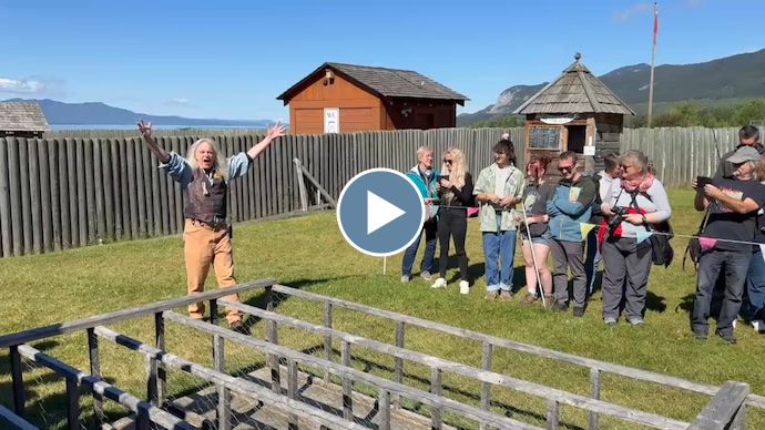
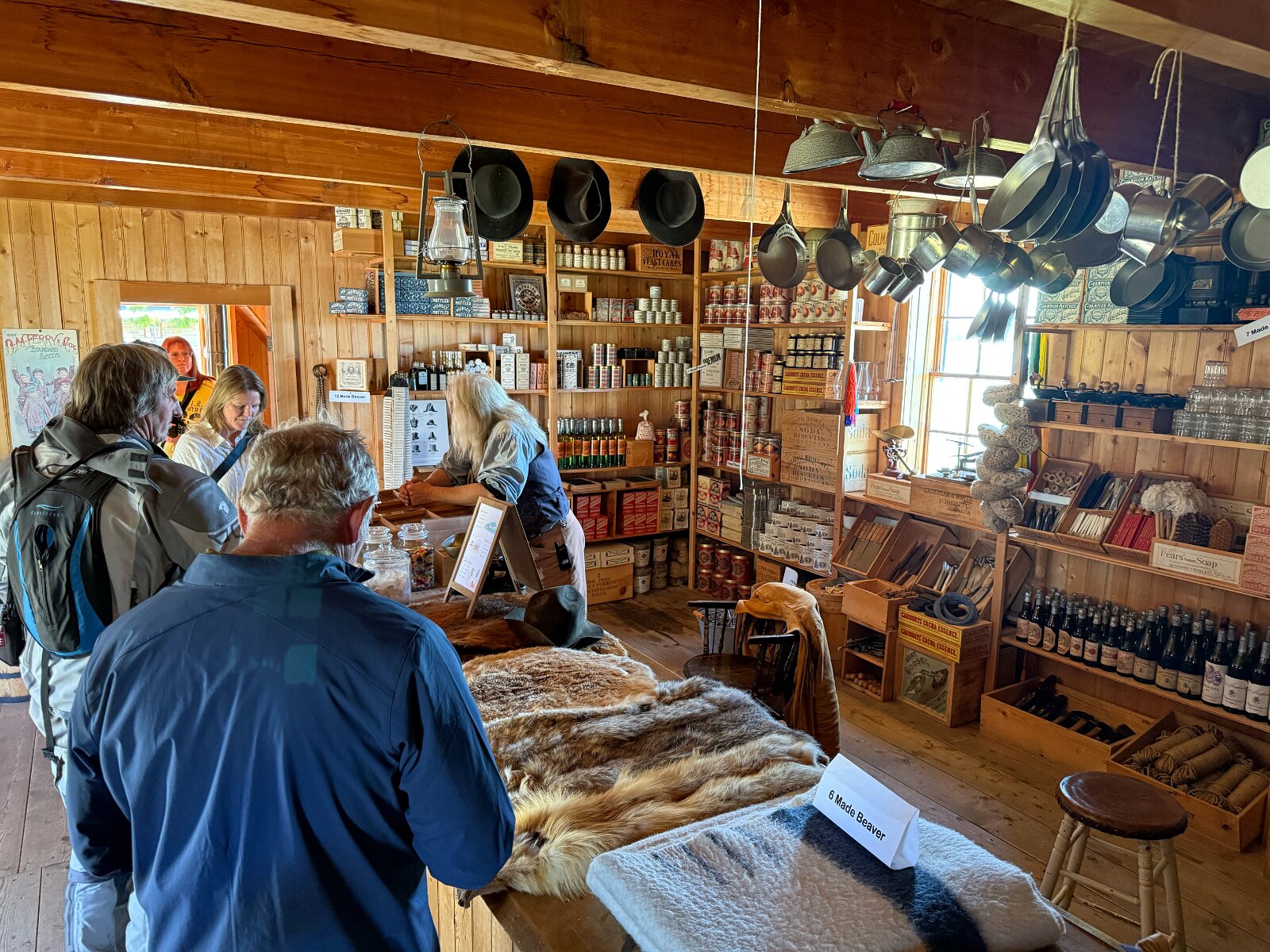
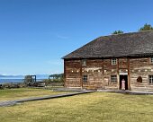
So off we went… it was fun! And the Fort St. James Historic Site, a restored Hudson’s Bay Company fur trading post, was great and interesting to visit too!