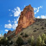
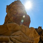
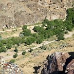
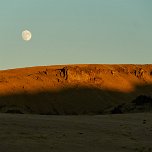
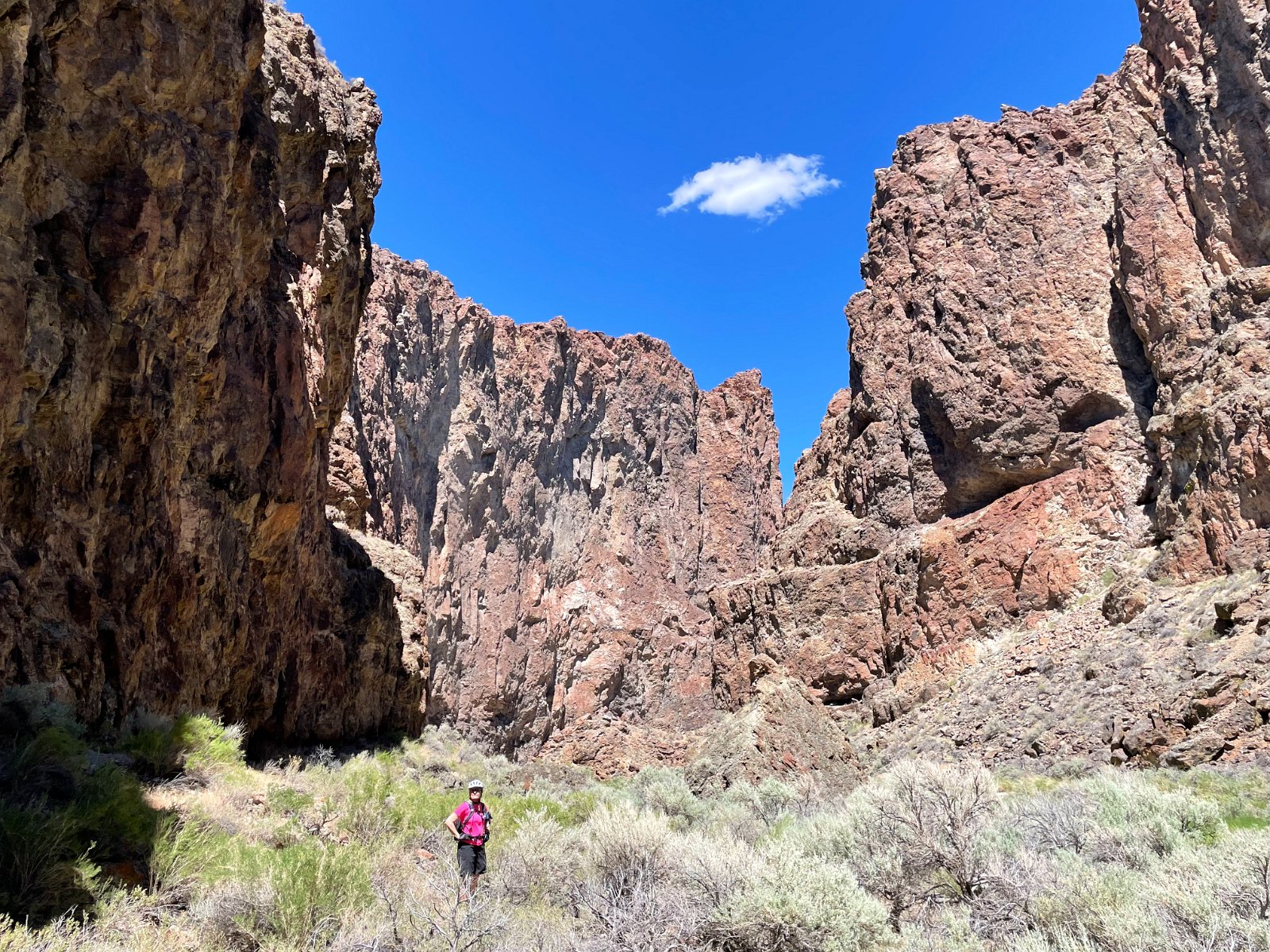
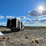
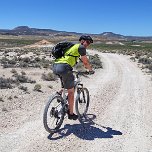
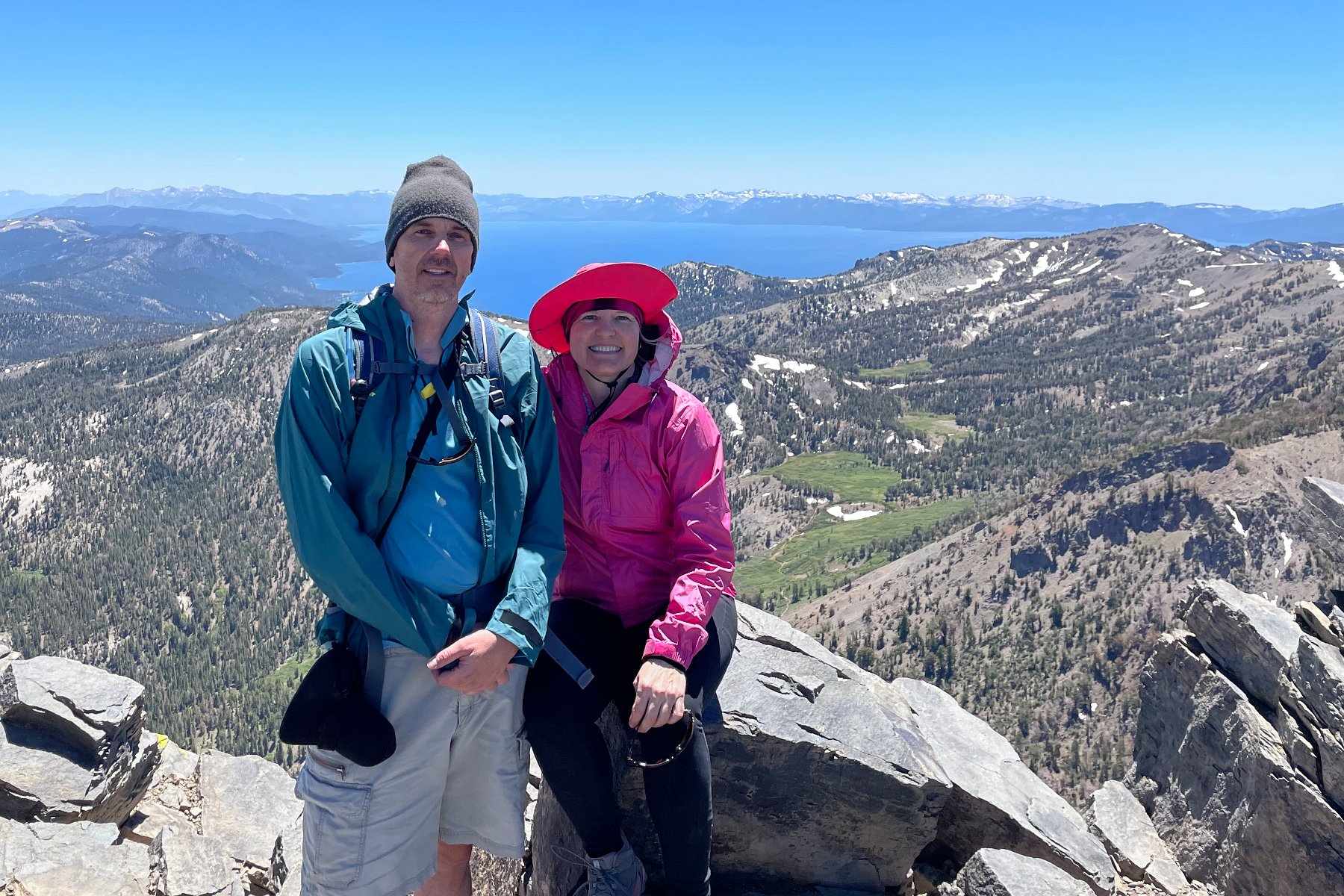
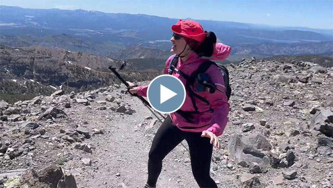
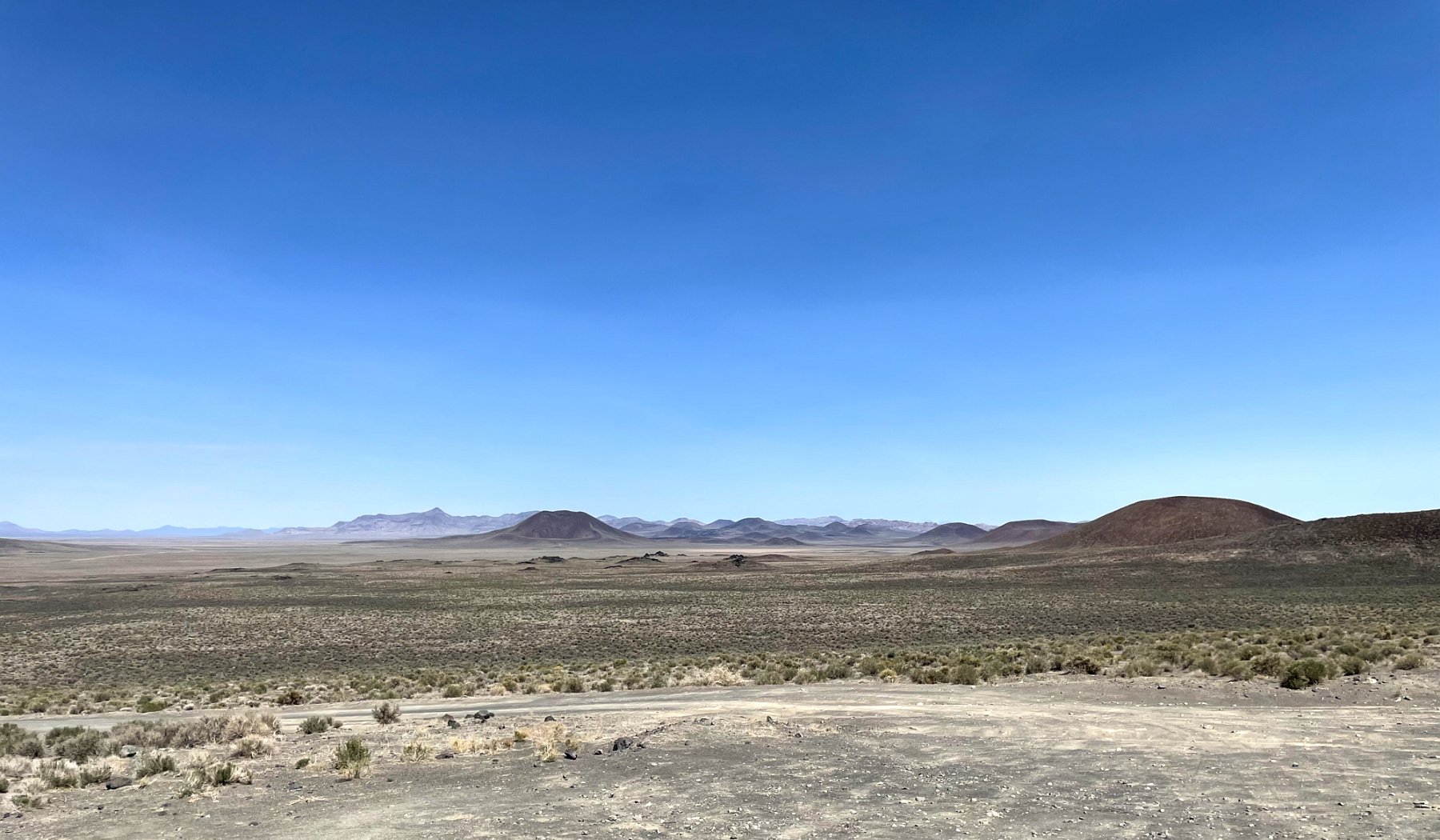
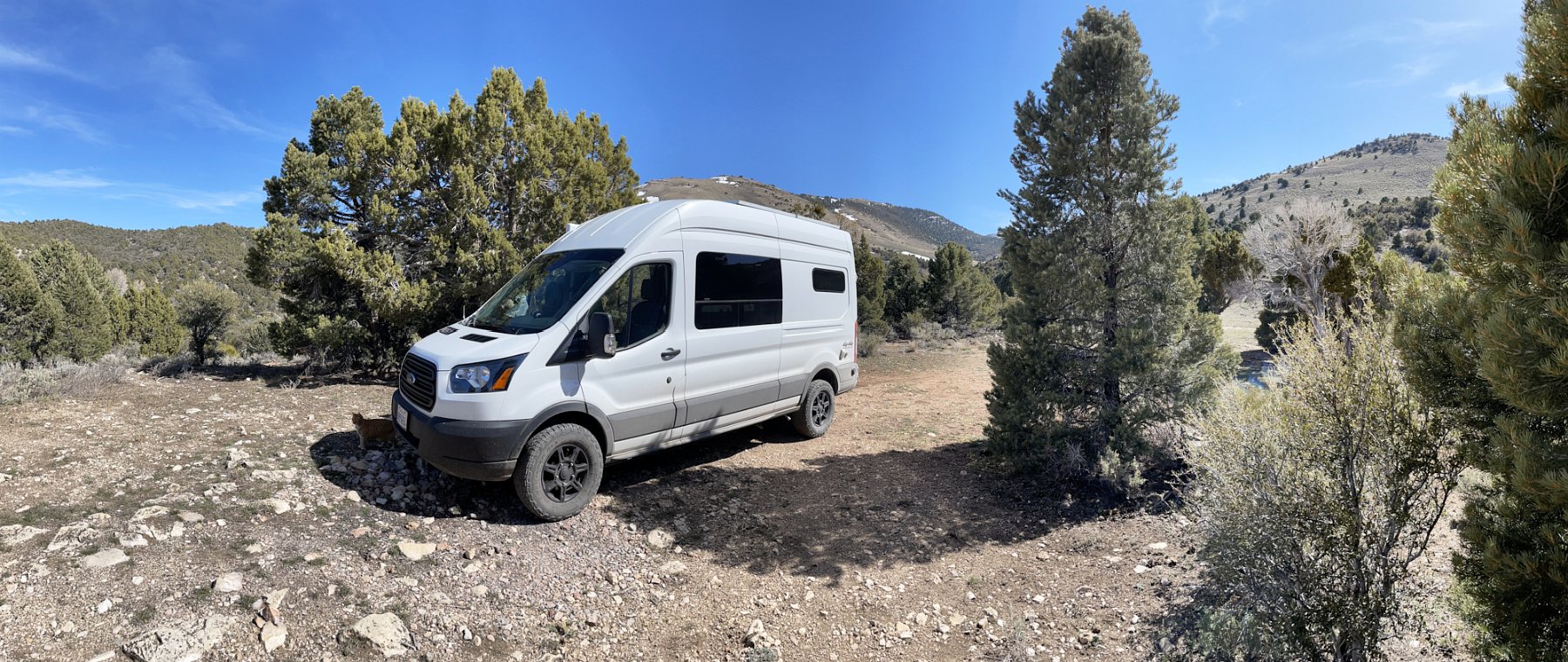
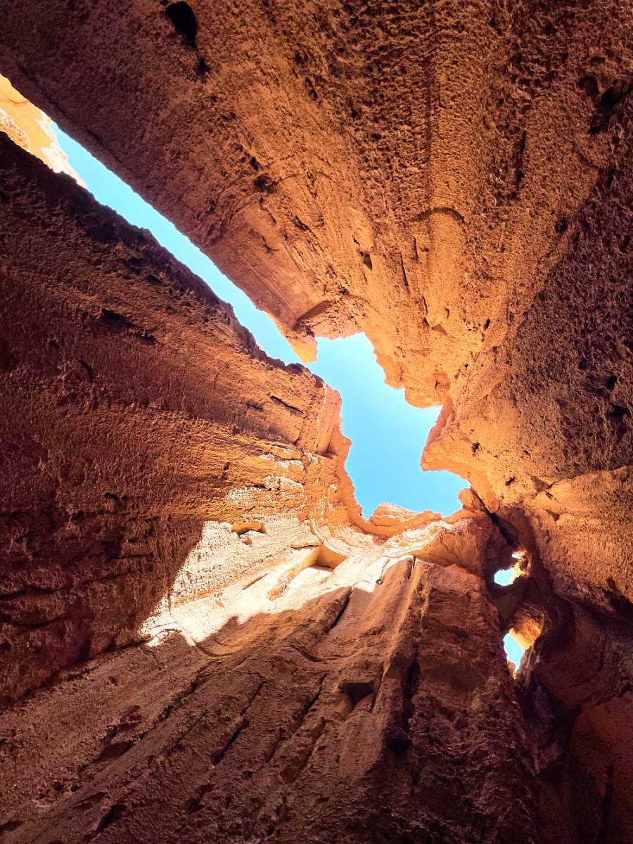
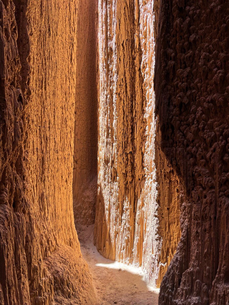
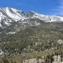
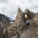
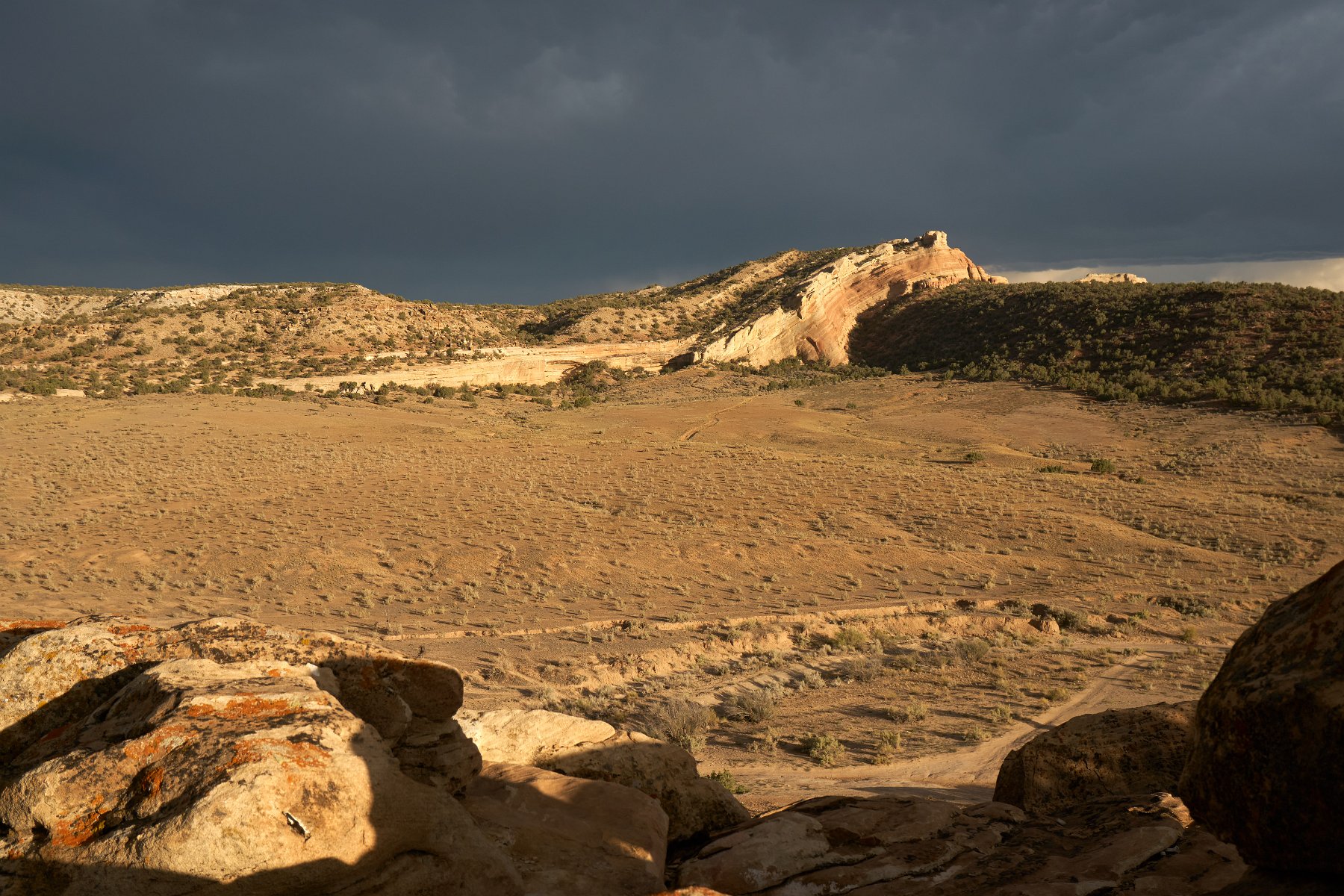
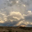
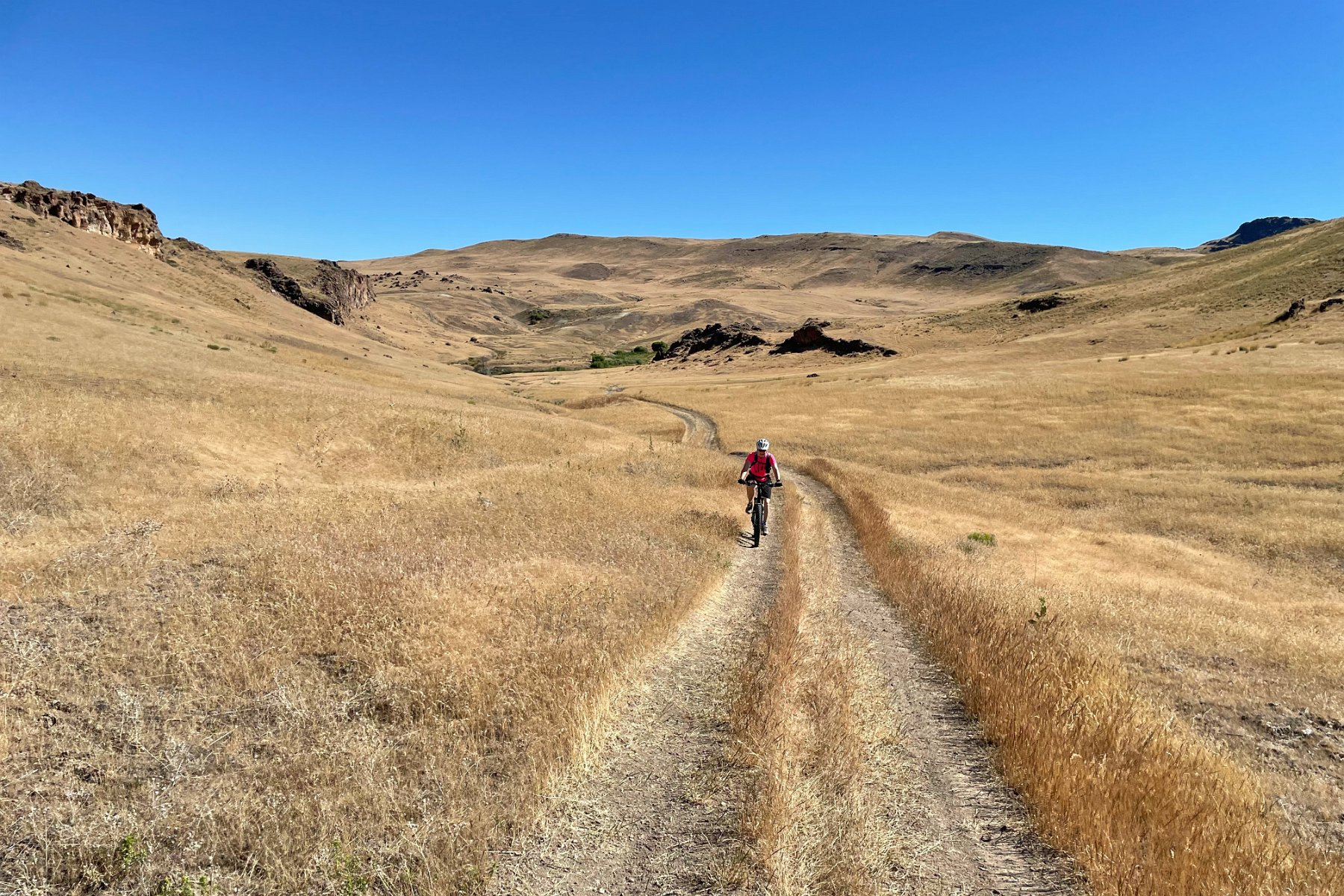
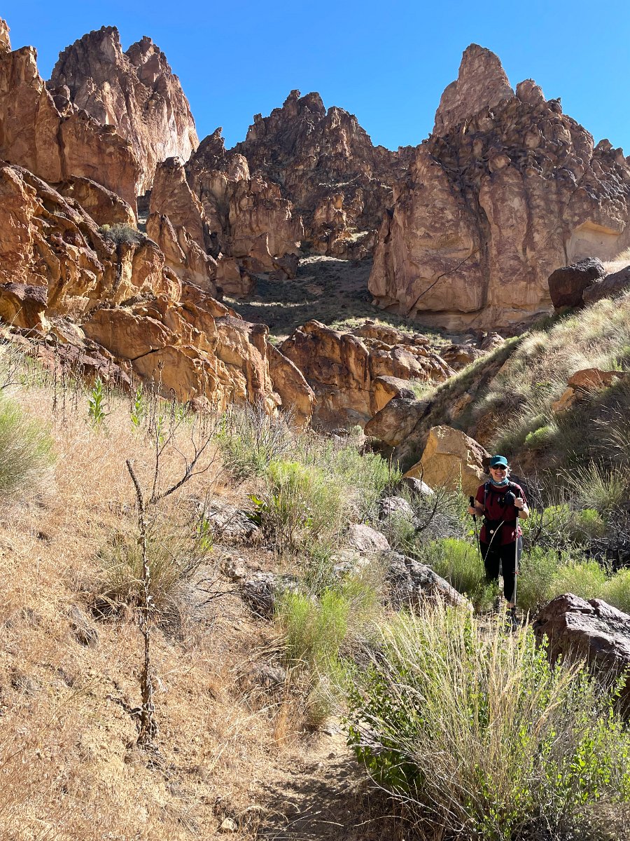
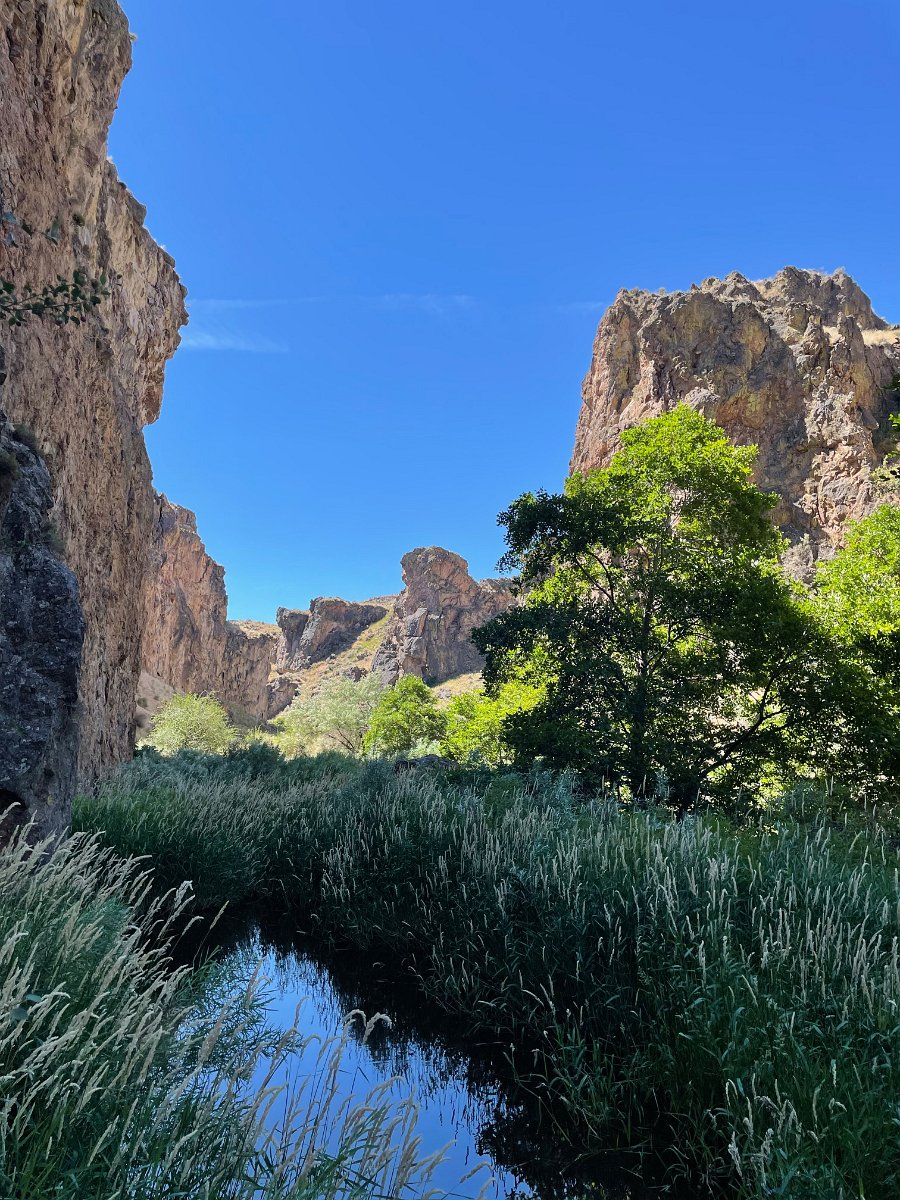
Tag Archives: mountain biking

Some More Tahoe Trail Riding

While up at the Tahoe house over the past two weeks, we got in some nice rides – and avoided any crowds.  We hit up the usual Sawtooth Ridge loop (just south of Truckee), found some fun trails accessible from the house (KB Trail and Rise and Shine, etc. just above Kings Beach) and we finally, finally, made it all the way out and back from Stampede Reservoir (some 24 miles) on the Emigrant Trail starting from the amusingly named Donner Party Picnic Area (seriously?).  I was totally spent, sore and dehydrated, but no need for cannibalism.  Darlene on the other hand was all smiles – as she was riding her new pedal assist e-mtn bike!

Click through for the full gallery:


Also tagged , , | Leave a comment

More Tahoe Trail Rides

Mark and Eve came up to the Tahoe house ahead of the extended Labor Day weekend, joined by their friends Matt & Lindsay for some excellent Tahoe area mountain biking.  Mike and Nanci then joined us on Sunday.

Here’s the video montage I put together for all four days of riding:

On Thursday, Mark, Eve, Matt, Darlene and I hit up the Incline Flume trail starting from highway 431.  We continued with an out-and-back on the classic Marlette Flume trail before Eve and Darlene opted to take Tunnel Creek Road down to lake level and the rest of us climbed the Incline Flume trail back to the cars.


On Friday, Darlene opted out and Lindsay joined us for a one-way ride from Watson Lake (above Tahoe City) on the newly completed Big Chief trail down to Sawtooth Ridge, outside of Truckee.  The upper section of Big Chief is rated expert/”black diamond” and is filled with lots of big drops – much more than what I’m comfortable with but the lower, intermediate section was fun and includes a long flow trail section too.  We finished up with Matt and Mark taking the west ridge, rocky portion of the Sawtooth Loop while Eve, Lindsay and I took the fast, flowy eastern side of the loop.


Matt left on Saturday, but the rest of us ended up trying a loop climbing up and around Incline Lake from the Incline Flume trailhead.  This was a mixed bag of very steep unrideable portions of trail to get up there but with some fun singletrack once we did.  Might be better to take the Old Mt. Rose Highway dirt road to get up there.  (Mike has a suggestion for another route that he uses that we’ll try sometime.)  For our return, Mark took the Tyrolean Downhill trail while he sent us to try a new trail through some recently logged terrain.


On Sunday, Mike and Nanci joined me and Darlene on part of the Emigrant Trail between highway 89 and Stampede Reservoir.  This trail turned out to be a lot of flowy fun through varying scenery with some nice long ascents that turned into great descents on the return.  Unfortunately, Nanci wasn’t feeling well and so she and Darlene bailed out early.  We’ll be trying this one again soon though!

Click through for the full gallery…

Also tagged , , | Leave a comment

A Week in Tahoe

Bunches of pictures from a week in Tahoe with Darlene: hiking with Glenn and Michele along the old railroad bed from Donner Summit and through some of the tunnels, mountain biking with Mike up to the fire lookout at Martis Peak, kayaking from Sand Harbor to Secret Cove on the east shore of the lake, riding the Truckee River trail to Squaw Valley, watching the fireworks from the water’s edge at Kings Beach and, posted separately, soaring over Tahoe in a glider and saving the world from total ruin in Pandemic Legacy.

Click through for the full gallery of pictures and video:


Also tagged , , , , , | Leave a comment

A Little Bit of the Tahoe Rim Trail

Darlene and I got a little taste of the Tahoe Rim Trail exploring west from the Tahoe house as far as Burton Creek State Park this past weekend.  I was surprised to find that there’s also a paved road that runs from Brockway Summit around to Burton Creek State Park, called the “Fiberboard Freeway” on some maps and apparently popular as a cross-country ski route.  We also wandered into the cross-country ski area that’s part of Northstar that I’d never seen before – including the “Caboose Hut”.

Click through for the full gallery:


Also tagged , , | Leave a comment

Passing through Colorado

On our return trip from Wisconsin, Darlene and I made our way down through Iowa and Missouri and across Kansas with one overnight stop and then into Colorado stopping off in Denver but failing to find anywhere nearby to grab a campsite.  (Ended up in a motel parking lot north of Boulder.)  We stayed a couple of nights in Rocky Mountain National Park to do some hiking.  The long views weren’t all that great because the smoke from the huge California wildfires were filling the skies even in Colorado.


Heading south, we found a spot to camp for a couple of nights in national forest land outside of Winter Park and got in some high altitude (10,000′) mountain biking.  We visited Dave and Martha at their new home in Evergreen before continuing west on I-70.  We camped out a couple of nights and did some trail riding in the hills above Eagle and had to wait out the mud in the morning in order to get the Traveling Cat Adventure Vehicle™ safely down the mountain again.

We also took some time to ride along Glenwood Canyon and tried to hike up to Hanging Lake late in the evening but ran out of time.  We came across a mama bear and her two cubs climbing in the trees near the trail though:

Also tagged , , , , , , | Leave a comment

Minnesota/Wisconsin State Parks

Continuing our road trip out to Darlene’s mom, we hit up a bunch of different parks in Minnesota and Wisconsin – some on my own (with Pan and Hera) while Darlene helped her mom during her hip surgery recovery and some together both before and after.  We got in some mountain biking, kayaking and sightseeing all around as well as a two-day photo shoot for Carlyn’s high school graduation.  However, I forgot to take any pictures while camped out with the cats in her mom’s driveway for a couple of weeks!


Also tagged , , , , , , , | Leave a comment

October Road Trip

I made a number of additional miscellaneous stops on my October road trip with Pan and Hera in the Traveling Cat Adventure Vehicle, including along a section of historic Route 66 in the Mojave Desert, on the road in northern Arizona and southern Utah, mountain biking outside of Zion National Park, and taking the tour of Hoover Dam.  This was over the course of two weeks (October 4th-19th, 2017).

Mojave Desert outside of Baker, CA

Looking down Hoover Dam

Click through for the full gallery:


Here are the other separate galleries for this trip:

And here’s a video montage of my drone flights over the trip, including my last flight where I lost control, crashed and was forced to leave it behind:

What happens when the Mavic Pro doesn’t have GPS lock and you’re too high for the down-facing optical sensors to work is that the Mavic becomes unable to hold its position and it starts drifting all over the place.  I was trying to compensate and keep it away from the walls but I was not at all successful.  It almost crashed into one wall but halted itself when it’s forward-facing sensors detected the wall.  As it started drifting towards the opposite wall, I had just decided to try to get it up and out of the shadow of the canyon entirely to hopefully gain GPS lock and regain control but it was too late – and this time it wasn’t facing the wall and didn’t detect it.  It crashed and fell to a point immediately below me.  While it was only like 35 feet down, it was a sheer drop with only a couple of narrow soft ledges.  Without rope and climbing gear, I would have been risking my neck to try to retrieve it.  Yeah, very sad to have to leave it behind, though it looked pretty busted up anyway.

Also tagged , , , , , , | Leave a comment

On the Mendocino Coast

Last week, Darlene and I were able to spend six days following the Mendocino Coast (with the cats in the Traveling Cat Adventure Vehicle, of course), continuing north from where we left off on the Sonoma Coast in December, just north of Fort Ross.  We discovered that all the state park campgrounds were full going up the coast for the coming days but we kept managing to find something.

We stayed the first night at Stillwater Cove and then snagged a spot in an overflow area at Salt Point State Park, where we spent an afternoon mountain biking up to the top of the park and part of the morning flying the drone around.  We visited the Point Arena Lighthouse, which turned out to be more interesting than I expected and we snagged a nice spot in another overflow area on the beach at the Van Damme State Park.  We were able to grab a vacated spot in the park the next morning and then headed out to explore the Mendocino Headlands.  We also checked out the Russian Gulch State Park.

This area around Mendocino has a lot of cool sea caves – we’ll need to come back some time and book a guided sea kayak tour to check them out.  Fort Bragg turned out to be pretty uninteresting and we just passed through, stopping at MacKerricher State Park instead for lunch and to walk around.  Our final and fifth night was at Westport Union Landing State Beach overlooking the bluffs.  At this point, Highway 1 turns inland and you leave the coast for good.  Our last day was essentially spent just getting back home to lots of traffic jams.

Click through for the full gallery:


Also tagged , , , , , | Leave a comment

Newberry National Volcanic Monument

Heading south from Mt. Hood in late June, we stopped off at the Crooked River gorge in the Peter Skene Ogden State Park between Madras and Redmond.  We were a bit bewildered by how many people were gathering and setting up lawn chairs as if waiting for a big event.  Unfortunately, we made the mistake of asking. ;-)  Turns out they were all there awaiting the passing of an historic steam train engine (Southern Pacific 4449) to cross the bridge.  It was due within the hour so we relocated the Traveling Cat Adventure Vehicle and decided to wait.  After a couple of hours though, it became clear from news being relayed around that there had been delays and it was still an hour or so out.  So we bailed.

Our destination was actually the Newberry National Volcanic Monument and this proved to be a nice place to spend a few days.  We camped the first and last night on some forest roads and one night at one of the campgrounds in the caldera alongside Pauline Lake.  We had a crazy red sky sunset one night, enjoyed some early morning kayaking on the completely still water and a nice trail ride up to near the caldera rim on our mountain bikes.  We hiked the mile-long Lava River Cave lava tube and checked out the lava tree casts.  There’s actually plenty of other trails and caves to visit too but we had to move on.


Click through for the full gallery of pictures.

Also tagged , , , , , , | Leave a comment

Columbia River Gorge

After picking up Darlene from the Portland airport, we headed over to the Columbia River Gorge for sightseeing, hiking and mountain biking.  There was certainly a lot to see and do and we ended up spending over four days in the area.  We started with the road up to the Vista House on the historic highway 30 (west to east) and enjoyed the view.  The campgrounds were full that night on the south side of the river so we had to cross over to the other side to find a place for the night.  We snagged a spot back on the south side at mid-day and hiked the lovely loop trail from Multnomah Falls up and over and down to Wahkeena Falls (and various falls in-between).  We started the next day with a shorter hike from the campground to Upper Horsetail Falls before heading out to go tour the Bonneville Fish Hatchery and then the visitor’s center at the Bonneville Dam (both very cool and interesting).

We stayed at a great county park outside of Hood River for the next two nights and enjoyed a full, long day of really fantastic mountain biking trails at Post Canyon.  And then, on the last day, we burnt up half the day checking out the huge number of old airplanes and cars at the Western Antique Aeroplane & Automobile Museum in Hood River.  (I’ve put up a separate post and gallery for this place.  We both thought it was really great.)  By afternoon, we had made it up to the Mt. Hood ski area for a rest stop for the kitties before heading onwards and south for new adventures.

Click through for the full gallery:


Also tagged , , , , , | Leave a comment

John Day River Basin


After dropping off Darlene at the Portland airport, Pan and Hera and I headed east for a week, to follow the path of the upcoming total eclipse and find a nice possible campsite.  We checked out the countryside from Madras to Unity and in the process discovered the gorgeous, extensive and richly varied landscape of the John Day River basin.  Along the way, I visited portions of the John Day Fossil Beds National Monument, including the Painted Hills area and the Thomas Condon Paleontology Center.  I certainly was not aware that central Oregon had such an important mammal fossil record.

I decided not to try to capture the constantly changing landscape in pictures as I would’ve been trying to pull off the highway every few miles.  So this gallery consists only of pictures and video from the places I stopped overnight, or where I went hiking or biking.  One frustrating aspect of this area though is how much of the John Day River basin is private land and not accessible to the public – no trespassing signs everywhere, even on county roads that lead to public lands.


Click through for the full gallery.

Also tagged , , , , , | Leave a comment

Wisconsin in July

Click through for a gallery of pictures from a visit with Darlene’s family in Wisconsin/Minnesota earlier this month, including some hiking, canoeing, riding some fat tire bikes for the first time, visiting the Santa Maria and Pinta replicas that happened to be docked on the Mississippi while we were in Winona and recording our successful cracking of another “escape room”, this time in LaCrosse:


Also tagged , | Leave a comment

Bolivia: Altiplano to Amazon

As an add-on for our trip to Chile’s Atacama Desert, we all wanted to be sure to get to see the amazing Uyuni Salt Flats in nearby Bolivia.  As it worked out, we were able to join up with BikeHike’s trial run of their new Bolivia adventure trip by taking a guided, three-day, 4×4 road trip from Chile over the Altiplano to the Uyuni Salt Flats in Bolivia.  Darlene was also able to finagle a little additional time off from work to join us on this portion of Glenn and Michele’s Most Excellent Adventure™.


Click through for the full gallery of photos and videos from the trip.

A video montage of our time in Bolivia. (6:45 min, 131 MB)

Across the Altiplano: Glenn, Michele and I started out in San Pedro de Atacama, Chile, and were driven up to the Altiplano and dropped off at the tiny, remote little border control building on the southwest Chilean/Bolivian border.  After successfully negotiating Michele and Glenn’s Bolivian visas (mostly about producing absolutely pristine US dollars for the visa fee), we were loaded into the apparently defacto standard Altiplano vehicle: a Toyota 4×4 Land Cruiser.  Over the next couple of days, we navigated a maze of dirt roads in the high altitude (15,000 ft) visiting a series of color-coded lagoons (red, green, white, etc) and a few miscellaneous sights and landmarks.  We overnighted in both a hotel made of stone and one made of salt and got to try our hand at herding llamas to pasture as well as trying to fire a slingshot without injuring ourselves.  We also spent the better part of two days criss-crossing the Uyuni Salt Flats and they proved to be as vast and amazing to behold as suggested in the photographs we’d seen before.

Crossing the Uyuni Salt Flats

Crossing the Uyuni Salt Flats

More of the Uyuni Salt Flats: After this initial introduction to Bolivia, we were deposited in the town of Uyuni in time to join Darlene and the rest of the BikeHike group flying in from La Paz.  Over the next couple of days, we would explore much of the area on bikes, starting with a tour of the mining ghost town of Pulcayo.  We biked back down to Uyuni, mostly following the route of the old mining railroad bed.  We biked across a few chunks of the salt flats itself – which proved quite daunting due to the vast, unchanging scenery.  We stayed overnight in a more rudimentary building made of salt on the slopes of the volcano Tunupa and enjoyed a ride out for sunset and stargazing on the salt flats.  On our second day, we visited a cave containing desiccated mummies and continued on to the island of Incahuasi, in the middle of the flats and home to hundreds of cacti.

Biking Bolivia's "Most Dangerous Road"

Biking Bolivia’s “Most Dangerous Road”

“Death Road” Ride: Upon our return to La Paz, we had an early start to go ride mountain bikes down along Bolivia’s infamous “world’s most dangerous road”.  They’ve since built a new, modern, paved highway to bypass the route but it was once very treacherous for being a dirt road cut into very steep mountainsides and forcing buses and other large vehicles to try to squeak by each other.  This route now makes for a gorgeous and easy downhill bike ride packed full of wonderful mountain vistas.  Unfortunately, we had to do the ride with one of several large tour groups and so you have to do things on their terms.  You’re forced to keep to a schedule that at times is pushing you forward (despite the desire to stop and enjoy the stupendous views) or making you wait (for organized photo portrait stops, despite the fact that everyone has cameras of their own, or while the staff clean and prep the bikes at the end of the ride, etc).  Amusingly, you’re also required to wear full downhill racing body armor and full face helmets despite a route that consists of first a paved highway and then a well-used dirt road and a gentle downhill slope.  Actually, the full face helmet was dangerous for how much it limited your ability to see around you.  I suspect the armor is both to drum up the “Death Road” adventure marketing as well as for insurance purposes – not that body armor would do you much good if you managed to ride off a several hundred-meter precipice!  Anyway, I think this excursion would be a lot more fun with your own group, going at your own pace and with normal biking gear.

Enjoying a scenic overlook in Bolivia's Amazon jungle

Enjoying a scenic overlook in Bolivia’s Amazon jungle

Amazon Jungle and Grassland: After La Paz, we were on to the Amazon jungle, starting with a river boat cruise to our jungle lodge in Madidi National Park. Along the way, we stopped off at a farm where among other things they grow sugar cane.  We were able to put a little labor into squeezing out a bucket of sugar cane juice for everyone to sample, with a touch of lime.  From our jungle lodge, we set out to hike to our overnight campsite, near a macaw nesting area.  Besides lots of spiders and ants, our guides were able to scare up a  pack of wild boar.  I was a little anxious about overnighting in the Amazon as I’m very not keen on large creepy-crawlies and have already had my share in other tropical rainforests.  As it turns out, at least this part of the Amazon was no more intense in terms of bugs and it was fine.  I do wish we could have spent a more leisurely time moving through the jungle though and seeing and learning about the rainforest (as I have enjoyed on other such hikes), instead of in the apparent rush we often seemed to be in.  I wasn’t even really able to pause to take any decent pictures along the trail.  We did enjoy a leisurely return trip to the lodge, floating down the river in the afternoon rain on a log raft constructed on the beach.  That night we went for a short jungle walk to see what we could find after dark.

Temo demonstrates his boundless affection for Michele. (30 second video)

The following day saw us return to town by river boat and then take an extended drive to get to a second lodge in the swampy  grasslands of Pampas del Yacuma.  First we were greeted by not-so-friendly caiman and turtles but then by a super-friendly and ever-curious coati at the lodge.  We ventured out again on a pair of boats to follow the river and see the many birds, caiman and capybara along the river… before the skies opened up for serious afternoon downpour.  (At least our boat didn’t pussyfoot it back to the lodge to get any silly rain gear.)  That night Glenn and I went out again with our guides Ishmael and Jorgen to see all the creepy eyes of the caiman reflecting back at us in the dark.  Plus we managed to catch several Amazon trout by expertly letting them leap into our boat.  On our fourth and last Amazon day, we went hiking in a plantation to hoot at howler monkeys in the trees and to catch meat-hungry piranha by the river side.  The tricky part seemed to be removing the hook from the menacing jaws of those little fish.

An alpine view near Mount Condoriri

An alpine view near Mount Condoriri

Our Last Day: After returning to the cool, high altitude of La Paz from the Amazon basin, we enjoyed a home-cooked meal at the home of a local resident while Glenn kept careful watch over a clearly demonically-possessed children’s doll. On our last day, Michele suggested a hiking destination for us all in the Andes: the glacier-laced Mount Condoriri.  The drive out there proved adventurous in itself, including trying to find a suitable box lunch among the raw meats and stacks of junk food in the street-side market.  We ended up hiking to an alpine lake at the base of the mountain and it proved to be a nice finish to a great little trip.

Recommendations: Our 4×4 excursion from San Pedro de Atacama over to the Uyuni Salt Flats was not particularly exceptional and I have no reason to recommend them (actually it seemed our driver was more knowledgeable and trying harder than our English-speaking guide).  For the rest of the trip, the BikeHike tour of Bolivia including the Uyuni Salt Flats and the Amazon jungle, this trip was very enjoyable despite being their trial run to shake out the “bugs” and find improvements to be made.  Definitely worth checking out.  But I want to call out special attention to Ishmael and the folks at Mashaquipe EcoTours for their splendid staff and lodges in the Bolivian Amazon basin as well as their efforts to benefit local indigenous families.  Lastly, thanks again to Trish and Jorgen for helping us (me, Darlene, Glenn and Michele) enjoy another great adventure!


Click through for the full gallery of photos and videos from our trip.

Michele has also posted several stories and pictures from the trip on her blog:

Also tagged , , , , , | Leave a comment

Exploring Chile’s Atacama Desert

Glenn and Michele are in the middle of a six-month travel adventure (starting in South America) and I was able to fly down and join them in northern Chile at the end of September to get to see some of the Atacama Desert region.  We were able to make arrangements through BikeHike for nine days of guided activities and exploration surrounding the little oasis/tourist town of San Pedro de Atacama, including hiking, biking, horseback riding and several days of trekking.


Click here for the full gallery of photos from our trip.

This is the world’s driest desert (in the sense of how little rain ever falls) and it may also be the world’s oldest desert, the region having been hyper-arid for many millions of years.  While it may almost never receive any rain, water does reach the basin from surrounding mountain sources though it all eventually evaporates, leaving behind salt and mineral deposits.  There’s still plenty of wildlife and the area is known for its varied and gorgeous geological formations, resting up against the immense Andes mountains.

Pink flamingos in the Salar de Atacama

Pink flamingos in the Salar de Atacama

Some of the highlights of the trip:

  • Horseback riding and later hiking and sand surfing in “Death Valley”, a beautiful area of red rock and sand dunes which apparently picked up a name mistook from the French priest who tried to name it Valley of Mars (“marte” not “muerte”, in French).
  • Hiking up the Gatchi Gorge to bathe in the hot springs and source of the river Puritama.
  • Trekking from the town of San Pedro de Atacama (7900 ft) up to the high wetlands of Machaca (13,000 ft) over three days and 42 miles, climbing up from desert terrain through river canyon lands to mountain villages and terraces.
  • Biking and walking out among the salt flats and lagoons in the Atacama.
  • Hiking up the little mountain of Zoquete (16,000 ft) above the high altitude El Tatio Geysers
  • Enjoying the magnificent night sky of stars from such a high and dry landscape.  The Atacama area is known as a prime astronomical viewing area for its clear, dry skies and high altitude and there are numerous observatories in the surrounding mountains.

If you’re interested in booking a similar tour, ours was actually put together by BikeHike, whom we’ve done trips with in the past, but they don’t actually offer this region any more.  However, even though our itinerary was customized for us to add a variety of activities, very similar itineraries (including the multi-day trekking and the overnight in the indigenous village of Rio Grande) are actually widely available from numerous tour operators over the web: Chimu Adventures, KE Adventure Travel, Cascada Travel, Amazon Adventures and others.  Despite this, we didn’t really encounter a lot of other tourists – and none at all during the trekking portion.  I believe we were there at the very start of the tourist season though.

Thanks again to Yasu and the rest of the crew for a wonderful little adventure!

A video montage of our exploration of the Atacama Desert region.

Michele has also posted a couple of times about the trip in her blog:

Also tagged , , , , , | 2 Comments

Yellowstone Safari

Darlene and I enjoyed an extended road trip to Yellowstone and Grand Teton National Parks this summer.  While in Yellowstone, we spent most of our time in safari mode, scouting the prime bear and wolf habitats (Lamar and Hayden Valleys) in the mornings and evenings.  Our perseverance paid off with many sightings: black bears, grizzly bears, wolves, coyotes, fox, elk, moose, bighorn sheep, beavers, marmots, rabbits, geese, cranes, storks and various other birds and rodents.


We did some day hiking but only on busy, populated trails (like the Canyon trail) since there was only the two of us (a minimum of three are recommended for backcountry trails to avoid bear encounters) and we rode our mountain bikes up the north side of Mount Washburn.  After enjoying many days in the north half of the park (Canyon, Hayden Valley, Tower-Roosevelt, Lamar Valley, Norris and Mammoth), I was pretty shocked when we approached the Old Faithful area.  It’s so busy and built-up with parking lots and lodges that it felt like going to a theme park, not a national park.  The geysers and geothermal pools were wonderful and beautiful to see but we were both anxious to escape back to the quieter areas.  If you’re not going to be camping or backpacking, I strongly recommend staying in the Canyon lodge area instead!

A video montage of our time in Yellowstone and Grand Teton.

Click through for the full gallery of pictures and video:


Also tagged , , , | Leave a comment

Road Trip: Through Idaho

Highlights from the Idaho portion of our summer road trip to Yellowstone:


We stayed several days in Boise: biking through town and up on some of the trails above the city, floated the Boise River through town, successfully solved (and escaped) the house in Boise Escape and made a side trip to historic Idaho City. After Boise, we visited the World Center for Birds of Prey, stopped off at Three Island Crossing (Oregon Trail crossing of the Snake River) and camped overnight at Craters of the Moon National Monument.  After exploring the lava formations we continued on to Idaho Falls, stopping off for a tour of the world’s first nuclear power plant, Experimental Breeder Reactor #1.  Our final leg included the Mesa Falls Scenic Byway and camping near West Yellowstone.

Also tagged , , , | Leave a comment