Yearly Archives: 2017

Christmas in New York City

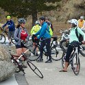
Darlene and I enjoyed a weeklong trip to New York City over Christmas this year just doing a lot of sightseeing.  It wasn’t a first visit for either of us but there was still plenty to go see and do.  We started off with a midnight visit to the top of the Empire State Building – and discovered that’s the way to entirely avoid any lines or crowds.

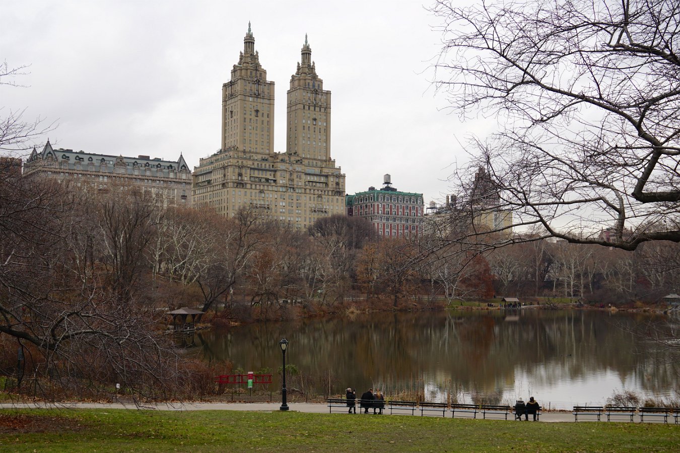
We enjoyed thoroughly exploring the lower half of Central Park and we walked around mid-town a lot, taking in the Christmas shops at Bryant Park, visiting the gorgeous Grand Central Station as well as the New York Public Library – home to specters from the movie Ghostbusters, which kicked off a hunt to seek the other filming locations including the Ghostbusters firehouse HQ, the “spook central” apartment building on Central Park West, the Tavern on the Green, Lincoln Center, etc.

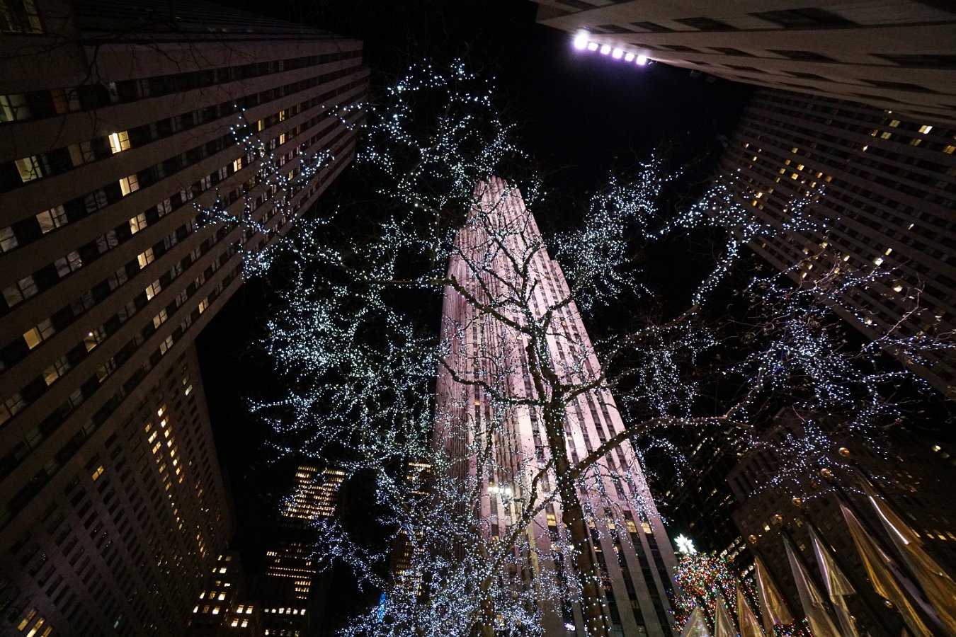
Of course we visited Rockefeller Center to see the Christmas displays there and along Fifth Ave.  We also saw two musicals on Broadway over our visit: The Lion King, which was just completely fantastic and amazing, as well as a repeat of Cats which happened to be the first musical each of us had ever seen.  I found I didn’t care for Cats at all this time though – I guess my tastes have changed a bit in 30 years!

We did the VIP tour (tip: not worth the extra) at One World Observatory and stayed for dinner after sunset.  The ride up the “time traveling” elevator was very cool (see YouTube video) but over too quickly to enjoy all the detail!  We saw the 9/11 memorial that night as well – really well done.


We walked the High Line (an elevated rail line converted to a green space) and walked around the financial district and down to Battery Park where we discovered and rode the wonderful Seaglass Carousel.  We slipped in a visit to the art collection at the Frick museum and we finished off with a lovely trip on the Staten Island ferry on our last crisp cold day.

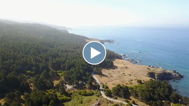
Click through for the full gallery of pictures and video clips.

Tagged , , , , | Leave a comment

Geminids over Pinnacles

Darlene and I went down to Pinnacles National Park for dark skies to watch the Geminids meteor shower Wednesday night:

Time-lapse of Geminids meteor shower

That’s a 20-second time-lapse I made looking south towards Orion about midnight, covering about 90 minutes that didn’t include any light trails from passing airplanes.  And here’s a still shot.

Tagged , , , , | Leave a comment

Pre-Movie Gaming Day


Clay, Roland, Vanessa and Kevin joined Darlene and me for some board gaming ahead of the full crowd we had for last Saturday’s BBQ/movie night.  (I should’ve taken a couple of pics of the full house.)  We got in a long game of Power Grid followed by trying a few rounds of the cute new Cheaty Mages.

Tagged | Leave a comment

Frie Family Halloween Gathering

It was Darlene’s turn to host her family’s holiday gathering this year in Wisconsin – Halloween-themed this time.  Click through for the full gallery:


Tagged , , | Leave a comment

October Road Trip

I made a number of additional miscellaneous stops on my October road trip with Pan and Hera in the Traveling Cat Adventure Vehicle, including along a section of historic Route 66 in the Mojave Desert, on the road in northern Arizona and southern Utah, mountain biking outside of Zion National Park, and taking the tour of Hoover Dam.  This was over the course of two weeks (October 4th-19th, 2017).

Mojave Desert outside of Baker, CA

Looking down Hoover Dam

Click through for the full gallery:


Here are the other separate galleries for this trip:

And here’s a video montage of my drone flights over the trip, including my last flight where I lost control, crashed and was forced to leave it behind:

What happens when the Mavic Pro doesn’t have GPS lock and you’re too high for the down-facing optical sensors to work is that the Mavic becomes unable to hold its position and it starts drifting all over the place.  I was trying to compensate and keep it away from the walls but I was not at all successful.  It almost crashed into one wall but halted itself when it’s forward-facing sensors detected the wall.  As it started drifting towards the opposite wall, I had just decided to try to get it up and out of the shadow of the canyon entirely to hopefully gain GPS lock and regain control but it was too late – and this time it wasn’t facing the wall and didn’t detect it.  It crashed and fell to a point immediately below me.  While it was only like 35 feet down, it was a sheer drop with only a couple of narrow soft ledges.  Without rope and climbing gear, I would have been risking my neck to try to retrieve it.  Yeah, very sad to have to leave it behind, though it looked pretty busted up anyway.

Tagged , , , , , , , | Leave a comment

Vermilion Cliffs / Paria Canyon

The Vermilion Cliffs / Paria Canyon National Monument in northern Arizona and southern Utah includes a huge area of amazing rock and sandstone formations, including what may be the longest slot canyon in the world, Buckskin Gulch (15 miles!).  During my October road trip, I got to experience a little taste of the canyon from the Wire Pass trailhead but it would take an overnight trip and gear to do the whole thing.  (Here’s some details on what it involves.)  I would definitely like to come back and do that as well as try to get a permit to go visit “The Wave” (restricted to 20 people per day via a lottery system) and some of the other formations in the Coyote Buttes area.  I tried to get out to the White Pocket formations but the road turned out to be too sandy for mountain bike access, too far for day hiking and certainly too much for the current incarnation of the Traveling Cat Adventure Vehicle.  Some serious 4WD required.


Another cool multi-day adventure trip in the area is backpacking all the way through Buckskin Gulch and following the Paria River Canyon out to Lees Ferry and the Colorado River over 4-5 days.  This whole wide area is a really cool region to explore and there’s plenty to come back and see.

Click through for the full gallery, including hiking a canyon wash above Soap Creek (and losing my drone!), visiting Lees Ferry and the start of the Grand Canyon at Marble Canyon, checking out Horseshoe Bend and Glen Canyon Dam and a couple of little detours into Grand Staircase-Escalante National Monument.

Tagged , , , , , | Leave a comment

North Rim of the Grand Canyon

Continuing my October road trip and coming straight from Bryce Canyon National Park, I was lucky to be able to snag the last remaining campsite on the North Rim of the Grand Canyon without a reservation – otherwise I would have had to drive all the way back out of the national park bounds to camp somewhere for the night.  The North Rim is pretty cool though in that it gets only 1/10 as many visitors as the south side of the canyon.

I was surprised to find that the North Rim campground is right on the edge of the canyon – not a good place to go sleep-walking! ;-)

On arrival that evening, I hiked the Transept Trail over to the viewpoint by the Grand Canyon Lodge as the sun went down. The next morning I made it out to Bright Angel Point before returning to break camp and spent the rest of the day checking out all the amazing and varied vistas along the Cape Royal Road.

Click through for the full gallery.

Tagged , , , | Leave a comment

Bryce Canyon Visit

As part of my October road trip to Utah and Arizona (with Pan and Hera in the Traveling Cat Adventure Vehicle), I finally visited gorgeous Bryce Canyon National Park.  I stayed a couple of nights at the Sunset Campground and walked or biked to the nearby viewpoints and trailheads to avoid the packed parking lots.  I definitely suggest that the prime hike to experience is the Peakaboo Loop trail (and I suggest going clockwise).  It was fantastic!  And you should combine it with the Navajo Loop trail (don’t skip “Wall Street”) and/or the Queens Garden trail.


Click through for the full gallery.

Tagged , , , | Leave a comment

Backpacking in the Enchantments

Leprechaun Lake (6875 ft) in the Enchantments core zone

The Enchantments is a popular backpacking destination in the Alpine Lakes Wilderness area of central Washington state.  It’s popular enough that you have to submit an application via a lottery system many months in advance (much like the Mt. Whitney trailhead).  We managed to score a permit for the “Snow Lakes Zone” and I was able to join Glenn and Michele and several of their friends (John, Kyle and Fritz) last week in Leavenworth to start our four-day adventure.  Unfortunately, Darlene had to bow out for a work-related conflict but we were able to make another backpacking trip to the High Sierra the week before.

It was looking sketchy with all the smoke from the wildfires across the northwest this summer, including a small wildfire burning in another part of the Enchantments area (closing off the other half), but we lucked out with some not-completely-unbreathable air the week we were there and even a remarkably clear day on our second day.

Ready for a nice long climb from the Snow Lakes trailhead

On our first day, we hiked from the Snow Lakes trailhead at about 1400 ft and climbed about 4000 ft over eight or nine miles to the far side of Snow Lakes.  It’s a lot of elevation but it’s spread out fairly well and, except for a couple of large rockfalls, the trail is in good condition and there’s plenty of opportunities to get water.  Part of Snow Lakes is used as a reservoir and it was down some 20-30 ft when we arrived – apparently drained like a bathtub by an underground aqueduct that shoots a huge jet of water out the side of the mountain above Nada Lake.   We camped alongside some of the exposed beach of Snow Lakes for two nights.

Working through the rockfalls between Snow Lakes and Nada Lake

Glenn and Fritz “volunteered to keep watch” over our campsite the second day as the rest of us headed up over the western ridge from Snow Lakes to the “core zone” of the Enchantments area.  That turned out to be not so much a trail as a rocky mountain goat path, scrambling up over granite outcroppings.  It was hard to picture carrying a full 40-pound pack over that but many people do the Enchantments as a 18+ mile through hike.  The craziness of that trail aside, the many lakes of the core zone were lovely, though we only went as far as the shore of Perfection Lake (while looking for mountain goats) before making our return to our camp.

Climbing the pass from Snow Lakes up over the ridge

On our third day, we packed up camp late in the morning and headed down the short distance through the rockfalls to Nada Lake, with a brief sojourn to the more natural looking half of Snow Lakes – where we stumbled into a small herd of deer who were remarkably unconcerned with our presence.  We camped along Nada Lake at the base of a huge rockfall of massive boulders that extended all the way up the mountain.  And on our last day, we got a close encounter with a family of mountain goats as we made a leisurely hike all the way back down to the trailhead.

Camped at Nada Lake (4900 ft)

Click through for the full gallery of pictures:


Tagged , , , , , , | Leave a comment

Backpacking the Silver Divide

I had promised Darlene a substitute backpacking trip when we found out she would no longer be able to go on our upcoming backpacking trip in Washington state.  We were able to take four days over the Labor Day weekend and I picked out a promising area that I hadn’t been to north of Lake Thomas A. Edison that would give Darlene another taste of the High Sierra.

We took off Saturday afternoon amid some unusual high temps as well as heavy smoke that had blown down from numerous wildfires in Oregon and Northern California.  It was a five and a half hour drive to get to the trailhead, including an interesting drive over a very rough, one lane road from Huntington Lake that goes over Kaiser Pass at 9184 feet.  We found a spot to camp along the road near the High Sierra Ranger Station on Saturday night and to wait to get a wilderness pass in the morning.

A meadow along Silver Pass Creek

We had our pick of numerous trailheads near Lake Edison but settled on doing a loop up and over part of the Silver Divide by following the John Muir Trail / Pacific Crest Trail over Silver Pass and then returning via Goodale Pass.  (View map.)  The smoke from the distant fires was still pretty heavy and worrisome on Sunday morning but we managed to just barely catch the backpacker’s ferry boat across Lake Edison and that cut out four miles of hiking our way around the reservoir to get started.  From the ferry landing (7643 ft), it’s about nine miles to the top of Silver Pass (10,900 ft).

Our room with a view over Chief Lake at 10,400 ft.

There’s lots of small, alpine lakes scattered along the divide and we found a lovely spot to spend two nights overlooking Chief Lake just below Silver Pass at about 10,400 ft.  Thankfully the smoke wasn’t too bad at altitude and it mostly cleared out overnight with the winds and occasional brief showers.  Not much to see in the way of stars though with a very bright full moon on display.

Sunset skies over the distant Minarets to the north

In the morning, we were treated to views of the distant Minarets (part of the Ritter Range) up near Mammoth.  There were a good deal of mosquitos in the morning and evening but not as much as I had feared given our really wet winter this year.  The weather alternated between periods of sunshine and heavy clouds with brief sprinkling while we ventured up a nearby ridge on the Silver Divide to get some more stupendous views of our surroundings.

Enjoying the panorama perched on a ridge above Silver Pass

Monday night was tough to sleep through as we had hours of heavy gusting winds but eventually it quieted down.  Our return journey on Tuesday was about 12 miles over Goodale Pass (10,997 ft) down to the Vermillion Resort on Lake Edison.  However, it was clear my boots were not going to make it – the soles were completely disintegrating.  They’re probably also why I lost my footing and ended up crashing into a creek when I attempted to push off one rock to leap to another.  I ended up using my shoelaces to tie the soles to the bottom of my shoes and keep them from coming completely separated before reaching the end of the trail.  I might need some new boots now though.

Click through for the full gallery of pictures.


Tagged , , , , | Leave a comment

A Total Eclipse of the Sun

Darlene and I managed to meet up with Glenn, Michele and Seaerra in Eastern Oregon this past week to experience the total solar eclipse together.  We snagged a nice dispersed camping spot in the Malheur National Forest in an area I had scouted out back in June and we arrived four days early to get ahead of any potential crowds.  As it turns out, we were in a remote enough area to only see a scattering of other campers.

We were also very lucky with the weather as there were a number of distant wildfires filling the skies with smoke days before and then it turned cloudy Sunday afternoon.  But on Monday, August 21st, the day of the eclipse, we had clear blue skies!  (And smoke-filled skies the very next morning.)

A short video montage of the eclipse viewing experience (2.5 minutes)

And yes, seeing a total solar eclipse is truly an amazing experience.  There’s the hour or so of build up beforehand as the light turns queer and dim and the heat of the sun fades away but then, as the last thin crescent splinter of sunlight disappears, you pull off your eye protection and… boom!  The sun’s gorgeous corona suddenly appears streaming all around the pure black disc of the moon.  It’s an incredible sight to behold.  The sky was dark enough to reveal a couple of planets and a few brighter stars.  The sky doesn’t go completely dark because of both the sun’s wispy corona and scattered sunlight from 35 miles away or less in every direction, outside the shadow of the moon.

The view was entirely captivating but, before we knew it, our two minutes of totality was already ending: a small bright bead of light starts to form which quickly brightens to create the stunning “diamond ring” effect.  And then back on with the solar filters and glasses.

I had several cameras set up and recording different perspectives: one with a telephoto lens, one on a drone hovering out-of-earshot, one focused on the scene of us and one on my telescope to capture a much closer view (an 8-inch Schmidt-Cassegrain with a focal reducer to widen the view) and I’m so glad I did as we were able to see several solar eruptions in progress around the edge.  Gorgeous!

Darlene and Michele also took some nice pics and video with handheld cameras.  Click through for the full gallery of pictures and videos:


Here’s Michele (my sister-in-law)’s take on the experience: Midnight Sun


Update:  Somebody asked me about our white sheet spread out on the ground and whether we had managed to see the elusive “shadow bands”.  The answer is no, but this question prompted me to go back to the video that was rolling the whole time to see if I could find them.

They’re supposed to be very faint, thin, moving shadows (aka, “shadow snakes”) that are difficult to see and more difficult to record.  We had looked specifically for them on the sheet about a minute before totality and then of course we were completely distracted by the amazing show in the sky afterward.

However, examining the video recording more closely and turning up the contrast, I think I may have found them:

Shadow bands?


Tagged , , , , , | Leave a comment

Bridge Out!

Big Sur got hit hard with the heavy rains earlier this year, with several massive land slides and the forced demolition of the Pfeiffer Canyon Bridge.  This severely isolated the community around Big Sur and so a temporary, emergency foot path was created to allow residents to get supplies.  They’ve since opened up a path through to the public.  So, until the replacement bridge is completed (end of September), you can park down near the road closure at the Pfieffer Big Sur State Park, hike the steep 1/2 mile trail and get to ride highway 1 with much reduced traffic.

And that’s what I did today with Mark and his family and friends!  We hiked over and rode as far as Julia Pfeiffer Burns State Park and the McWay Falls (about 20 miles round trip).

Click through for the full gallery:


Tagged , | 1 Comment

Home Theater Upgrade: Dolby Atmos

I’ve just added Dolby Atmos support to my home theater by upgrading my receiver and my Blu-Ray player and by adding a pair of vertically firing speakers.  I decided to go with the Onkyo TX-RZ3100 which provides for 11 audio channels at 140W/channel, giving me 7.2.2 in my new speaker configuration (seven = three front + two side + two rear, two subwoofers, and now two down-firing).  For sources, I now have an UltraHD-capable Sony UBP-X800 Blu-Ray player and the newest AppleTV.  All of this also means I’m ready for 4K/HDR if/when I eventually upgrade my projector.

The additional speakers are a pair of Klipsch RP-140SA add-on speakers that I can simply set on top of my two front subwoofers. They’re naturally angled to fire upwards and bounce off the ceiling and back down to the listening area.  I didn’t want to have to go to the trouble to mount downward-firing speakers on my very high, vaulted ceilings so these were a very easy and convenient solution.  They’re not really meant to be used for a vaulted ceiling, but they seem to be working well enough.  I certainly seem to get a nice reproduction of Dolby Atmos movie soundtracks.


So how does it sound?  Well, I definitely like it and I definitely think it was worth the cost and effort.  As much as I liked my existing 7.1 surround sound system, this new object-based, spatially-encoded audio is quite impressive in the movies that make use of it.  It certainly sounds much better than the old channel-based surround sound.  It’s amazing how much more the sound seems to be coming from directions where your speakers aren’t!  I say go for it – particularly if you’re planning to upgrade your components to support 4K/HDR anyway!

Tagged | Leave a comment

Flying Over Humpbacks

I saw this news article in the Santa Cruz Sentinel this morning talking about how active the humpback whales have been near shore off of Santa Cruz and Aptos these past few weeks.  So Darlene and I grabbed the drone and dashed down to Seacliff State Beach.  I’ve been wanting to try flying the drone to get nice, aerial views of the whales.  (A lot of the coastline is protected via the Monterey Bay Marine Sanctuary but flying in this area is allowed.)

There were probably a dozen of them near shore – you could see them popping up every which way!  The lighting wasn’t great (completely overcast) as the marine layer had yet to burn off but it was still very fun to hang around with the drone waiting for them to appear.

It’s quite the challenge to find them and stay with them using the narrow view of the drone’s camera – even when you can easily see them from shore.  Darlene was helping by watching the feed with the goggles because it’s also hard to see small/distant details on the iPhone or iPad screen, particularly when you’re outside. It’s much easier to see with the goggles but then of course all you can see is what the drone sees.

It was hard tracking them too because once they go under it’s hard to predict where to be looking when they come back up. You want to get closer for more detail but if you’re too close you won’t see them at all when they resurface off camera (which happened repeatedly) – and of course not so close as to harass them.  I should point out that the limited view angle of the drone’s camera makes them appear closer than they really are and yet I still had to heavily crop every one of these clips to make the whales appear large enough in the frame – even in the most distant shots.

I did put a polarizer on the drone camera to try to cut through the reflection of the water surface but it didn’t work that well with the diffuse overcast light so it might work better in directed sunlight.

Need more practice! ;-)

Tagged , , , , | Leave a comment

Two More Bobcats

I heard a strange, low moaning/growl from the scrub behind the house.  It definitely got Pan and Hera’s attention.  It sounded like a noise a calf might make – but when I waited around to see if whatever it was would emerge, it turned out to be a pair of juvenile bobcats growling at each other:

Video footage of two bobcats hanging out behind the house (2:31, 51 MB)

Tagged , | Leave a comment

On the Mendocino Coast

Last week, Darlene and I were able to spend six days following the Mendocino Coast (with the cats in the Traveling Cat Adventure Vehicle, of course), continuing north from where we left off on the Sonoma Coast in December, just north of Fort Ross.  We discovered that all the state park campgrounds were full going up the coast for the coming days but we kept managing to find something.

We stayed the first night at Stillwater Cove and then snagged a spot in an overflow area at Salt Point State Park, where we spent an afternoon mountain biking up to the top of the park and part of the morning flying the drone around.  We visited the Point Arena Lighthouse, which turned out to be more interesting than I expected and we snagged a nice spot in another overflow area on the beach at the Van Damme State Park.  We were able to grab a vacated spot in the park the next morning and then headed out to explore the Mendocino Headlands.  We also checked out the Russian Gulch State Park.

This area around Mendocino has a lot of cool sea caves – we’ll need to come back some time and book a guided sea kayak tour to check them out.  Fort Bragg turned out to be pretty uninteresting and we just passed through, stopping at MacKerricher State Park instead for lunch and to walk around.  Our final and fifth night was at Westport Union Landing State Beach overlooking the bluffs.  At this point, Highway 1 turns inland and you leave the coast for good.  Our last day was essentially spent just getting back home to lots of traffic jams.

Click through for the full gallery:


Tagged , , , , , , | Leave a comment